

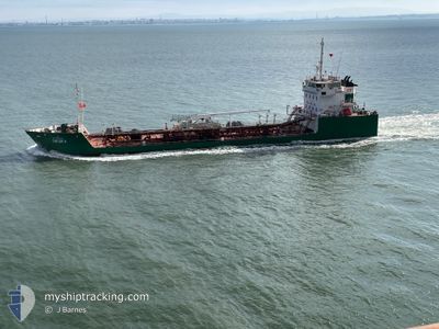
SACOR II
Oil Products Tanker

Current Trip
LISBOA
| Time Travelled | 6 h, 51 mins |
|---|---|
| Remaining Time | --- |
| Distance Travelled | 3.92 nm |
| Remaining Distance | --- |
| AVG Speed | 9 Noeuds |
| MAX Speed | 10.1 Noeuds |
| AVG Wind | 5.6 knots |
| MAX Wind | 5.8 knots |
| MIN Temp | 16.1°C / 60.98°F |
| MAX Temp | 16.5°C / 61.7°F |
| Tirant d eau | 4.2 m |
| Position reçue | 45 m depuis |
Current Position
| Longitude | --- |
|---|---|
| Latitude | --- |
| Etat | Moored |
| Vitesse | |
| Parcours | 80° |
| Zone | North Atlantic Ocean |
| Station | T-AIS |
| Position reçue | 45 m depuis |
Information
The current position of SACOR II is in North Atlantic Ocean with coordinates 38.67891° / -9.20344° as reported on 2025-03-27 19:33 by AIS to our vessel tracker app. The vessel's current speed is 0 Noeuds
The vessel SACOR II (IMO: 9630884, MMSI: 263702340) is a Oil Products Tanker that was built in 2012 ( 13 Age ). It's sailing under the flag of [PT] Portugal.
In this page you can find informations about the vessels current position, last detected port calls, and current voyage information. If the vessels is not in coverage by AIS you will find the latest position.
The current position of SACOR II is detected by our AIS receivers and we are not responsible for the reliability of the data. The last position was recorded while the vessel was in Coverage by the Ais receivers of our vessel tracking app.
The current draught of SACOR II as reported by AIS is 4.2 meters
Weather
| Temperature | 11.9°C / 53.42°F |
|---|---|
| Wind Speed | 8 knots |
| Direction | 339° NNW |
| Pressure | 1018.6 hPa |
| Humidity | 82.6 % |
| Cloud Coverage | 6 % |


Featured Company
Last Port Calls
| Port | Arrival | Departure | Time In Port |
|---|---|---|---|
| 2025-03-27 08:43 | 2025-03-27 13:27 | 4 h | |
| 2025-03-25 10:11 | 2025-03-25 15:59 | 5 h | |
| 2025-03-24 08:22 | 2025-03-24 11:21 | 2 h | |
| 2025-03-22 11:28 | 2025-03-22 19:07 | 7 h | |
| 2025-03-21 19:36 | 2025-03-22 00:15 | 4 h | |
| 2025-03-21 13:11 | 2025-03-21 16:05 | 2 h | |
| 2025-03-20 14:32 | 2025-03-20 20:21 | 5 h | |
| 2025-03-17 13:15 | 2025-03-17 17:25 | 4 h | |
| 2025-03-17 09:05 | 2025-03-17 12:55 | 3 h | |
| 2025-03-15 13:09 | 2025-03-15 15:06 | 1 h |
Most Visited Ports (Last year)
| Port | Arrivals | |
|---|---|---|
| 245 | ||
| 15 | ||
| 13 | ||
| 2 |
Last Trips
| Origin | Departure | Destination | Arrival | Distance | |
|---|---|---|---|---|---|
| 2025-03-25 15:59 | 2025-03-27 08:43 | 16.11 nm | |||
| 2025-03-24 11:21 | 2025-03-25 10:11 | 12.51 nm | |||
| 2025-03-22 19:07 | 2025-03-24 08:22 | 21.22 nm | |||
| 2025-03-22 00:15 | 2025-03-22 11:28 | 8.50 nm | |||
| 2025-03-21 16:05 | 2025-03-21 19:36 | 7.65 nm | |||
| 2025-03-20 20:21 | 2025-03-21 13:11 | 10.83 nm | |||
| 2025-03-17 17:25 | 2025-03-20 14:32 | 15.27 nm | |||
| 2025-03-17 12:55 | 2025-03-17 13:15 | 3.57 nm | |||
| 2025-03-15 15:06 | 2025-03-17 09:05 | 12.18 nm | |||
| 2025-03-12 00:26 | 2025-03-15 13:09 | 21.85 nm |
Events
| Heure | Evenement | Détails | Position/ Destination | Info |
|---|---|---|---|---|
| 2025-03-27 19:39 | Etat Changé | Default Moored |
38.67891 / -9.20344
LISBOA
|
Vitesse: Parcours: 80° |
| 2025-03-27 19:15 | Etat Changé | Moored Default |
38.67891 / -9.20344
LISBOA
|
Vitesse: Parcours: 79° |
| 2025-03-27 19:03 | Dans la zone couverte |
38.67891 / -9.20344
North Atlantic Ocean
|
Vitesse: Parcours: 0° |
|
| 2025-03-27 14:54 | Etat Changé | Default Moored |
38.67896 / -9.20348
LISBOA
|
Vitesse: Parcours: 80° |
| 2025-03-27 14:48 | Etat Changé | Moored Default |
38.67895 / -9.20346
LISBOA
|
Vitesse: Parcours: 80° |
| 2025-03-27 14:48 | Hors de la zone couverte |
38.67895 / -9.20346
North Atlantic Ocean
|
Vitesse: Parcours: 0° |
|
| 2025-03-27 14:27 | Etat Changé | Default Moored |
38.67894 / -9.20345
LISBOA
|
Vitesse: Parcours: 80° |
| 2025-03-27 14:15 | Etat Changé | Moored Default |
38.67894 / -9.20345
LISBOA
|
Vitesse: Parcours: 81° |
| 2025-03-27 14:09 | Etat Changé | Default Moored |
38.67894 / -9.20344
LISBOA
|
Vitesse: Parcours: 81° |
| 2025-03-27 14:00 | Arret | 1.43 nm, East of TRAFARIA |
38.67895 / -9.20343
LISBOA
|
Vitesse: Parcours: 81° |