
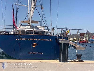
S/Y Q
Yacht
Current Trip
SXM
| Time Travelled | 2 days |
|---|---|
| Remaining Time | --- |
| Distance Travelled | 3.67 nm |
| Remaining Distance | --- |
| AVG Speed | --- |
| MAX Speed | --- |
| AVG Wind | 17.6 knots |
| MAX Wind | 20 knots |
| MIN Temp | 25.1°C / 77.18°F |
| MAX Temp | 26.2°C / 79.16°F |
| Tirant d eau | 4.9 m |
| Position reçue | 3 m depuis |
Current Position
| Longitude | --- |
|---|---|
| Latitude | --- |
| Etat | At anchor |
| Vitesse | 0.3 Noeuds |
| Parcours | 65° |
| Zone | Caribbean Sea |
| Station | T-AIS |
| Position reçue | 3 m depuis |
Info
Information
The current position of S/Y Q is in Caribbean Sea with coordinates 18.03456° / -63.10691° as reported on 2025-02-18 06:20 by AIS to our vessel tracker app. The vessel's current speed is 0.3 Noeuds
The vessel S/Y Q (IMO: 1010040, MMSI: 319560000) is a Yacht that was built in 2008 ( 17 Age ). It's sailing under the flag of [KY] Cayman Is.
In this page you can find informations about the vessels current position, last detected port calls, and current voyage information. If the vessels is not in coverage by AIS you will find the latest position.
The current position of S/Y Q is detected by our AIS receivers and we are not responsible for the reliability of the data. The last position was recorded while the vessel was in Coverage by the Ais receivers of our vessel tracking app.
The current draught of S/Y Q as reported by AIS is 4.9 meters
Weather
| Temperature | 25.5°C / 77.9°F |
|---|---|
| Wind Speed | 16 knots |
| Direction | 83° E |
| Pressure | 1016.5 hPa |
| Humidity | 68.9 % |
| Cloud Coverage | 16 % |
Featured Company
Last Port Calls
| Port | Arrival | Departure | Time In Port |
|---|---|---|---|
| 2025-02-08 13:43 | 2025-02-15 14:33 | 7 d | |
| 2025-01-05 21:15 | 2025-01-08 20:12 | 2 d | |
| 2024-12-31 18:42 | 2024-12-31 19:39 | 57 m | |
| 2024-12-26 18:38 | 2024-12-27 13:33 | 18 h | |
| 2024-12-07 15:40 | 2024-12-16 12:39 | 8 d |
Last Trips
| Origin | Departure | Destination | Arrival | Distance | |
|---|---|---|---|---|---|
| 2025-01-08 16:12 | 2025-02-08 09:43 | 289.74 nm | |||
| 2024-12-31 15:39 | 2025-01-05 17:15 | 185.90 nm | |||
| 2024-12-27 09:33 | 2024-12-31 14:42 | 248.97 nm | |||
| 2024-12-16 08:39 | 2024-12-26 14:38 | 262.24 nm | |||
| 2024-11-25 15:14 | 2024-12-07 11:40 | 3305.11 nm |
Events
| Heure | Evenement | Détails | Position/ Destination | Info |
|---|---|---|---|---|
| 2025-02-15 14:56 | Arret | 0.83 nm, West of ST MAARTEN |
18.03477 / -63.10649
SXM
|
Vitesse: 0.2 kn Parcours: 73° |
| 2025-02-15 14:33 | PORT DE DEPART |
|
18.03494 / -63.09624
SXM
|
Vitesse: 4.8 kn Parcours: 246° |
| 2025-02-15 14:32 | Démarrage |
18.03550 / -63.09502
[SX] ST MAARTEN
|
Vitesse: 4.7 kn Parcours: 248° |
|
| 2025-02-14 17:05 | Changement de destination | SXM SXM E>0XNW |
18.03839 / -63.09493
[SX] ST MAARTEN
|
Vitesse: Parcours: 40° |
| 2025-02-14 16:59 | Changement de destination | SXM E>0XNW SXM |
18.03839 / -63.09492
[SX] ST MAARTEN
|
Vitesse: Parcours: 39° |
| 2025-02-08 14:53 | Etat Changé | At anchor Under way using engine |
18.03841 / -63.09491
[SX] ST MAARTEN
|
Vitesse: Parcours: 40° |
| 2025-02-08 13:44 | Arret |
18.03654 / -63.09340
[SX] ST MAARTEN
|
Vitesse: 0.2 kn Parcours: 32° |
|
| 2025-02-08 13:43 | Port d'arrivée |
|
18.03653 / -63.09339
[SX] ST MAARTEN
|
Vitesse: 0.7 kn Parcours: 34° |
| 2025-02-08 13:23 | Démarrage | 0.85 nm, South West of ST MAARTEN |
18.03183 / -63.10591
SXM
|
Vitesse: 3.5 kn Parcours: 140° |
| 2025-02-08 13:18 | Etat Changé | Under way using engine At anchor |
18.03377 / -63.10583
SXM
|
Vitesse: 0.9 kn Parcours: 80° |