

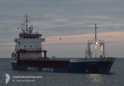
RIX VOYAGER
General Cargo

Current Trip
| Time Travelled | 1 day |
|---|---|
| Remaining Time | 8 h, 2 mins |
| Distance Travelled | 213.69 nm |
| Remaining Distance | 99.26 nm |
| AVG Speed | 8.1 Noeuds |
| MAX Speed | 10.1 Noeuds |
| AVG Wind | 13.5 knots |
| MAX Wind | 16.9 knots |
| MIN Temp | 2.6°C / 36.68°F |
| MAX Temp | 4.8°C / 40.64°F |
| Tirant d eau | 6 m |
| Position reçue | 7 h, 30 m depuis |
Current Position
| Longitude | --- |
|---|---|
| Latitude | --- |
| Etat | Under way using engine |
| Vitesse | 7.2 Noeuds |
| Parcours | 126.9° |
| Zone | North Sea |
| Station | T-AIS |
| Position reçue | 7 h, 30 m depuis |
Information
The current position of RIX VOYAGER is in North Sea with coordinates 53.04389° / 2.02409° as reported on 2025-02-15 05:42 by AIS to our vessel tracker app. The vessel's current speed is 7.2 Noeuds and is heading at the port of AMSTERDAM. The estimated time of arrival as calculated by MyShipTracking vessel tracking app is 2025-02-15 21:15 LT
The vessel RIX VOYAGER (IMO: 9125671, MMSI: 636022775) is a General Cargo that was built in 1997 ( 28 Age ). It's sailing under the flag of [LR] Liberia.
In this page you can find informations about the vessels current position, last detected port calls, and current voyage information. If the vessels is not in coverage by AIS you will find the latest position.
The current position of RIX VOYAGER is detected by our AIS receivers and we are not responsible for the reliability of the data. The last position was recorded while the vessel was in Coverage by the Ais receivers of our vessel tracking app.
The current draught of RIX VOYAGER as reported by AIS is 6 meters
Weather
| Temperature | 2.6°C / 36.68°F |
|---|---|
| Wind Speed | 10 knots |
| Direction | 136° SE |
| Pressure | 1022.6 hPa |
| Humidity | 70.2 % |
| Cloud Coverage | 100 % |


Featured Company
Last Port Calls
| Port | Arrival | Departure | Time In Port |
|---|---|---|---|
| 2025-02-08 11:30 | 2025-02-14 10:52 | 5 d | |
| 2025-02-03 10:37 | 2025-02-05 16:51 | 2 d | |
| 2025-01-31 11:14 | 2025-02-02 17:37 | 2 d | |
| 2025-01-23 10:52 | 2025-01-24 06:36 | 19 h | |
| 2025-01-22 11:47 | 2025-01-22 11:53 | 5 m | |
| 2025-01-18 13:48 | 2025-01-21 20:07 | 3 d | |
| 2025-01-16 23:46 | 2025-01-17 21:11 | 21 h | |
| 2025-01-13 22:18 | 2025-01-15 12:35 | 1 d | |
| 2025-01-12 05:03 | 2025-01-12 05:07 | 3 m | |
| 2025-01-09 08:00 | 2025-01-11 08:10 | 2 d |
Last Trips
| Origin | Departure | Destination | Arrival | Distance | |
|---|---|---|---|---|---|
| 2025-02-05 17:51 | 2025-02-08 11:30 | 428.78 nm | |||
| 2025-02-02 18:37 | 2025-02-03 11:37 | 150.72 nm | |||
| 2025-01-24 07:36 | 2025-01-31 12:14 | 1166.61 nm | |||
| 2025-01-22 12:53 | 2025-01-23 11:52 | 186.58 nm | |||
| 2025-01-21 21:07 | 2025-01-22 12:47 | 90.26 nm | |||
| 2025-01-17 22:11 | 2025-01-18 14:48 | 132.30 nm | |||
| 2025-01-15 13:35 | 2025-01-17 00:46 | 234.58 nm | |||
| 2025-01-12 06:07 | 2025-01-13 23:18 | 85.87 nm | |||
| 2025-01-11 09:10 | 2025-01-12 06:03 | 166.64 nm | |||
| 2025-01-08 20:13 | 2025-01-09 09:00 | 128.10 nm |
Events
| Heure | Evenement | Détails | Position/ Destination | Info |
|---|---|---|---|---|
| 2025-02-15 05:49 | Etat Changé | Default Under way using engine |
53.03556 / 2.04318
NLAMS
|
Vitesse: 7.2 kn Parcours: 126.9° |
| 2025-02-15 05:42 | Etat Changé | Under way using engine Default |
53.04389 / 2.02409
NLAMS
|
Vitesse: 7.2 kn Parcours: 126° |
| 2025-02-15 05:42 | Hors de la zone couverte |
53.04389 / 2.02409
North Sea
NLAMS
|
Vitesse: 7.2 kn Parcours: 126.9° |
|
| 2025-02-15 05:13 | Etat Changé | Default Under way using engine |
53.07762 / 1.94784
NLAMS
|
Vitesse: 6.9 kn Parcours: 124.2° |
| 2025-02-15 01:13 | Etat Changé | Under way using engine Default |
53.36288 / 1.38912
NLAMS
|
Vitesse: 6.6 kn Parcours: 146° |
| 2025-02-15 01:02 | Dans la zone couverte |
53.36288 / 1.38912
North Sea
NLAMS
|
Vitesse: 6.8 kn Parcours: 146.1° |
|
| 2025-02-14 18:09 | Etat Changé | Default Under way using engine |
54.04708 / .29676
NLAMS
|
Vitesse: 9.9 kn Parcours: 133.4° |
| 2025-02-14 18:03 | Hors de la zone couverte |
54.05903 / .27471
North Sea
NLAMS
|
Vitesse: 9.9 kn Parcours: 133.4° |
|
| 2025-02-14 16:41 | Etat Changé | Under way using engine Default |
54.21806 / -.00378
NLAMS
|
Vitesse: 10.1 kn Parcours: 134° |
| 2025-02-14 16:35 | Dans la zone couverte |
54.21361 / .00412
North Sea
NLAMS
|
Vitesse: 10 kn Parcours: 134° |