
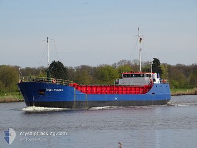
RIVER TRADER
General Cargo
Current Trip
| Time Travelled | 13 h, 47 mins |
|---|---|
| Remaining Time | --- |
| Distance Travelled | 100.89 nm |
| Remaining Distance | --- |
| AVG Speed | 6.9 Noeuds |
| MAX Speed | 9.3 Noeuds |
| AVG Wind | 9.8 knots |
| MAX Wind | 14.9 knots |
| MIN Temp | 17.7°C / 63.86°F |
| MAX Temp | 22.1°C / 71.78°F |
| Tirant d eau | 2.5 m |
| Position reçue | 1 m depuis |
Current Position
| Longitude | 2.03209° |
|---|---|
| Latitude | 51.51508° |
| Etat | Under way using engine |
| Vitesse | 6.2 Noeuds |
| Parcours | 225.9° |
| Zone | North Sea |
| Station | T-AIS |
| Position reçue | 1 m depuis |
Info
Information
The current position of RIVER TRADER is in North Sea with coordinates 51.51508° / 2.03209° as reported on 2024-09-21 05:38 by AIS to our vessel tracker app. The vessel's current speed is 6.2 Noeuds and is heading at the port of HEYSHAM. The estimated time of arrival as calculated by MyShipTracking vessel tracking app is 2024-09-24 23:00 LT
The vessel RIVER TRADER (IMO: 8813051, MMSI: 636015670) is a General Cargo that was built in 1989 ( 35 Age ). It's sailing under the flag of [LR] Liberia.
In this page you can find informations about the vessels current position, last detected port calls, and current voyage information. If the vessels is not in coverage by AIS you will find the latest position.
The current position of RIVER TRADER is detected by our AIS receivers and we are not responsible for the reliability of the data. The last position was recorded while the vessel was in Coverage by the Ais receivers of our vessel tracking app.
The current draught of RIVER TRADER as reported by AIS is 2.5 meters
Weather
| Temperature | 17.8°C / 64.04°F |
|---|---|
| Wind Speed | 10 knots |
| Direction | 111° ESE |
| Pressure | 1018.2 hPa |
| Humidity | 85.3 % |
| Cloud Coverage | 29 % |
Featured Company
Last Port Calls
| Port | Arrival | Departure | Time In Port |
|---|---|---|---|
| 2024-09-20 03:48 | 2024-09-20 15:52 | 12 h | |
| 2024-09-19 17:17 | 2024-09-20 03:19 | 10 h | |
| 2024-09-14 14:56 | 2024-09-16 16:20 | 2 d | |
| 2024-09-09 09:53 | 2024-09-10 23:57 | 1 d | |
| 2024-09-04 12:43 | 2024-09-07 13:57 | 3 d | |
| 2024-09-03 01:27 | 2024-09-04 01:23 | 23 h | |
| 2024-08-25 09:55 | 2024-08-27 09:35 | 1 d | |
| 2024-08-21 12:13 | 2024-08-24 13:59 | 3 d | |
| 2024-08-14 08:45 | 2024-08-14 09:36 | 50 m | |
| 2024-08-11 20:47 | 2024-08-12 16:58 | 20 h |
Most Visited Ports (Last year)
| Port | Arrivals | |
|---|---|---|
| 8 | ||
| 7 | ||
| 7 | ||
| 7 | ||
| 5 | ||
| 5 |
Last Trips
| Origin | Departure | Destination | Arrival | Distance | |
|---|---|---|---|---|---|
| 2024-09-20 05:19 | 2024-09-20 05:48 | 1.42 nm | |||
| 2024-09-16 17:20 | 2024-09-19 19:17 | 324.87 nm | |||
| 2024-09-11 01:57 | 2024-09-14 15:56 | 293.08 nm | |||
| 2024-09-07 14:57 | 2024-09-09 11:53 | 115.21 nm | |||
| 2024-09-04 02:23 | 2024-09-04 13:43 | 63.53 nm | |||
| 2024-08-27 10:35 | 2024-09-03 02:27 | 708.82 nm | |||
| 2024-08-24 14:59 | 2024-08-25 10:55 | 143.48 nm | |||
| 2024-08-14 10:36 | 2024-08-21 13:13 | 537.86 nm | |||
| 2024-08-12 18:58 | 2024-08-14 09:45 | 297.14 nm | |||
| 2024-08-09 20:20 | 2024-08-11 22:47 | 320.31 nm |
Events
| Heure | Evenement | Détails | Position/ Destination | Info |
|---|---|---|---|---|
| 2024-09-21 01:59 | Detecté en mer | United Kingdom part of the North Sea |
51.76433 / 2.43238
North Sea
GBHYM
|
Vitesse: 6.7 kn Parcours: 227.1° |
| 2024-09-21 00:55 | Changement de zone | Belgian part of the North Sea Dutch part of the North Sea |
51.85171 / 2.56968
North Sea
GBHYM
|
Vitesse: 7.9 kn Parcours: 224.6° |
| 2024-09-20 23:51 | Etat Changé | Under way using engine Default |
51.95860 / 2.74072
GBHYM
|
Vitesse: 8.7 kn Parcours: 229° |
| 2024-09-20 23:44 | Etat Changé | Default Under way using engine |
51.96949 / 2.76122
GBHYM
|
Vitesse: 9.2 kn Parcours: 236.4° |
| 2024-09-20 20:26 | Etat Changé | Under way using engine Default |
52.05447 / 3.50553
GBHYM
|
Vitesse: 8.4 kn Parcours: 262° |
| 2024-09-20 20:21 | Etat Changé | Default Under way using engine |
52.05564 / 3.52581
GBHYM
|
Vitesse: 8.1 kn Parcours: 263.1° |
| 2024-09-20 20:12 | Etat Changé | Under way using engine Default |
52.05795 / 3.55726
GBHYM
|
Vitesse: 8.1 kn Parcours: 269° |
| 2024-09-20 20:07 | Etat Changé | Default Under way using engine |
52.05925 / 3.57748
GBHYM
|
Vitesse: 8.1 kn Parcours: 271° |
| 2024-09-20 19:59 | Etat Changé | Under way using engine Default |
52.05956 / 3.60819
GBHYM
|
Vitesse: 8 kn Parcours: 268° |
| 2024-09-20 19:16 | Etat Changé | Default Under way using engine |
52.06145 / 3.76182
GBHYM
|
Vitesse: 8 kn Parcours: 271.9° |