
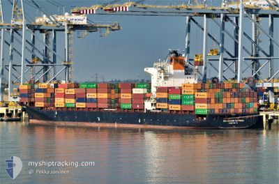
RIO GRANDE EXPRESS
Container Ship
Current Trip
| Time Travelled | 2 days |
|---|---|
| Remaining Time | --- |
| Distance Travelled | 272.96 nm |
| Remaining Distance | 1.22 nm |
| AVG Speed | 13.3 Noeuds |
| MAX Speed | 18.7 Noeuds |
| AVG Wind | 10 knots |
| MAX Wind | 13.9 knots |
| MIN Temp | 28.3°C / 82.94°F |
| MAX Temp | 29.7°C / 85.46°F |
| Tirant d eau | 11.4 m |
| Position reçue | 18 d depuis |
Current Position
| Longitude | 17.56566° |
|---|---|
| Latitude | -33.66342° |
| Etat | Under way using engine |
| Vitesse | 18.3 Noeuds |
| Parcours | 336.8° |
| Zone | South Atlantic Ocean |
| Station | T-AIS |
| Position reçue | 18 d depuis |
Info
Information
The current position of RIO GRANDE EXPRESS is in South Atlantic Ocean with coordinates -33.66342° / 17.56566° as reported on 2024-04-08 10:57 by AIS to our vessel tracker app. The vessel's current speed is 18.3 Noeuds and is heading at the port of TEMA.
The vessel RIO GRANDE EXPRESS (IMO: 9301823, MMSI: 477696800) is a Container Ship that was built in 2006 ( 18 Age ). It's sailing under the flag of [HK] Hong Kong.
In this page you can find informations about the vessels current position, last detected port calls, and current voyage information. If the vessels is not in coverage by AIS you will find the latest position.
The current position of RIO GRANDE EXPRESS is detected by our AIS receivers and we are not responsible for the reliability of the data. The last position was recorded while the vessel was in Coverage by the Ais receivers of our vessel tracking app.
The current draught of RIO GRANDE EXPRESS as reported by AIS is 11.4 meters
Weather
| Temperature | 28.8°C / 83.84°F |
|---|---|
| Wind Speed | 10 knots |
| Direction | 221° SW |
| Pressure | 1006.8 hPa |
| Humidity | 81.9 % |
| Cloud Coverage | 100 % |
Featured Company
Last Port Calls
| Port | Arrival | Departure | Time In Port |
|---|---|---|---|
| 2024-04-17 09:08 | 2024-04-24 13:48 | 7 d | |
| 2024-04-04 07:44 | 2024-04-06 10:24 | 2 d | |
| 2024-03-19 14:36 | 2024-03-20 05:04 | 14 h | |
| 2024-03-13 08:43 | 2024-03-14 01:31 | 16 h | |
| 2024-03-08 10:59 | 2024-03-10 08:07 | 1 d | |
| 2024-02-17 05:18 | 2024-02-19 13:04 | 2 d | |
| 2024-02-04 16:05 |
Last Trips
| Origin | Departure | Destination | Arrival | Distance | |
|---|---|---|---|---|---|
| 2024-04-06 12:24 | 2024-04-17 10:08 | 3669.32 nm | |||
| 2024-03-20 10:34 | 2024-04-04 09:44 | 4029.84 nm | |||
| 2024-03-14 07:01 | 2024-03-19 20:06 | 1435.94 nm | |||
| 2024-03-10 12:07 | 2024-03-13 14:13 | 950.32 nm | |||
| 2024-02-19 15:04 | 2024-03-08 14:59 | 4214.25 nm | |||
| 2024-02-04 17:05 | 2024-02-17 07:18 | 3560.12 nm |
Events
| Heure | Evenement | Détails | Position/ Destination | Info |
|---|---|---|---|---|
| 2024-04-27 01:14 | Arret | 1.94 nm, South West of TEMA |
5.61256 / -.01331
TEMA
|
Vitesse: 0.2 kn Parcours: 247° |
| 2024-04-26 23:32 | Démarrage | 6.99 nm, South East of TEMA |
5.53110 / .07751
TEMA
|
Vitesse: 5 kn Parcours: 131° |
| 2024-04-25 07:48 | Arret | 7.31 nm, South East of TEMA |
5.52628 / .07987
TEMA
|
Vitesse: 0.3 kn Parcours: 285° |
| 2024-04-24 13:48 | PORT DE DEPART |
|
6.38502 / 3.40482
TEMA
|
Vitesse: 6.8 kn Parcours: 158° |
| 2024-04-24 13:16 | Démarrage |
6.43372 / 3.38972
[NG] LAGOS
|
Vitesse: 5.4 kn Parcours: 105° |
|
| 2024-04-23 10:20 | Arret |
6.43661 / 3.38505
[NG] LAGOS
|
Vitesse: 0.3 kn Parcours: 115° |
|
| 2024-04-23 09:24 | Démarrage |
6.42893 / 3.34330
[NG] LAGOS
|
Vitesse: 3.3 kn Parcours: 262° |
|
| 2024-04-17 09:08 | Arret |
6.43041 / 3.34548
[NG] LAGOS
|
Vitesse: Parcours: 242° |
|
| 2024-04-17 09:08 | Port d'arrivée |
|
6.43041 / 3.34548
[NG] LAGOS
|
Vitesse: 4.5 kn Parcours: 256° |
| 2024-04-17 07:20 | Démarrage | 6.75 nm, South East of LAGOS |
6.33324 / 3.41978
TEMA
|
Vitesse: 6.9 kn Parcours: 326° |