
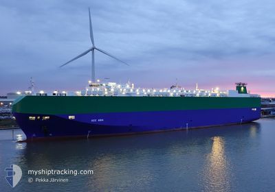
RCC ASIA
Vehicles Carrier
Current Trip
| Time Travelled | 7 days |
|---|---|
| Remaining Time | --- |
| Distance Travelled | 2748.39 nm |
| Remaining Distance | --- |
| AVG Speed | 14.9 Noeuds |
| MAX Speed | 18 Noeuds |
| AVG Wind | 12.8 knots |
| MAX Wind | 36 knots |
| MIN Temp | 6°C / 42.8°F |
| MAX Temp | 17°C / 62.6°F |
| Tirant d eau | 8.3 m |
| Position reçue | 7 d depuis |
Current Position
| Longitude | --- |
|---|---|
| Latitude | --- |
| Etat | Under way using engine |
| Vitesse | 17.3 Noeuds |
| Parcours | 126.6° |
| Zone | Philippine Sea |
| Station | T-AIS |
| Position reçue | 7 d depuis |
Info
Information
The current position of RCC ASIA is in Philippine Sea with coordinates 34.66068° / 136.84761° as reported on 2025-12-27 13:48 by AIS to our vessel tracker app. The vessel's current speed is 17.3 Noeuds and is heading at the port of TOYOHASHI.
The vessel RCC ASIA (IMO: 9391581, MMSI: 311003200) is a Vehicles Carrier that was built in 2009 ( 17 Age ). It's sailing under the flag of [BS] Bahamas.
In this page you can find informations about the vessels current position, last detected port calls, and current voyage information. If the vessels is not in coverage by AIS you will find the latest position.
The current position of RCC ASIA is detected by our AIS receivers and we are not responsible for the reliability of the data. The last position was recorded while the vessel was in Coverage by the Ais receivers of our vessel tracking app.
The current draught of RCC ASIA as reported by AIS is 8.3 meters
Weather
| Temperature | 15.5°C / 59.9°F |
|---|---|
| Wind Speed | 16 knots |
| Direction | 103° ESE |
| Pressure | 1026.6 hPa |
| Humidity | 74.1 % |
| Cloud Coverage | 6 % |
Featured Company
Last Port Calls
| Port | Arrival | Departure | Time In Port |
|---|---|---|---|
| 2025-12-26 20:08 | 2025-12-27 21:32 | 1 d | |
| 2025-12-25 08:46 | 2025-12-26 16:56 | 1 d | |
| 2025-12-23 06:59 | 2025-12-24 16:05 | 1 d | |
| 2025-12-13 15:01 | 2025-12-14 12:25 | 21 h | |
| 2025-12-11 08:11 | 2025-12-11 15:34 | 7 h | |
| 2025-11-09 23:29 | 2025-11-10 17:05 | 17 h | |
| 2025-11-09 22:26 | 2025-11-09 23:21 | 54 m | |
| 2025-11-07 00:30 | 2025-11-09 15:44 | 2 d | |
| 2025-11-04 02:52 | 2025-11-04 20:21 | 17 h |
Last Trips
| Origin | Departure | Destination | Arrival | Distance | |
|---|---|---|---|---|---|
| 2025-12-26 16:56 | 2025-12-26 20:08 | 45.03 nm | |||
| 2025-12-24 16:05 | 2025-12-25 08:46 | 196.73 nm | |||
| 2025-12-14 12:25 | 2025-12-23 06:59 | 3041.47 nm | |||
| 2025-12-11 15:34 | 2025-12-13 15:01 | 823.95 nm | |||
| 2025-11-10 17:05 | 2025-12-11 08:11 | 11913.25 nm | |||
| 2025-11-09 23:21 | 2025-11-09 23:29 | 0.29 nm | |||
| 2025-11-09 15:44 | 2025-11-09 22:26 | 97.59 nm | |||
| 2025-11-04 20:21 | 2025-11-07 00:30 | 558.48 nm | |||
| 2025-10-29 01:29 | 2025-11-04 02:52 | 2074.39 nm |
Events
| Heure | Evenement | Détails | Position/ Destination | Info |
|---|---|---|---|---|
| 2025-12-27 13:49 | Etat Changé | Default Under way using engine |
34.65989 / 136.84888
JP THS
|
Vitesse: 17.3 kn Parcours: 126.6° |
| 2025-12-27 13:48 | Hors de la zone couverte |
34.66068 / 136.84761
Philippine Sea
|
Vitesse: 17.3 kn Parcours: 126.6° |
|
| 2025-12-27 13:44 | Etat Changé | Under way using engine Default |
34.67735 / 136.82922
JP THS
|
Vitesse: 18 kn Parcours: 153° |
| 2025-12-27 13:01 | Etat Changé | Default Under way using engine |
34.87734 / 136.75681
JP THS
|
Vitesse: 16.2 kn Parcours: 180.2° |
| 2025-12-27 12:52 | Etat Changé | Under way using engine Default |
34.91811 / 136.75764
JP THS
|
Vitesse: 16.9 kn Parcours: 214° |
| 2025-12-27 12:32 | PORT DE DEPART |
|
34.99051 / 136.81711
JP THS
|
Vitesse: 13.7 kn Parcours: 214° |
| 2025-12-27 12:29 | Etat Changé | Default Under way using engine |
35.00265 / 136.82719
[JP] NAGOYA
|
Vitesse: 12.2 kn Parcours: 215° |
| 2025-12-27 12:21 | Etat Changé | Under way using engine Default |
35.02492 / 136.84628
[JP] NAGOYA
|
Vitesse: 11.6 kn Parcours: 215° |
| 2025-12-27 12:13 | Démarrage |
35.04325 / 136.85420
[JP] NAGOYA
|
Vitesse: 3.5 kn Parcours: 175° |
|
| 2025-12-27 12:09 | Dans la zone couverte |
35.02492 / 136.84628
Philippine Sea
[JP] NAGOYA
|
Vitesse: 12.2 kn Parcours: 215° |