
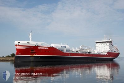
RAMANDA
Tanker
Current Trip
| Time Travelled | 1 day |
|---|---|
| Remaining Time | 16 h, 36 mins |
| Distance Travelled | 449.60 nm |
| Remaining Distance | 213.90 nm |
| AVG Speed | 10.9 Noeuds |
| MAX Speed | 15.8 Noeuds |
| AVG Wind | 4.7 knots |
| MAX Wind | 12.2 knots |
| MIN Temp | 8.8°C / 47.84°F |
| MAX Temp | 13.9°C / 57.02°F |
| Tirant d eau | 6.8 m |
| Position reçue | 1 m depuis |
Current Position
| Longitude | -5.31646° |
|---|---|
| Latitude | 49.09450° |
| Etat | Under way using engine |
| Vitesse | 12.6 Noeuds |
| Parcours | 236.8° |
| Zone | Celtic Sea |
| Station | T-AIS |
| Position reçue | 1 m depuis |
Info
Information
The current position of RAMANDA is in Celtic Sea with coordinates 49.09450° / -5.31646° as reported on 2024-05-10 13:19 by AIS to our vessel tracker app. The vessel's current speed is 12.6 Noeuds and is heading at the port of DONGES. The estimated time of arrival as calculated by MyShipTracking vessel tracking app is 2024-05-11 05:57 LT
The vessel RAMANDA (IMO: 9739812, MMSI: 266457000) is a Tanker It's sailing under the flag of [SE] Sweden.
In this page you can find informations about the vessels current position, last detected port calls, and current voyage information. If the vessels is not in coverage by AIS you will find the latest position.
The current position of RAMANDA is detected by our AIS receivers and we are not responsible for the reliability of the data. The last position was recorded while the vessel was in Coverage by the Ais receivers of our vessel tracking app.
The current draught of RAMANDA as reported by AIS is 6.8 meters
Weather
| Temperature | 13.5°C / 56.3°F |
|---|---|
| Wind Speed | 12 knots |
| Direction | 71° ENE |
| Pressure | 1020.6 hPa |
| Humidity | 89.3 % |
| Cloud Coverage | 100 % |
Featured Company
Last Port Calls
| Port | Arrival | Departure | Time In Port |
|---|---|---|---|
| 2024-05-05 15:22 | 2024-05-08 21:38 | 3 d | |
| 2024-04-30 04:33 | 2024-05-02 08:38 | 2 d | |
| 2024-04-25 12:44 | 2024-04-26 14:10 | 1 d | |
| 2024-04-22 02:23 | 2024-04-23 18:10 | 1 d | |
| 2024-04-20 14:05 | 2024-04-21 12:18 | 22 h | |
| 2024-04-17 22:57 | 2024-04-19 00:52 | 1 d | |
| 2024-04-14 12:29 | 2024-04-15 15:16 | 1 d | |
| 2024-04-07 16:56 | 2024-04-12 00:25 | 4 d | |
| 2024-03-16 00:54 | 2024-03-17 23:32 | 1 d | |
| 2024-03-12 13:59 | 2024-03-14 06:25 | 1 d |
Last Trips
| Origin | Departure | Destination | Arrival | Distance | |
|---|---|---|---|---|---|
| 2024-05-02 09:38 | 2024-05-05 17:22 | 413.88 nm | |||
| 2024-04-26 16:10 | 2024-04-30 05:33 | 413.96 nm | |||
| 2024-04-23 19:10 | 2024-04-25 14:44 | 395.83 nm | |||
| 2024-04-21 13:18 | 2024-04-22 03:23 | 135.43 nm | |||
| 2024-04-19 01:52 | 2024-04-20 15:05 | 25.51 nm | |||
| 2024-04-15 17:16 | 2024-04-17 23:57 | 441.55 nm | |||
| 2024-04-12 02:25 | 2024-04-14 14:29 | 564.44 nm | |||
| 2024-03-17 23:32 | 2024-04-07 18:56 | 628.34 nm | |||
| 2024-03-14 06:25 | 2024-03-16 00:54 | 143.66 nm | |||
| 2024-03-10 08:18 | 2024-03-12 13:59 | 605.22 nm |
Events
| Heure | Evenement | Détails | Position/ Destination | Info |
|---|---|---|---|---|
| 2024-05-10 12:20 | Changement de zone | French part of the Celtic Sea French part of the English Channel |
49.20446 / -5.03811
Celtic Sea
FRDON
|
Vitesse: 13.4 kn Parcours: 239.6° |
| 2024-05-10 09:08 | Detecté en mer | French part of the English Channel |
49.52208 / -4.14006
English Channel
FRDON
|
Vitesse: 11.2 kn Parcours: 242.8° |
| 2024-05-10 04:25 | Changement de zone | United Kingdom part of the English Channel Guernsey part of the English Channel |
49.94239 / -3.04468
English Channel
FRDON
|
Vitesse: 12.5 kn Parcours: 240.1° |
| 2024-05-10 01:38 | Detecté en mer | Guernsey part of the English Channel |
50.15195 / -2.06428
English Channel
FRDON
|
Vitesse: 14.7 kn Parcours: 255.3° |
| 2024-05-09 11:37 | Changement de zone | United Kingdom part of the English Channel United Kingdom part of the North Sea |
51.06996 / 1.47054
English Channel
FRDON
|
Vitesse: 9.4 kn Parcours: 234.7° |
| 2024-05-09 09:44 | Changement d'ETA | 2024/05/11 08:00 2024/05/10 12:00 |
51.31514 / 1.86352
FRDON
|
Vitesse: 13.1 kn Parcours: 213.1° |
| 2024-05-09 07:31 | Changement de zone | United Kingdom part of the North Sea Belgian part of the North Sea |
51.70503 / 2.36173
North Sea
FRDON
|
Vitesse: 15.6 kn Parcours: 221.5° |
| 2024-05-09 06:46 | Changement de zone | Belgian part of the North Sea Dutch part of the North Sea |
51.84643 / 2.56184
North Sea
FRDON
|
Vitesse: 14.7 kn Parcours: 220.3° |
| 2024-05-09 04:00 | Etat Changé | Under way using engine Default |
52.32506 / 3.19754
FRDON
|
Vitesse: 12.6 kn Parcours: 231° |
| 2024-05-09 03:56 | Etat Changé | Default Under way using engine |
52.33348 / 3.21489
FRDON
|
Vitesse: 12.5 kn Parcours: 221.7° |