
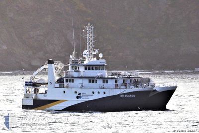
R/V ANTEA
Fishery Research Vessel
Current Trip
HO CHI MINH
| Time Travelled | 3 days |
|---|---|
| Remaining Time | --- |
| Distance Travelled | 23.78 nm |
| Remaining Distance | --- |
| AVG Speed | 9.4 Noeuds |
| MAX Speed | 11.5 Noeuds |
| AVG Wind | 3.8 knots |
| MAX Wind | 5.9 knots |
| MIN Temp | 25.6°C / 78.08°F |
| MAX Temp | 26.9°C / 80.42°F |
| Tirant d eau | 3.8 m |
| Position reçue | 3 d depuis |
Current Position
| Longitude | 106.84629° |
|---|---|
| Latitude | 20.62222° |
| Etat | Under way using engine |
| Vitesse | 7.8 Noeuds |
| Parcours | 211.3° |
| Zone | South China Sea |
| Station | T-AIS |
| Position reçue | 3 d depuis |
Info
Information
The current position of R/V ANTEA is in South China Sea with coordinates 20.62222° / 106.84629° as reported on 2024-06-01 02:24 by AIS to our vessel tracker app. The vessel's current speed is 7.8 Noeuds
The vessel R/V ANTEA (IMO: 9128506, MMSI: 228111000) is a Fishery Research Vessel that was built in 1995 ( 29 Age ). It's sailing under the flag of [FR] France.
In this page you can find informations about the vessels current position, last detected port calls, and current voyage information. If the vessels is not in coverage by AIS you will find the latest position.
The current position of R/V ANTEA is detected by our AIS receivers and we are not responsible for the reliability of the data. The last position was recorded while the vessel was in Coverage by the Ais receivers of our vessel tracking app.
The current draught of R/V ANTEA as reported by AIS is 3.8 meters
Weather
| Temperature | 27.1°C / 80.78°F |
|---|---|
| Wind Speed | 3 knots |
| Direction | 325° NW |
| Pressure | 1008.8 hPa |
| Humidity | 79.2 % |
| Cloud Coverage | 100 % |
Featured Company
Last Trips
Events
| Heure | Evenement | Détails | Position/ Destination | Info |
|---|---|---|---|---|
| 2024-06-01 02:24 | Hors de la zone couverte |
20.62222 / 106.84629
South China Sea
HO CHI MINH
|
Vitesse: 7.8 kn Parcours: 211.3° |
|
| 2024-05-31 23:49 | PORT DE DEPART |
|
20.83423 / 106.78575
HO CHI MINH
|
Vitesse: 7.8 kn Parcours: 117° |
| 2024-05-31 23:00 | Etat Changé | Under way using engine Moored |
20.86804 / 106.68698
[VN] HAI PHONG
|
Vitesse: 7.5 kn Parcours: 72° |
| 2024-05-31 22:59 | Démarrage |
20.86743 / 106.68485
[VN] HAI PHONG
|
Vitesse: 7.3 kn Parcours: 72° |
|
| 2024-05-31 22:41 | Changement d'ETA | 2024/06/10 18:00 2024/05/31 18:00 |
20.86648 / 106.68294
[VN] HAI PHONG
|
Vitesse: Parcours: 257° |
| 2024-05-31 22:34 | Changement de destination | HO CHI MINH VIETNAM HPH |
20.86648 / 106.68294
[VN] HAI PHONG
|
Vitesse: Parcours: 257° |
| 2024-05-31 08:56 | Etat Changé | Moored Under way using engine |
20.86650 / 106.68292
[VN] HAI PHONG
|
Vitesse: Parcours: 258° |
| 2024-05-31 08:43 | Arret |
20.86653 / 106.68292
[VN] HAI PHONG
|
Vitesse: 0.3 kn Parcours: 251° |
|
| 2024-05-31 08:43 | Port d'arrivée |
|
20.86655 / 106.68294
[VN] HAI PHONG
|
Vitesse: 0.7 kn Parcours: 245° |
| 2024-05-31 04:47 | Dans la zone couverte |
20.57240 / 106.88705
South China Sea
VIETNAM HPH
|
Vitesse: 7.8 kn Parcours: 5.3° |