
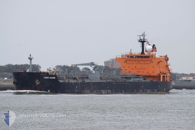
QUEEN MAJESTY
Oil/Chemical Tanker
Current Trip
| Trip Time | 1 day |
|---|---|
| Trip Distance | 221.90 nm |
| AVG Speed | 9.3 Noeuds |
| MAX Speed | 11.3 Noeuds |
| Tirant d eau | 7.2 m |
| AVG Wind | 5.1 knots |
| MAX Wind | 9 knots |
| MIN Temp | 26.7°C / 80.06°F |
| MAX Temp | 30.6°C / 87.08°F |
| Position reçue | 4 d depuis |
Current Position
| Longitude | 119.71994° |
|---|---|
| Latitude | -5.84473° |
| Etat | Under way using engine |
| Vitesse | 11.6 Noeuds |
| Parcours | 255.9° |
| Zone | Flores Sea |
| Station | T-AIS |
| Position reçue | 4 d depuis |
Info
Information
The current position of QUEEN MAJESTY is in Flores Sea with coordinates -5.84473° / 119.71994° as reported on 2024-09-20 12:59 by AIS to our vessel tracker app. The vessel's current speed is 11.6 Noeuds and is currently inside the port of BALIKPAPAN.
The vessel QUEEN MAJESTY (IMO: 9295323, MMSI: 525111010) is a Oil/Chemical Tanker that was built in 2004 ( 20 Age ). It's sailing under the flag of [ID] Indonesia.
In this page you can find informations about the vessels current position, last detected port calls, and current voyage information. If the vessels is not in coverage by AIS you will find the latest position.
The current position of QUEEN MAJESTY is detected by our AIS receivers and we are not responsible for the reliability of the data. The last position was recorded while the vessel was in Coverage by the Ais receivers of our vessel tracking app.
The current draught of QUEEN MAJESTY as reported by AIS is 7.2 meters
Weather
| Temperature | 24.9°C / 76.82°F |
|---|---|
| Wind Speed | 3 knots |
| Direction | 217° SW |
| Pressure | 1009.9 hPa |
| Humidity | 91.5 % |
| Cloud Coverage | 99 % |
Featured Company
Last Port Calls
| Port | Arrival | Departure | Time In Port |
|---|---|---|---|
| 2024-09-24 19:55 | |||
| 2024-09-22 01:56 | 2024-09-22 22:44 | 20 h | |
| 2024-09-11 13:55 | 2024-09-13 08:32 | 1 d | |
| 2024-08-24 13:23 | 2024-08-25 12:23 | 23 h | |
| 2024-08-19 00:45 | 2024-08-20 19:19 | 1 d |
Most Visited Ports (Last year)
| Port | Arrivals | |
|---|---|---|
| 7 | ||
| 7 | ||
| 4 | ||
| 3 | ||
| 2 | ||
| 2 |
Last Trips
| Origin | Departure | Destination | Arrival | Distance | |
|---|---|---|---|---|---|
| 2024-09-22 22:44 | 2024-09-24 19:55 | 221.90 nm | |||
| 2024-09-13 08:32 | 2024-09-22 01:56 | 1378.90 nm | |||
| 2024-08-25 12:23 | 2024-09-11 13:55 | 1246.61 nm | |||
| 2024-08-20 19:19 | 2024-08-24 13:23 | 598.31 nm | |||
| 2024-06-15 11:32 | 2024-08-19 00:45 | 4348.00 nm |
Events
| Heure | Evenement | Détails | Position/ Destination | Info |
|---|---|---|---|---|
| 2024-09-24 11:55 | Arret |
-1.26188 / 116.81234
[ID] BALIKPAPAN
|
Vitesse: Parcours: 7° |
|
| 2024-09-24 11:55 | Port d'arrivée |
|
-1.26188 / 116.81234
[ID] BALIKPAPAN
|
Vitesse: 0.7 kn Parcours: 12° |
| 2024-09-24 09:20 | Démarrage | 9.42 nm, South East of BALIKPAPAN |
-1.34557 / 116.94389
CILACAP,ID
|
Vitesse: 3.5 kn Parcours: 226° |
| 2024-09-24 00:08 | Arret | 9.31 nm, South East of BALIKPAPAN |
-1.34313 / 116.94299
CILACAP,ID
|
Vitesse: 0.2 kn Parcours: 73° |
| 2024-09-22 14:44 | Démarrage | 0.52 nm, South West of MEKAR PUTIH |
-4.03345 / 116.02951
CILACAP,ID
|
Vitesse: 6 kn Parcours: 221° |
| 2024-09-22 14:44 | PORT DE DEPART |
|
-4.03345 / 116.02951
CILACAP,ID
|
Vitesse: 3 kn Parcours: 234° |
| 2024-09-21 18:44 | Arret |
-4.02900 / 116.03462
[ID] MEKAR PUTIH
|
Vitesse: Parcours: 267° |
|
| 2024-09-21 17:56 | Port d'arrivée |
|
-4.02968 / 116.03360
[ID] MEKAR PUTIH
|
Vitesse: 4.8 kn Parcours: 78° |
| 2024-09-20 13:09 | Etat Changé | Default Under way using engine |
-5.85418 / 119.68918
CILACAP,ID
|
Vitesse: 11.6 kn Parcours: 255.9° |
| 2024-09-20 12:59 | Hors de la zone couverte |
-5.84473 / 119.71994
Flores Sea
|
Vitesse: 11.6 kn Parcours: 255.9° |