
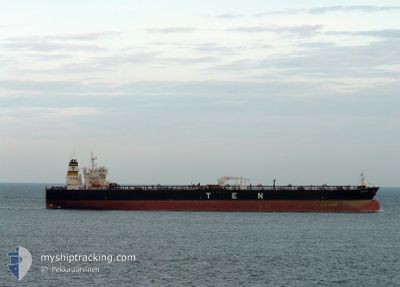
PROPONTIS
Oil Products Tanker
Current Trip
| Time Travelled | 21 days |
|---|---|
| Remaining Time | --- |
| Distance Travelled | 4485.29 nm |
| Remaining Distance | --- |
| AVG Speed | 11.6 Noeuds |
| MAX Speed | 14.3 Noeuds |
| AVG Wind | 11.7 knots |
| MAX Wind | 34 knots |
| MIN Temp | 5.6°C / 42.08°F |
| MAX Temp | 22.3°C / 72.14°F |
| Tirant d eau | 12.1 m |
| Position reçue | 3 m depuis |
Current Position
| Longitude | 8.86551° |
|---|---|
| Latitude | 44.35862° |
| Etat | At anchor |
| Vitesse | |
| Parcours | 76° |
| Zone | Ligurian Sea |
| Station | T-AIS |
| Position reçue | 3 m depuis |
Info
Information
The current position of PROPONTIS is in Ligurian Sea with coordinates 44.35862° / 8.86551° as reported on 2024-05-18 22:52 by AIS to our vessel tracker app. The vessel's current speed is 0 Noeuds
The vessel PROPONTIS (IMO: 9305623, MMSI: 240565000) is a Oil Products Tanker that was built in 2006 ( 18 Age ). It's sailing under the flag of [GR] Greece.
In this page you can find informations about the vessels current position, last detected port calls, and current voyage information. If the vessels is not in coverage by AIS you will find the latest position.
The current position of PROPONTIS is detected by our AIS receivers and we are not responsible for the reliability of the data. The last position was recorded while the vessel was in Coverage by the Ais receivers of our vessel tracking app.
The current draught of PROPONTIS as reported by AIS is 12.1 meters
Weather
| Temperature | 17.5°C / 63.5°F |
|---|---|
| Wind Speed | 6 knots |
| Direction | 22° NNE |
| Pressure | 1012.7 hPa |
| Humidity | 69.3 % |
| Cloud Coverage | --- |
Featured Company
Last Trips
| Origin | Departure | Destination | Arrival | Distance | |
|---|---|---|---|---|---|
| 2024-04-17 01:54 | 2024-04-26 10:09 | 928.71 nm | |||
| 2024-04-03 08:09 | 2024-04-14 09:05 | 2516.13 nm | |||
| 2024-03-17 21:28 | 2024-04-02 04:41 | 3485.47 nm | |||
| 2024-03-09 11:31 | 2024-03-16 12:16 | 750.86 nm | |||
| 2024-02-23 00:53 | 2024-03-08 09:47 | 2307.26 nm |
Events
| Heure | Evenement | Détails | Position/ Destination | Info |
|---|---|---|---|---|
| 2024-05-18 14:46 | Etat Changé | At anchor Default |
44.36037 / 8.86626
LYESI > ITGOA
|
Vitesse: Parcours: 142° |
| 2024-05-18 14:43 | Etat Changé | Default At anchor |
44.36037 / 8.86623
LYESI > ITGOA
|
Vitesse: Parcours: 142° |
| 2024-05-16 20:36 | Arret | 2.7 nm, South of GENOVA |
44.35834 / 8.86607
LYESI > ITGOA
|
Vitesse: 0.3 kn Parcours: 75° |
| 2024-05-16 20:30 | Etat Changé | At anchor Under way using engine |
44.35800 / 8.86673
LYESI > ITGOA
|
Vitesse: 0.4 kn Parcours: 77° |
| 2024-05-16 13:49 | Changement de zone | Italian part of the Ligurian Sea Italian part of the Tyrrhenian Sea |
43.31251 / 9.54391
Ligurian Sea
LYESI > ITGOA
|
Vitesse: 12.3 kn Parcours: 341.9° |
| 2024-05-16 13:41 | Etat Changé | Under way using engine Default |
43.28594 / 9.55592
LYESI > ITGOA
|
Vitesse: 12 kn Parcours: 342° |
| 2024-05-16 13:39 | Etat Changé | Default Under way using engine |
43.27833 / 9.55833
LYESI > ITGOA
|
Vitesse: 12.4 kn Parcours: 341.8° |
| 2024-05-16 13:19 | Changement de zone | Italian part of the Tyrrhenian Sea French part of the Tyrrhenian Sea |
43.21411 / 9.58862
Tyrrhenian Sea
LYESI > ITGOA
|
Vitesse: 12.5 kn Parcours: 341.7° |
| 2024-05-16 12:34 | Changement de zone | French part of the Tyrrhenian Sea Italian part of the Tyrrhenian Sea |
43.05926 / 9.63512
Tyrrhenian Sea
LYESI > ITGOA
|
Vitesse: 12.7 kn Parcours: 345.4° |
| 2024-05-16 11:43 | Detecté en mer | Italian part of the Tyrrhenian Sea |
42.88610 / 9.69880
Tyrrhenian Sea
LYESI > ITGOA
|
Vitesse: 12.7 kn Parcours: 345.1° |