
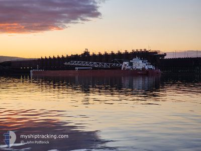
PRESQUE ISLE
Articulated Pusher Tug
Current Trip
| Time Travelled | 11 h, 41 mins |
|---|---|
| Remaining Time | --- |
| Distance Travelled | 117.88 nm |
| Remaining Distance | --- |
| AVG Speed | 11.3 Noeuds |
| MAX Speed | 11.8 Noeuds |
| AVG Wind | 14.7 knots |
| MAX Wind | 20.3 knots |
| MIN Temp | --- |
| MAX Temp | 2.5°C / 36.5°F |
| Tirant d eau | 6.7 m |
| Position reçue | 1 m depuis |
Current Position
| Longitude | --- |
|---|---|
| Latitude | --- |
| Etat | Under way using engine |
| Vitesse | 10.4 Noeuds |
| Parcours | 248.6° |
| Zone | --- |
| Station | T-AIS |
| Position reçue | 1 m depuis |
Info
Information
The current position of PRESQUE ISLE is in --- with coordinates 41.81858° / -82.43960° as reported on 2024-12-04 02:17 by AIS to our vessel tracker app. The vessel's current speed is 10.4 Noeuds and is heading at the port of DULUTH SUPERIOR. The estimated time of arrival as calculated by MyShipTracking vessel tracking app is 2024-12-07 01:00 LT
The vessel PRESQUE ISLE (IMO: 7303877, MMSI: 367348220) is a Articulated Pusher Tug that was built in 1973 ( 51 Age ). It's sailing under the flag of [US] USA.
In this page you can find informations about the vessels current position, last detected port calls, and current voyage information. If the vessels is not in coverage by AIS you will find the latest position.
The current position of PRESQUE ISLE is detected by our AIS receivers and we are not responsible for the reliability of the data. The last position was recorded while the vessel was in Coverage by the Ais receivers of our vessel tracking app.
The current draught of PRESQUE ISLE as reported by AIS is 6.7 meters
Weather
| Temperature | 0.1°C / 32.18°F |
|---|---|
| Wind Speed | 20 knots |
| Direction | 239° WSW |
| Pressure | 1027.3 hPa |
| Humidity | 65.1 % |
| Cloud Coverage | 95 % |
Featured Company
Last Port Calls
| Port | Arrival | Departure | Time In Port |
|---|---|---|---|
| 2024-12-02 18:13 | 2024-12-03 14:38 | 20 h | |
| 2024-11-29 16:02 | 2024-11-29 17:38 | 1 h | |
| 2024-11-26 16:00 | 2024-11-27 21:15 | 1 d | |
| 2024-11-25 09:10 | 2024-11-25 12:14 | 3 h | |
| 2024-11-23 00:32 | 2024-11-23 11:27 | 10 h | |
| 2024-11-20 21:57 | 2024-11-20 23:41 | 1 h | |
| 2024-11-17 13:36 | 2024-11-18 23:35 | 1 d | |
| 2024-11-16 09:21 | 2024-11-16 10:22 | 1 h | |
| 2024-11-13 23:57 | 2024-11-14 11:42 | 11 h | |
| 2024-11-11 15:30 | 2024-11-11 16:58 | 1 h |
Most Visited Ports (Last year)
| Port | Arrivals | |
|---|---|---|
| 73 | ||
| 30 | ||
| 20 | ||
| 14 | ||
| 9 | ||
| 8 |
Last Trips
| Origin | Departure | Destination | Arrival | Distance | |
|---|---|---|---|---|---|
| 2024-11-29 12:38 | 2024-12-02 13:13 | 504.07 nm | |||
| 2024-11-27 15:15 | 2024-11-29 11:02 | 407.78 nm | |||
| 2024-11-25 07:14 | 2024-11-26 10:00 | 319.30 nm | |||
| 2024-11-23 06:27 | 2024-11-25 04:10 | 474.39 nm | |||
| 2024-11-20 18:41 | 2024-11-22 19:32 | 503.00 nm | |||
| 2024-11-18 17:35 | 2024-11-20 16:57 | 332.10 nm | |||
| 2024-11-16 05:22 | 2024-11-17 07:36 | 319.90 nm | |||
| 2024-11-14 06:42 | 2024-11-16 04:21 | 476.65 nm | |||
| 2024-11-11 11:58 | 2024-11-13 18:57 | 478.94 nm | |||
| 2024-11-10 03:38 | 2024-11-11 10:30 | 343.73 nm |
Events
| Heure | Evenement | Détails | Position/ Destination | Info |
|---|---|---|---|---|
| 2024-12-04 00:59 | Etat Changé | Under way using engine Default |
41.90665 / -82.13997
SUPERIOR
|
Vitesse: 11.3 kn Parcours: 251° |
| 2024-12-04 00:44 | Dans la zone couverte |
41.90665 / -82.13997
SUPERIOR
|
Vitesse: 11.2 kn Parcours: 250.1° |
|
| 2024-12-03 19:28 | Etat Changé | Default Under way using engine |
42.27741 / -80.84429
SUPERIOR
|
Vitesse: 11.4 kn Parcours: 248° |
| 2024-12-03 19:00 | Etat Changé | Under way using engine Default |
42.31035 / -80.72933
SUPERIOR
|
Vitesse: 11.5 kn Parcours: 249° |
| 2024-12-03 19:00 | Hors de la zone couverte |
42.31035 / -80.72933
SUPERIOR
|
Vitesse: 11.4 kn Parcours: 248° |
|
| 2024-12-03 18:42 | Etat Changé | Default Under way using engine |
42.33021 / -80.66016
SUPERIOR
|
Vitesse: 11.5 kn Parcours: 247.9° |
| 2024-12-03 18:19 | Etat Changé | Under way using engine Default |
42.35691 / -80.56720
SUPERIOR
|
Vitesse: 11.6 kn Parcours: 249° |
| 2024-12-03 18:19 | Etat Changé | Default Under way using engine |
42.35772 / -80.56447
SUPERIOR
|
Vitesse: 11.6 kn Parcours: 248.3° |
| 2024-12-03 17:17 | Etat Changé | Under way using engine Default |
42.42904 / -80.31506
SUPERIOR
|
Vitesse: 11.8 kn Parcours: 249° |
| 2024-12-03 17:12 | Etat Changé | Default Under way using engine |
42.43508 / -80.29383
SUPERIOR
|
Vitesse: 11.8 kn Parcours: 248.7° |