

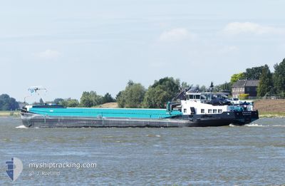
PORTADOR
Other Type

Current Trip
PORTADOR is out of coverage. Learn how you can join the community and extend the coverage to your area by clicking here!
WERKSBRUCKE HOECHST
Unknown Port
ETA*
2025-02-22 06:44 UTC
| Time Travelled | 3 days |
|---|---|
| Remaining Time | --- |
| Distance Travelled | 128.02 nm |
| Remaining Distance | --- |
| AVG Speed | 5.3 Noeuds |
| MAX Speed | 7.2 Noeuds |
| AVG Wind | 6.7 knots |
| MAX Wind | 8.8 knots |
| MIN Temp | 5.7°C / 42.26°F |
| MAX Temp | 15.6°C / 60.08°F |
| Tirant d eau | 0 m |
| Position reçue | 1 d depuis |
Current Position
| Longitude | --- |
|---|---|
| Latitude | --- |
| Etat | Under way using engine |
| Vitesse | 5.2 Noeuds |
| Parcours | 341.9° |
| Zone | North Sea |
| Station | T-AIS |
| Position reçue | 1 d depuis |
Information
The current position of PORTADOR is in North Sea with coordinates 50.07519° / 8.52324° as reported on 2025-02-23 08:44 by AIS to our vessel tracker app. The vessel's current speed is 5.2 Noeuds
The vessel PORTADOR (MMSI: 244071788) is a Other Type It's sailing under the flag of [NL] Netherlands.
In this page you can find informations about the vessels current position, last detected port calls, and current voyage information. If the vessels is not in coverage by AIS you will find the latest position.
The current position of PORTADOR is detected by our AIS receivers and we are not responsible for the reliability of the data. The last position was recorded while the vessel was in Coverage by the Ais receivers of our vessel tracking app.
Weather
| Temperature | 6.8°C / 44.24°F |
|---|---|
| Wind Speed | 2 knots |
| Direction | 211° SSW |
| Pressure | 1029.7 hPa |
| Humidity | 85 % |
| Cloud Coverage | 100 % |


Featured Company
Limited time offer - Install a base station receiver to your area and list your company on MyShipTracking Free forever!
Last Port Calls
| Port | Arrival | Departure | Time In Port |
|---|---|---|---|
| 2025-02-22 18:07 | |||
| 2025-02-21 06:59 | 2025-02-21 08:24 | 1 h | |
| 2025-02-20 20:50 | 2025-02-21 05:41 | 8 h | |
| 2025-02-20 11:03 | 2025-02-20 11:12 | 8 m | |
| 2025-02-19 18:35 | 2025-02-20 05:24 | 10 h | |
| 2025-02-19 10:24 | 2025-02-19 14:18 | 3 h | |
| 2025-02-18 15:35 | 2025-02-19 06:35 | 15 h | |
| 2025-02-17 16:53 | 2025-02-18 11:23 | 18 h | |
| 2025-02-17 16:25 | 2025-02-17 16:41 | 15 m | |
| 2025-02-15 16:53 | 2025-02-16 08:26 | 15 h |
Most Visited Ports (Last year)
| Port | Arrivals | |
|---|---|---|
| 11 | ||
| 11 | ||
| 10 | ||
| 8 | ||
| 8 | ||
| 8 |
Last Trips
| Origin | Departure | Destination | Arrival | Distance | |
|---|---|---|---|---|---|
| 2025-02-21 08:24 | 2025-02-22 18:07 | 117.71 nm | |||
| 2025-02-21 05:41 | 2025-02-21 06:59 | 6.91 nm | |||
| 2025-02-20 11:12 | 2025-02-20 20:50 | 47.37 nm | |||
| 2025-02-20 05:24 | 2025-02-20 11:03 | 33.56 nm | |||
| 2025-02-19 14:18 | 2025-02-19 18:35 | 30.54 nm | |||
| 2025-02-19 06:35 | 2025-02-19 10:24 | 31.96 nm | |||
| 2025-02-18 11:23 | 2025-02-18 15:35 | 30.59 nm | |||
| 2025-02-17 16:41 | 2025-02-17 16:53 | 0.62 nm | |||
| 2025-02-16 08:26 | 2025-02-17 16:25 | 33.76 nm | |||
| 2025-02-15 12:43 | 2025-02-15 16:53 | 25.71 nm |
Events
| Heure | Evenement | Détails | Position/ Destination | Info |
|---|---|---|---|---|
| 2025-02-23 08:44 | Hors de la zone couverte |
50.07519 / 8.52324
North Sea
|
Vitesse: 5.2 kn Parcours: 341.9° |
|
| 2025-02-23 08:09 | Démarrage | 3.65 nm, South West of HOCHST |
50.04094 / 8.48001
WERKSBRUCKE HOECHST
|
Vitesse: 3.7 kn Parcours: 44.1° |
| 2025-02-23 08:02 | Etat Changé | Under way using engine Moored |
50.03827 / 8.47643
WERKSBRUCKE HOECHST
|
Vitesse: 0.5 kn Parcours: 511° |
| 2025-02-23 07:59 | Etat Changé | Moored Under way using engine |
50.03784 / 8.47586
WERKSBRUCKE HOECHST
|
Vitesse: Parcours: 511° |
| 2025-02-23 07:50 | Arret | 3.91 nm, South West of HOCHST |
50.03768 / 8.47560
WERKSBRUCKE HOECHST
|
Vitesse: 0.3 kn Parcours: 511° |
| 2025-02-23 06:36 | Démarrage | 0.62 nm, East of BISCHOFSHEIM |
49.99966 / 8.35124
WERKSBRUCKE HOECHST
|
Vitesse: 3.8 kn Parcours: 81.5° |
| 2025-02-23 06:33 | Etat Changé | Under way using engine Moored |
49.99943 / 8.34858
WERKSBRUCKE HOECHST
|
Vitesse: Parcours: 511° |
| 2025-02-23 03:45 | Dans la zone couverte |
49.99939 / 8.34834
North Sea
|
Vitesse: Parcours: 511° |
|
| 2025-02-23 02:31 | Hors de la zone couverte |
49.99937 / 8.34835
North Sea
[DE] BISCHOFSHEIM
|
Vitesse: Parcours: 511° |
|
| 2025-02-23 02:25 | Dans la zone couverte |
49.99937 / 8.34835
North Sea
[DE] BISCHOFSHEIM
|
Vitesse: Parcours: 511° |