
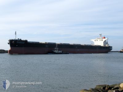
PORO NUPURI MARU
Cargo
Current Trip
AUNTL
| Time Travelled | 25 days |
|---|---|
| Remaining Time | --- |
| Distance Travelled | 6067.82 nm |
| Remaining Distance | --- |
| AVG Speed | 10.8 Noeuds |
| MAX Speed | 14 Noeuds |
| AVG Wind | 16.7 knots |
| MAX Wind | 37 knots |
| MIN Temp | 2.8°C / 37.04°F |
| MAX Temp | 29.6°C / 85.28°F |
| Tirant d eau | 9 m |
| Position reçue | 4 d depuis |
Current Position
| Longitude | --- |
|---|---|
| Latitude | --- |
| Etat | Under way using engine |
| Vitesse | 11.8 Noeuds |
| Parcours | 175.4° |
| Zone | North Pacific Ocean |
| Station | T-AIS |
| Position reçue | 4 d depuis |
Information
The current position of PORO NUPURI MARU is in North Pacific Ocean with coordinates 41.00106° / 141.92544° as reported on 2025-03-14 08:03 by AIS to our vessel tracker app. The vessel's current speed is 11.8 Noeuds
The vessel PORO NUPURI MARU (IMO: 9837303, MMSI: 636019016) is a Cargo It's sailing under the flag of [LR] Liberia.
In this page you can find informations about the vessels current position, last detected port calls, and current voyage information. If the vessels is not in coverage by AIS you will find the latest position.
The current position of PORO NUPURI MARU is detected by our AIS receivers and we are not responsible for the reliability of the data. The last position was recorded while the vessel was in Coverage by the Ais receivers of our vessel tracking app.
The current draught of PORO NUPURI MARU as reported by AIS is 9 meters
Weather
| Temperature | 24.4°C / 75.92°F |
|---|---|
| Wind Speed | 9 knots |
| Direction | 19° NNE |
| Pressure | 1016.5 hPa |
| Humidity | 88.3 % |
| Cloud Coverage | --- |
Featured Company
Most Visited Ports (Last year)
| Port | Arrivals | |
|---|---|---|
| 8 | ||
| 1 |
Events
| Heure | Evenement | Détails | Position/ Destination | Info |
|---|---|---|---|---|
| 2025-03-14 08:10 | Etat Changé | Default Under way using engine |
40.97827 / 141.92809
AUNTL
|
Vitesse: 11.8 kn Parcours: 175.4° |
| 2025-03-14 08:03 | Hors de la zone couverte |
41.00106 / 141.92544
North Pacific Ocean
|
Vitesse: 11.8 kn Parcours: 175.4° |
|
| 2025-03-14 07:59 | Etat Changé | Under way using engine Default |
41.01356 / 141.92414
AUNTL
|
Vitesse: 11.7 kn Parcours: 173° |
| 2025-03-14 07:54 | Etat Changé | Default Under way using engine |
41.03060 / 141.92145
AUNTL
|
Vitesse: 12.4 kn Parcours: 173.5° |
| 2025-03-14 07:45 | Etat Changé | Under way using engine Default |
41.06244 / 141.91587
AUNTL
|
Vitesse: 12.4 kn Parcours: 173° |
| 2025-03-14 07:42 | Etat Changé | Default Under way using engine |
41.07230 / 141.91426
AUNTL
|
Vitesse: 12.4 kn Parcours: 171.5° |
| 2025-03-14 05:03 | Etat Changé | Under way using engine Default |
41.59831 / 141.82810
AUNTL
|
Vitesse: 12 kn Parcours: 174° |
| 2025-03-14 05:01 | Etat Changé | Default Under way using engine |
41.60330 / 141.82726
AUNTL
|
Vitesse: 12 kn Parcours: 171.8° |
| 2025-03-14 04:55 | Etat Changé | Under way using engine Default |
41.62533 / 141.82322
AUNTL
|
Vitesse: 12 kn Parcours: 172° |
| 2025-03-14 04:53 | Etat Changé | Default Under way using engine |
41.63086 / 141.82208
AUNTL
|
Vitesse: 12.1 kn Parcours: 172.7° |