
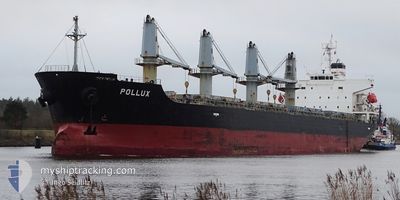
POLLUX
Bulk Carrier
Current Trip
BY ORDER
| Time Travelled | 6 days |
|---|---|
| Remaining Time | --- |
| Distance Travelled | 1140.63 nm |
| Remaining Distance | --- |
| AVG Speed | 10.2 Noeuds |
| MAX Speed | 14.3 Noeuds |
| AVG Wind | 7.2 knots |
| MAX Wind | 24.5 knots |
| MIN Temp | 8.4°C / 47.12°F |
| MAX Temp | 17.9°C / 64.22°F |
| Tirant d eau | 5.8 m |
| Position reçue | 2 m depuis |
Current Position
| Longitude | --- |
|---|---|
| Latitude | --- |
| Etat | Moored |
| Vitesse | |
| Parcours | 2° |
| Zone | Aegean Sea |
| Station | T-AIS |
| Position reçue | 2 m depuis |
Info
Information
The current position of POLLUX is in Aegean Sea with coordinates 37.94740° / 23.55415° as reported on 2024-12-18 04:10 by AIS to our vessel tracker app. The vessel's current speed is 0 Noeuds
The vessel POLLUX (IMO: 9379648, MMSI: 636019890) is a Bulk Carrier that was built in 2007 ( 17 Age ). It's sailing under the flag of [LR] Liberia.
In this page you can find informations about the vessels current position, last detected port calls, and current voyage information. If the vessels is not in coverage by AIS you will find the latest position.
The current position of POLLUX is detected by our AIS receivers and we are not responsible for the reliability of the data. The last position was recorded while the vessel was in Coverage by the Ais receivers of our vessel tracking app.
The current draught of POLLUX as reported by AIS is 5.8 meters
Weather
| Temperature | 11.8°C / 53.24°F |
|---|---|
| Wind Speed | 4 knots |
| Direction | 357° N |
| Pressure | 1025 hPa |
| Humidity | 54.9 % |
| Cloud Coverage | --- |
Featured Company
Most Visited Ports (Last year)
| Port | Arrivals | |
|---|---|---|
| 2 | ||
| 1 | ||
| 1 | ||
| 1 | ||
| 1 | ||
| 1 |
Events
| Heure | Evenement | Détails | Position/ Destination | Info |
|---|---|---|---|---|
| 2024-12-17 23:40 | Changement d'ETA | 2024/12/17 01:00 2025/01/01 01:00 |
37.94737 / 23.55419
BY ORDER
|
Vitesse: Parcours: 2° |
| 2024-12-17 23:34 | Changement d'ETA | 2025/01/01 01:00 2024/12/17 01:00 |
37.94740 / 23.55418
BY ORDER
|
Vitesse: Parcours: 2° |
| 2024-12-17 22:10 | Changement d'ETA | 2024/12/17 01:00 2025/01/01 01:00 |
37.94743 / 23.55413
BY ORDER
|
Vitesse: Parcours: 2° |
| 2024-12-17 22:04 | Changement d'ETA | 2025/01/01 01:00 2024/12/17 01:00 |
37.94741 / 23.55414
BY ORDER
|
Vitesse: Parcours: 2° |
| 2024-12-17 09:34 | Etat Changé | Moored Under way using engine |
37.94741 / 23.55413
BY ORDER
|
Vitesse: Parcours: 2° |
| 2024-12-17 08:49 | Arret | 0.84 nm, South West of PERAMA |
37.94864 / 23.55454
BY ORDER
|
Vitesse: 0.3 kn Parcours: 356° |
| 2024-12-17 06:55 | Changement d'ETA | 2024/12/17 01:00 2025/01/01 01:00 |
37.79702 / 23.68373
BY ORDER
|
Vitesse: 11 kn Parcours: 342.4° |
| 2024-12-17 06:49 | Changement d'ETA | 2025/01/01 01:00 2024/12/17 01:00 |
37.77834 / 23.69416
BY ORDER
|
Vitesse: 12.3 kn Parcours: 333.8° |
| 2024-12-17 04:01 | Tirant d'eau modifié | 5.8 9.7 |
37.22059 / 23.70772
BY ORDER
|
Vitesse: 12 kn Parcours: 14° |
| 2024-12-17 04:01 | Changement de destination | BY ORDER DZBJA |
37.22059 / 23.70772
BY ORDER
|
Vitesse: 12 kn Parcours: 14° |