

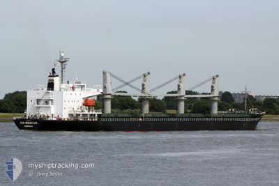
POCHARD S
General Cargo

Current Trip
| Time Travelled | 17 h, 36 mins |
|---|---|
| Remaining Time | --- |
| Distance Travelled | 196.52 nm |
| Remaining Distance | --- |
| AVG Speed | 11.3 Noeuds |
| MAX Speed | 14.5 Noeuds |
| AVG Wind | 9.2 knots |
| MAX Wind | 17.5 knots |
| MIN Temp | 7.9°C / 46.22°F |
| MAX Temp | 13.5°C / 56.3°F |
| Tirant d eau | 7.9 m |
| Position reçue | 4 h, 29 m depuis |
Current Position
| Longitude | --- |
|---|---|
| Latitude | --- |
| Etat | Under way using engine |
| Vitesse | 14.2 Noeuds |
| Parcours | 254.3° |
| Zone | English Channel |
| Station | T-AIS |
| Position reçue | 4 h, 29 m depuis |
Information
The current position of POCHARD S is in English Channel with coordinates 50.31527° / -1.23813° as reported on 2025-03-28 01:35 by AIS to our vessel tracker app. The vessel's current speed is 14.2 Noeuds and is heading at the port of DOMVRAINA. The estimated time of arrival as calculated by MyShipTracking vessel tracking app is 2025-04-07 07:00 LT
The vessel POCHARD S (IMO: 9363314, MMSI: 636017555) is a General Cargo that was built in 2007 ( 18 Age ). It's sailing under the flag of [LR] Liberia.
In this page you can find informations about the vessels current position, last detected port calls, and current voyage information. If the vessels is not in coverage by AIS you will find the latest position.
The current position of POCHARD S is detected by our AIS receivers and we are not responsible for the reliability of the data. The last position was recorded while the vessel was in Coverage by the Ais receivers of our vessel tracking app.
The current draught of POCHARD S as reported by AIS is 7.9 meters
Weather
| Temperature | 10.8°C / 51.44°F |
|---|---|
| Wind Speed | 18 knots |
| Direction | 253° WSW |
| Pressure | 1013.5 hPa |
| Humidity | 92.9 % |
| Cloud Coverage | 99 % |


Featured Company
Last Port Calls
| Port | Arrival | Departure | Time In Port |
|---|---|---|---|
| 2025-03-23 16:39 | 2025-03-27 13:29 | 3 d | |
| 2025-03-14 10:06 | 2025-03-21 17:35 | 7 d | |
| 2025-02-22 10:18 | 2025-02-26 21:26 | 4 d | |
| 2025-02-05 13:13 | 2025-02-12 18:05 | 7 d | |
| 2025-01-26 17:21 | 2025-01-29 08:20 | 2 d | |
| 2025-01-26 13:45 | 2025-01-26 16:20 | 2 h | |
| 2025-01-26 12:49 | |||
| 2025-01-26 12:01 | |||
| 2025-01-08 18:59 | 2025-01-13 13:59 | 4 d |
Most Visited Ports (Last year)
| Port | Arrivals | |
|---|---|---|
| 5 | ||
| 3 | ||
| 2 | ||
| 1 | ||
| 1 | ||
| 1 |
Last Trips
| Origin | Departure | Destination | Arrival | Distance | |
|---|---|---|---|---|---|
| 2025-03-21 17:35 | 2025-03-23 16:39 | 102.53 nm | |||
| 2025-02-26 21:26 | 2025-03-14 10:06 | 3429.42 nm | |||
| 2025-02-12 18:05 | 2025-02-22 10:18 | 518.39 nm | |||
| 2025-01-29 08:20 | 2025-02-05 13:13 | 1335.43 nm | |||
| 2025-01-26 16:20 | 2025-01-26 17:21 | 5.24 nm | |||
| 2025-01-26 12:01 | 2025-01-26 13:45 | 22.27 nm | |||
| 2025-01-13 13:59 | 2025-01-26 12:49 | 796.91 nm | |||
| 2024-12-22 00:34 | 2025-01-08 18:59 | 4287.81 nm |
Events
| Heure | Evenement | Détails | Position/ Destination | Info |
|---|---|---|---|---|
| 2025-03-28 01:44 | Etat Changé | Default Under way using engine |
50.30651 / -1.28846
GR THI
|
Vitesse: 14.2 kn Parcours: 254.3° |
| 2025-03-28 01:35 | Hors de la zone couverte |
50.31527 / -1.23813
English Channel
GR THI
|
Vitesse: 14.2 kn Parcours: 254.3° |
|
| 2025-03-28 01:30 | Etat Changé | Under way using engine Default |
50.32074 / -1.20737
GR THI
|
Vitesse: 14.2 kn Parcours: 256° |
| 2025-03-28 01:28 | Etat Changé | Default Under way using engine |
50.32293 / -1.19298
GR THI
|
Vitesse: 14.1 kn Parcours: 255.6° |
| 2025-03-28 01:21 | Etat Changé | Under way using engine Default |
50.32942 / -1.15106
GR THI
|
Vitesse: 14.3 kn Parcours: 258° |
| 2025-03-28 01:20 | Etat Changé | Default Under way using engine |
50.33031 / -1.14499
GR THI
|
Vitesse: 14.3 kn Parcours: 257.4° |
| 2025-03-28 01:12 | Etat Changé | Under way using engine Default |
50.33717 / -1.09950
GR THI
|
Vitesse: 14.3 kn Parcours: 256° |
| 2025-03-28 01:12 | Etat Changé | Default Under way using engine |
50.33763 / -1.09647
GR THI
|
Vitesse: 14.3 kn Parcours: 255.7° |
| 2025-03-27 19:57 | Etat Changé | Under way using engine Default |
50.60699 / .42830
GR THI
|
Vitesse: 9.2 kn Parcours: 255° |
| 2025-03-27 19:54 | Etat Changé | Default Under way using engine |
50.60899 / .43933
GR THI
|
Vitesse: 9.2 kn Parcours: 254.7° |