

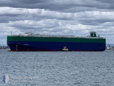
PLATINUM RAY
Ro-Ro/Passenger Ship

Current Trip
| Time Travelled | 2 days |
|---|---|
| Remaining Time | 3 h, 40 mins |
| Distance Travelled | 143.23 nm |
| Remaining Distance | 53.59 nm |
| AVG Speed | 11.4 Noeuds |
| MAX Speed | 17.9 Noeuds |
| AVG Wind | 14.4 knots |
| MAX Wind | 31 knots |
| MIN Temp | 6.2°C / 43.16°F |
| MAX Temp | 7.9°C / 46.22°F |
| Tirant d eau | 8 m |
| Position reçue | 1 d depuis |
Current Position
| Longitude | --- |
|---|---|
| Latitude | --- |
| Etat | At anchor |
| Vitesse | 0.1 Noeuds |
| Parcours | 27° |
| Zone | North Sea |
| Station | T-AIS |
| Position reçue | 1 d depuis |
Information
The current position of PLATINUM RAY is in North Sea with coordinates 54.03244° / 7.47133° as reported on 2025-03-29 02:14 by AIS to our vessel tracker app. The vessel's current speed is 0.1 Noeuds and is heading at the port of BREMERHAVEN. The estimated time of arrival as calculated by MyShipTracking vessel tracking app is 2025-03-30 16:45 LT
The vessel PLATINUM RAY (IMO: 9210438, MMSI: 308726000) is a Ro-Ro/Passenger Ship that was built in 2000 ( 25 Age ). It's sailing under the flag of [BS] Bahamas.
In this page you can find informations about the vessels current position, last detected port calls, and current voyage information. If the vessels is not in coverage by AIS you will find the latest position.
The current position of PLATINUM RAY is detected by our AIS receivers and we are not responsible for the reliability of the data. The last position was recorded while the vessel was in Coverage by the Ais receivers of our vessel tracking app.
The current draught of PLATINUM RAY as reported by AIS is 8 meters
Weather
| Temperature | 7.4°C / 45.32°F |
|---|---|
| Wind Speed | 30 knots |
| Direction | 285° WNW |
| Pressure | 1006.2 hPa |
| Humidity | 83.9 % |
| Cloud Coverage | 98 % |


Featured Company
Last Port Calls
| Port | Arrival | Departure | Time In Port |
|---|---|---|---|
| 2025-03-25 20:42 | 2025-03-27 22:23 | 2 d | |
| 2025-03-22 11:04 | 2025-03-23 17:10 | 1 d | |
| 2025-03-18 06:12 | 2025-03-18 12:53 | 6 h | |
| 2025-02-27 03:23 | 2025-02-28 23:55 | 1 d | |
| 2025-02-23 04:28 | 2025-02-24 07:24 | 1 d | |
| 2025-02-19 03:48 | 2025-02-19 19:24 | 15 h | |
| 2025-02-11 20:25 | 2025-02-12 08:25 | 12 h | |
| 2025-02-08 10:50 | 2025-02-09 00:57 | 14 h | |
| 2025-02-06 03:23 | 2025-02-07 00:55 | 21 h | |
| 2025-01-28 03:36 | 2025-01-29 17:23 | 1 d |
Most Visited Ports (Last year)
| Port | Arrivals | |
|---|---|---|
| 4 | ||
| 4 | ||
| 4 | ||
| 2 | ||
| 2 | ||
| 2 |
Last Trips
| Origin | Departure | Destination | Arrival | Distance | |
|---|---|---|---|---|---|
| 2025-03-23 17:10 | 2025-03-25 20:42 | 266.62 nm | |||
| 2025-03-18 12:53 | 2025-03-22 11:04 | 931.94 nm | |||
| 2025-02-28 23:55 | 2025-03-18 06:12 | 6144.57 nm | |||
| 2025-02-24 07:24 | 2025-02-27 03:23 | 477.17 nm | |||
| 2025-02-19 19:24 | 2025-02-23 04:28 | 1185.96 nm | |||
| 2025-02-12 08:25 | 2025-02-19 03:48 | 1914.04 nm | |||
| 2025-02-09 00:57 | 2025-02-11 20:25 | 1043.57 nm | |||
| 2025-02-07 00:55 | 2025-02-08 10:50 | 479.93 nm | |||
| 2025-01-29 17:23 | 2025-02-06 03:23 | 2659.89 nm | |||
| 2025-01-26 14:47 | 2025-01-28 03:36 | 335.46 nm |
Events
| Heure | Evenement | Détails | Position/ Destination | Info |
|---|---|---|---|---|
| 2025-03-29 19:20 | Démarrage | 17.43 nm, South West of HELGOLAND |
54.03174 / 7.46601
DEBRV
|
Vitesse: 5.1 kn Parcours: 274° |
| 2025-03-29 02:17 | Etat Changé | Default At anchor |
54.03253 / 7.47121
DEBRV
|
Vitesse: 0.1 kn Parcours: 27° |
| 2025-03-29 02:14 | Etat Changé | At anchor Default |
54.03244 / 7.47133
DEBRV
|
Vitesse: 0.1 kn Parcours: 22° |
| 2025-03-29 02:14 | Hors de la zone couverte |
54.03244 / 7.47133
North Sea
|
Vitesse: 0.1 kn Parcours: 273° |
|
| 2025-03-29 02:08 | Etat Changé | Default At anchor |
54.03234 / 7.47158
DEBRV
|
Vitesse: 0.1 kn Parcours: 21° |
| 2025-03-29 02:02 | Etat Changé | At anchor Default |
54.03236 / 7.47190
DEBRV
|
Vitesse: 0.1 kn Parcours: 13° |
| 2025-03-29 01:50 | Dans la zone couverte |
54.03236 / 7.47190
North Sea
|
Vitesse: 0.1 kn Parcours: 302.9° |
|
| 2025-03-28 04:17 | Arret | 17.22 nm, South West of HELGOLAND |
54.03381 / 7.47086
DEBRV
|
Vitesse: 0.1 kn Parcours: 189° |
| 2025-03-28 02:35 | Etat Changé | Default Under way using engine |
53.89350 / 7.25298
DEBRV
|
Vitesse: 14.3 kn Parcours: 71.5° |
| 2025-03-28 02:31 | Hors de la zone couverte |
53.88871 / 7.22661
North Sea
DEBRV
|
Vitesse: 14.3 kn Parcours: 71.5° |