
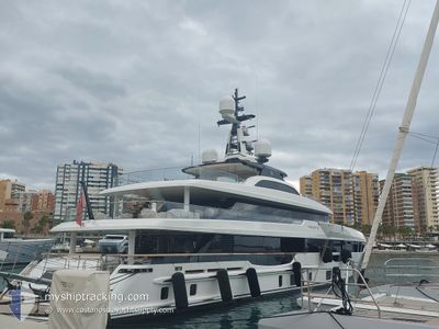
PIACERE
Pleasure Craft
Current Trip
| Trip Time | 3 h, 20 mins |
|---|---|
| Trip Distance | 31.62 nm |
| AVG Speed | 9 Noeuds |
| MAX Speed | 10.9 Noeuds |
| Tirant d eau | 2.5 m |
| AVG Wind | 4.9 knots |
| MAX Wind | 7.9 knots |
| MIN Temp | 15.6°C / 60.08°F |
| MAX Temp | 17.5°C / 63.5°F |
| Position reçue | 3 m depuis |
Current Position
| Longitude | 7.28430° |
|---|---|
| Latitude | 43.69741° |
| Etat | Moored |
| Vitesse | |
| Parcours | 103° |
| Zone | Mediterranean Sea - Western Basin |
| Station | T-AIS |
| Position reçue | 3 m depuis |
Info
Information
The current position of PIACERE is in Mediterranean Sea - Western Basin with coordinates 43.69741° / 7.28430° as reported on 2024-05-07 15:39 by AIS to our vessel tracker app. The vessel's current speed is 0 Noeuds and is currently inside the port of NICE.
The vessel PIACERE (IMO: 9881017, MMSI: 319250800) is a Pleasure Craft It's sailing under the flag of [KY] Cayman Is.
In this page you can find informations about the vessels current position, last detected port calls, and current voyage information. If the vessels is not in coverage by AIS you will find the latest position.
The current position of PIACERE is detected by our AIS receivers and we are not responsible for the reliability of the data. The last position was recorded while the vessel was in Coverage by the Ais receivers of our vessel tracking app.
The current draught of PIACERE as reported by AIS is 2.5 meters
Weather
| Temperature | 16.4°C / 61.52°F |
|---|---|
| Wind Speed | 7 knots |
| Direction | 95° E |
| Pressure | 1011 hPa |
| Humidity | 70.8 % |
| Cloud Coverage | 3 % |
Featured Company
Last Port Calls
| Port | Arrival | Departure | Time In Port |
|---|---|---|---|
| 2024-05-07 10:35 | |||
| 2024-05-05 11:45 | 2024-05-07 07:15 | 1 d | |
| 2024-05-02 10:10 | 2024-05-03 05:04 | 18 h | |
| 2024-04-28 13:22 | 2024-05-02 09:13 | 3 d | |
| 2024-04-26 18:40 | 2024-04-28 05:00 | 1 d | |
| 2024-04-25 15:47 | |||
| 2024-04-17 17:57 | 2024-04-22 12:47 | 4 d | |
| 2024-04-05 06:05 | 2024-04-17 05:39 | 11 d | |
| 2024-04-03 05:31 | 2024-04-04 10:04 | 1 d | |
| 2024-04-01 12:12 | 2024-04-02 11:13 | 23 h |
Last Trips
| Origin | Departure | Destination | Arrival | Distance | |
|---|---|---|---|---|---|
| 2024-05-07 09:15 | 2024-05-07 12:35 | 31.62 nm | |||
| 2024-05-03 07:04 | 2024-05-05 13:45 | 176.86 nm | |||
| 2024-05-02 11:13 | 2024-05-02 12:10 | 9.55 nm | |||
| 2024-04-28 07:00 | 2024-04-28 15:22 | 80.00 nm | |||
| 2024-04-22 14:47 | 2024-04-25 17:47 | 147.50 nm | |||
| 2024-04-17 07:39 | 2024-04-17 19:57 | 131.78 nm | |||
| 2024-04-04 12:04 | 2024-04-05 08:05 | 221.74 nm | |||
| 2024-04-02 13:13 | 2024-04-03 07:31 | 203.00 nm | |||
| 2024-03-30 13:58 | 2024-04-01 14:12 | 73.25 nm | |||
| 2024-03-29 04:15 | 2024-03-29 10:40 | 65.57 nm |
Events
| Heure | Evenement | Détails | Position/ Destination | Info |
|---|---|---|---|---|
| 2024-05-07 11:01 | Etat Changé | Moored Under way using engine |
43.69741 / 7.28430
[FR] NICE
|
Vitesse: Parcours: 103° |
| 2024-05-07 10:45 | Arret |
43.69725 / 7.28493
[FR] NICE
|
Vitesse: 0.3 kn Parcours: 71° |
|
| 2024-05-07 10:35 | Port d'arrivée |
|
43.69024 / 7.28886
[FR] NICE
|
Vitesse: 4 kn Parcours: 33° |
| 2024-05-07 10:33 | Démarrage | 0.16 nm, South West of NICE |
43.68920 / 7.28645
NICE
|
Vitesse: 3.9 kn Parcours: 85° |
| 2024-05-07 10:23 | Arret | 0.26 nm, South West of NICE |
43.68745 / 7.28563
NICE
|
Vitesse: 0.3 kn Parcours: 315° |
| 2024-05-07 09:19 | Changement de zone | French part of the Mediterranean Sea - Western Basin Mon�gasque part of the Mediterranean Sea - Western Basin |
43.62036 / 7.45258
Mediterranean Sea - Western Basin
NICE
|
Vitesse: 10.9 kn Parcours: 272.5° |
| 2024-05-07 09:10 | Detecté en mer | Mon�gasque part of the Mediterranean Sea - Western Basin |
43.62260 / 7.48817
Mediterranean Sea - Western Basin
NICE
|
Vitesse: 10.8 kn Parcours: 244.4° |
| 2024-05-07 08:40 | Detecté en mer | French part of the Mediterranean Sea - Western Basin |
43.66009 / 7.59792
Mediterranean Sea - Western Basin
NICE
|
Vitesse: 10.3 kn Parcours: 244° |
| 2024-05-07 08:07 | Changement de zone | Italian part of the Mediterranean Sea - Western Basin Italian part of the Ligurian Sea |
43.70003 / 7.71713
Mediterranean Sea - Western Basin
NICE
|
Vitesse: 10.6 kn Parcours: 244.7° |
| 2024-05-07 07:16 | Changement de destination | NICE RAPALLO |
43.81221 / 7.79137
NICE
|
Vitesse: 9.7 kn Parcours: 143.5° |