
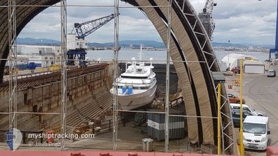
PGS APOLLO
Research/Survey Vessel
Current Trip
SOUTH OF LP FOR FMEA
| Time Travelled | 4 days |
|---|---|
| Remaining Time | --- |
| Distance Travelled | 925.75 nm |
| Remaining Distance | --- |
| AVG Speed | 9 Noeuds |
| MAX Speed | 18.6 Noeuds |
| AVG Wind | 16.9 knots |
| MAX Wind | 22 knots |
| MIN Temp | 18.3°C / 64.94°F |
| MAX Temp | 23.1°C / 73.58°F |
| Tirant d eau | 6.5 m |
| Position reçue | 3 h, 7 m depuis |
Current Position
| Longitude | -15.64835° |
|---|---|
| Latitude | 27.44900° |
| Etat | Under way using engine |
| Vitesse | 1.9 Noeuds |
| Parcours | 310° |
| Zone | North Atlantic Ocean |
| Station | T-AIS |
| Position reçue | 3 h, 7 m depuis |
Info
Information
The current position of PGS APOLLO is in North Atlantic Ocean with coordinates 27.44900° / -15.64835° as reported on 2024-06-12 01:52 by AIS to our vessel tracker app. The vessel's current speed is 1.9 Noeuds
The vessel PGS APOLLO (IMO: 9378228, MMSI: 311056100) is a Research/Survey Vessel that was built in 2010 ( 14 Age ). It's sailing under the flag of [BS] Bahamas.
In this page you can find informations about the vessels current position, last detected port calls, and current voyage information. If the vessels is not in coverage by AIS you will find the latest position.
The current position of PGS APOLLO is detected by our AIS receivers and we are not responsible for the reliability of the data. The last position was recorded while the vessel was in Coverage by the Ais receivers of our vessel tracking app.
The current draught of PGS APOLLO as reported by AIS is 6.5 meters
Weather
| Temperature | 20.3°C / 68.54°F |
|---|---|
| Wind Speed | 22 knots |
| Direction | 24° NNE |
| Pressure | 1019.3 hPa |
| Humidity | 71.6 % |
| Cloud Coverage | 92 % |
Featured Company
Last Port Calls
| Port | Arrival | Departure | Time In Port |
|---|---|---|---|
| 2024-04-30 09:33 | 2024-06-07 15:35 | ||
| 2024-04-19 18:56 | 2024-04-27 08:31 | 7 d |
Most Visited Ports (Last year)
| Port | Arrivals | |
|---|---|---|
| 5 | ||
| 2 | ||
| 2 | ||
| 1 | ||
| 1 |
Last Trips
| Origin | Departure | Destination | Arrival | Distance | |
|---|---|---|---|---|---|
| 2024-04-27 08:31 | 2024-04-30 09:33 | 715.13 nm | |||
| 2024-03-14 13:17 | 2024-04-19 18:56 | 190.36 nm |
Events
| Heure | Evenement | Détails | Position/ Destination | Info |
|---|---|---|---|---|
| 2024-06-12 01:59 | Etat Changé | Default Under way using engine |
27.44333 / -15.65833
SOUTH OF LP FOR FMEA
|
Vitesse: 1.9 kn Parcours: 310° |
| 2024-06-12 01:52 | Hors de la zone couverte |
27.44900 / -15.64835
North Atlantic Ocean
|
Vitesse: 1.9 kn Parcours: 248.4° |
|
| 2024-06-12 01:41 | Etat Changé | Under way using engine Default |
27.45270 / -15.64311
SOUTH OF LP FOR FMEA
|
Vitesse: 2.1 kn Parcours: 228° |
| 2024-06-12 01:39 | Dans la zone couverte |
27.45270 / -15.64311
North Atlantic Ocean
|
Vitesse: 1.6 kn Parcours: 203.6° |
|
| 2024-06-12 00:19 | Etat Changé | Default Under way using engine |
27.47390 / -15.59518
SOUTH OF LP FOR FMEA
|
Vitesse: 5.4 kn Parcours: 249.8° |
| 2024-06-12 00:11 | Hors de la zone couverte |
27.48071 / -15.59449
North Atlantic Ocean
|
Vitesse: 5.4 kn Parcours: 249.8° |
|
| 2024-06-12 00:04 | Etat Changé | Under way using engine Default |
27.48296 / -15.58849
SOUTH OF LP FOR FMEA
|
Vitesse: 2.2 kn Parcours: 299° |
| 2024-06-12 00:03 | Etat Changé | Default Under way using engine |
27.48348 / -15.58817
SOUTH OF LP FOR FMEA
|
Vitesse: 2 kn Parcours: 303° |
| 2024-06-11 23:28 | Etat Changé | Under way using engine Default |
27.50095 / -15.57805
SOUTH OF LP FOR FMEA
|
Vitesse: 1.8 kn Parcours: 302° |
| 2024-06-11 23:27 | Etat Changé | Default Under way using engine |
27.50129 / -15.57787
SOUTH OF LP FOR FMEA
|
Vitesse: 1.8 kn Parcours: 303° |