
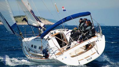
PEPPER
Pleasure Craft
Current Trip
| Trip Time | 18 h, 38 mins |
|---|---|
| Trip Distance | 34.66 nm |
| AVG Speed | 5.4 Noeuds |
| MAX Speed | 9 Noeuds |
| Tirant d eau | --- |
| AVG Wind | 8.2 knots |
| MAX Wind | 11.4 knots |
| MIN Temp | 17.9°C / 64.22°F |
| MAX Temp | 20.7°C / 69.26°F |
| Position reçue | 5 d depuis |
Current Position
| Longitude | 10.28362° |
|---|---|
| Latitude | 54.41960° |
| Etat | Default |
| Vitesse | 0.1 Noeuds |
| Parcours | --- |
| Zone | Baltic Sea |
| Station | T-AIS |
| Position reçue | 5 d depuis |
Info
Information
The current position of PEPPER is in Baltic Sea with coordinates 54.41960° / 10.28362° as reported on 2024-06-27 08:54 by AIS to our vessel tracker app. The vessel's current speed is 0.1 Noeuds and is currently inside the port of WENDTORF.
The vessel PEPPER (MMSI: 211840870) is a Pleasure Craft It's sailing under the flag of [DE] Germany.
In this page you can find informations about the vessels current position, last detected port calls, and current voyage information. If the vessels is not in coverage by AIS you will find the latest position.
The current position of PEPPER is detected by our AIS receivers and we are not responsible for the reliability of the data. The last position was recorded while the vessel was in Coverage by the Ais receivers of our vessel tracking app.
Weather
| Temperature | 20.4°C / 68.72°F |
|---|---|
| Wind Speed | 10 knots |
| Direction | 115° ESE |
| Pressure | 1008.7 hPa |
| Humidity | 83.1 % |
| Cloud Coverage | 100 % |
Featured Company
Last Port Calls
| Port | Arrival | Departure | Time In Port |
|---|---|---|---|
| 2024-06-27 08:26 | |||
| 2024-06-26 12:46 | 2024-06-26 13:48 | 1 h | |
| 2024-06-24 15:10 | 2024-06-25 10:39 | 19 h | |
| 2024-06-21 09:37 | 2024-06-23 05:09 | 1 d | |
| 2024-06-16 15:44 | 2024-06-18 11:19 | 1 d | |
| 2024-06-13 12:13 | 2024-06-14 03:26 | 15 h | |
| 2024-06-08 14:24 | 2024-06-11 02:15 | 2 d | |
| 2024-06-07 09:48 | 2024-06-08 03:44 | 17 h | |
| 2024-06-06 17:57 | 2024-06-07 05:38 | 11 h | |
| 2024-05-20 13:50 | 2024-06-05 01:40 | 15 d |
Last Trips
| Origin | Departure | Destination | Arrival | Distance | |
|---|---|---|---|---|---|
| 2024-06-26 15:48 | 2024-06-27 10:26 | 34.66 nm | |||
| 2024-06-25 12:39 | 2024-06-26 14:46 | 36.42 nm | |||
| 2024-06-23 07:09 | 2024-06-24 17:10 | 115.58 nm | |||
| 2024-06-18 13:19 | 2024-06-21 11:37 | 129.57 nm | |||
| 2024-06-14 05:26 | 2024-06-16 17:44 | 97.95 nm | |||
| 2024-06-11 04:15 | 2024-06-13 14:13 | 90.27 nm | |||
| 2024-06-08 05:44 | 2024-06-08 16:24 | 62.29 nm | |||
| 2024-06-07 07:38 | 2024-06-07 11:48 | 21.75 nm | |||
| 2024-06-05 03:40 | 2024-06-06 19:57 | 172.56 nm | |||
| 2024-05-19 10:25 | 2024-05-20 15:50 | 63.36 nm |
Events
| Heure | Evenement | Détails | Position/ Destination | Info |
|---|---|---|---|---|
| 2024-06-27 08:54 | Hors de la zone couverte |
54.41960 / 10.28362
Baltic Sea
[DE] WENDTORF
|
Vitesse: 0.1 kn Parcours: 511° |
|
| 2024-06-27 08:34 | Arret |
54.42089 / 10.28408
[DE] WENDTORF
|
Vitesse: 0.3 kn Parcours: 511° |
|
| 2024-06-27 08:26 | Port d'arrivée |
|
54.42048 / 10.27587
[DE] WENDTORF
|
Vitesse: 2.9 kn Parcours: 511° |
| 2024-06-27 06:04 | Changement de zone | German part of the Baltic Sea Danish part of the Baltic Sea |
54.57229 / 10.54126
Baltic Sea
|
Vitesse: 6.9 kn Parcours: 221° |
| 2024-06-27 04:34 | Changement de zone | Danish part of the Baltic Sea Danish part of the Kattegat |
54.74117 / 10.64276
Baltic Sea
|
Vitesse: 6.7 kn Parcours: 179.1° |
| 2024-06-27 04:14 | Démarrage | 7.58 nm, South East of MARSTAL |
54.76208 / 10.66663
|
Vitesse: 3.5 kn Parcours: 272.4° |
| 2024-06-27 04:07 | Dans la zone couverte |
54.76214 / 10.67047
Kattegat
|
Vitesse: 0.4 kn Parcours: 511° |
|
| 2024-06-26 15:59 | Hors de la zone couverte |
54.76223 / 10.67034
Kattegat
|
Vitesse: 0.1 kn Parcours: 511° |
|
| 2024-06-26 15:51 | Arret | 7.67 nm, South East of MARSTAL |
54.76213 / 10.67074
|
Vitesse: 0.2 kn Parcours: 511° |
| 2024-06-26 13:48 | PORT DE DEPART |
|
54.85601 / 10.52687
|
Vitesse: 3.5 kn Parcours: 109.4° |