
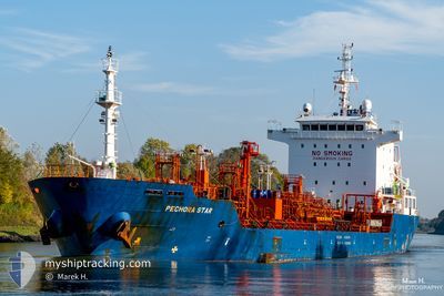
PECHORA STAR
Oil/Chemical Tanker
Current Trip
| Time Travelled | 9 days |
|---|---|
| Remaining Time | 14 h, 18 mins |
| Distance Travelled | 1881.77 nm |
| Remaining Distance | 60.95 nm |
| AVG Speed | 7.9 Noeuds |
| MAX Speed | 13.6 Noeuds |
| AVG Wind | 23.9 knots |
| MAX Wind | 31 knots |
| MIN Temp | 3.1°C / 37.58°F |
| MAX Temp | 19°C / 66.2°F |
| Tirant d eau | 5.9 m |
| Position reçue | 1 m depuis |
Current Position
| Longitude | --- |
|---|---|
| Latitude | --- |
| Etat | Under way using engine |
| Vitesse | 1.8 Noeuds |
| Parcours | 286° |
| Zone | North Sea |
| Station | T-AIS |
| Position reçue | 1 m depuis |
Info
Information
The current position of PECHORA STAR is in North Sea with coordinates 51.82908° / 3.42932° as reported on 2026-01-03 14:28 by AIS to our vessel tracker app. The vessel's current speed is 1.8 Noeuds and is heading at the port of ANTWERP. The estimated time of arrival as calculated by MyShipTracking vessel tracking app is 2026-01-04 05:47 LT
The vessel PECHORA STAR (IMO: 9488322, MMSI: 215760000) is a Oil/Chemical Tanker that was built in 2011 ( 15 Age ). It's sailing under the flag of [MT] Malta.
In this page you can find informations about the vessels current position, last detected port calls, and current voyage information. If the vessels is not in coverage by AIS you will find the latest position.
The current position of PECHORA STAR is detected by our AIS receivers and we are not responsible for the reliability of the data. The last position was recorded while the vessel was in Coverage by the Ais receivers of our vessel tracking app.
The current draught of PECHORA STAR as reported by AIS is 5.9 meters
Weather
| Temperature | 5.3°C / 41.54°F |
|---|---|
| Wind Speed | 24 knots |
| Direction | 319° NW |
| Pressure | 1003.8 hPa |
| Humidity | 66.6 % |
| Cloud Coverage | 100 % |
Featured Company
Last Port Calls
| Port | Arrival | Departure | Time In Port |
|---|---|---|---|
| 2025-12-23 23:41 | 2025-12-25 06:45 | 1 d | |
| 2025-12-14 14:34 | 2025-12-15 15:12 | 1 d | |
| 2025-12-11 00:13 | 2025-12-12 10:25 | 1 d | |
| 2025-12-06 19:18 | 2025-12-08 03:43 | 1 d | |
| 2025-11-26 06:06 | 2025-11-28 13:48 | 2 d | |
| 2025-11-26 04:50 | 2025-11-26 05:47 | 57 m | |
| 2025-11-23 06:17 | 2025-11-23 07:07 | 50 m | |
| 2025-11-22 05:14 | 2025-11-23 05:32 | 1 d | |
| 2025-11-22 03:58 | 2025-11-22 04:36 | 37 m | |
| 2025-11-18 13:05 | 2025-11-21 01:09 | 2 d |
Last Trips
| Origin | Departure | Destination | Arrival | Distance | |
|---|---|---|---|---|---|
| 2025-12-15 15:12 | 2025-12-23 23:41 | 1885.70 nm | |||
| 2025-12-12 10:25 | 2025-12-14 14:34 | 198.08 nm | |||
| 2025-12-08 03:43 | 2025-12-11 00:13 | 209.58 nm | |||
| 2025-11-28 13:48 | 2025-12-06 19:18 | 837.23 nm | |||
| 2025-11-26 05:47 | 2025-11-26 06:06 | 1.18 nm | |||
| 2025-11-23 07:07 | 2025-11-26 04:50 | 172.21 nm | |||
| 2025-11-23 05:32 | 2025-11-23 06:17 | 5.27 nm | |||
| 2025-11-22 04:36 | 2025-11-22 05:14 | 4.73 nm | |||
| 2025-11-21 01:09 | 2025-11-22 03:58 | 273.33 nm | |||
| 2025-11-15 03:51 | 2025-11-18 13:05 | 634.89 nm |
Events
| Heure | Evenement | Détails | Position/ Destination | Info |
|---|---|---|---|---|
| 2026-01-03 13:38 | Démarrage | 16.47 nm, North West of BURGHSLUIS |
51.84719 / 3.41290
ES LPA>BE ANR
|
Vitesse: 3.2 kn Parcours: 265° |
| 2026-01-03 12:30 | Arret | 15.08 nm, North West of BURGHSLUIS |
51.82674 / 3.43456
ES LPA>BE ANR
|
Vitesse: 0.2 kn Parcours: 283° |
| 2026-01-02 23:32 | Démarrage | 15.72 nm, North West of BROUWERSDAM |
51.85849 / 3.44744
ES LPA>BE ANR
|
Vitesse: 3.2 kn Parcours: 340° |
| 2026-01-02 20:33 | Arret | 16.32 nm, North West of BURGHSLUIS |
51.83863 / 3.40757
ES LPA>BE ANR
|
Vitesse: 0.2 kn Parcours: 1° |
| 2026-01-02 19:58 | Démarrage | 16 nm, North West of BURGHSLUIS |
51.83608 / 3.41508
ES LPA>BE ANR
|
Vitesse: 3.1 kn Parcours: 8° |
| 2026-01-02 16:42 | Arret | 15.43 nm, North West of BURGHSLUIS |
51.84389 / 3.44486
ES LPA>BE ANR
|
Vitesse: 0.1 kn Parcours: 325° |
| 2026-01-02 14:07 | Démarrage | 14.97 nm, West of BROUWERSDAM |
51.84572 / 3.46058
ES LPA>BE ANR
|
Vitesse: 3.2 kn Parcours: 300° |
| 2026-01-02 13:19 | Arret | 14.6 nm, North West of BURGHSLUIS |
51.83571 / 3.46297
ES LPA>BE ANR
|
Vitesse: 0.3 kn Parcours: 299° |
| 2026-01-02 12:41 | Démarrage | 14.94 nm, North West of BROUWERSDAM |
51.86010 / 3.47158
ES LPA>BE ANR
|
Vitesse: 3.1 kn Parcours: 204° |
| 2026-01-02 12:18 | Arret | 14.76 nm, North West of BROUWERSDAM |
51.85435 / 3.47260
ES LPA>BE ANR
|
Vitesse: 0.1 kn Parcours: 298° |