
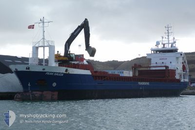
PEAK SAUDA
General Cargo
Current Trip
| Time Travelled | 5 h, 39 mins |
|---|---|
| Remaining Time | 5 h, 25 mins |
| Distance Travelled | 51.47 nm |
| Remaining Distance | 53.98 nm |
| AVG Speed | 10 Noeuds |
| MAX Speed | 11.7 Noeuds |
| AVG Wind | 8.4 knots |
| MAX Wind | 10.2 knots |
| MIN Temp | 3.1°C / 37.58°F |
| MAX Temp | 6.8°C / 44.24°F |
| Tirant d eau | 3.9 m |
| Position reçue | 3 m depuis |
Current Position
| Longitude | 5.73412° |
|---|---|
| Latitude | 58.47265° |
| Etat | Under way using engine |
| Vitesse | 9 Noeuds |
| Parcours | 310.9° |
| Zone | North Sea |
| Station | T-AIS |
| Position reçue | 3 m depuis |
Info
Information
The current position of PEAK SAUDA is in North Sea with coordinates 58.47265° / 5.73412° as reported on 2024-04-27 00:42 by AIS to our vessel tracker app. The vessel's current speed is 9 Noeuds and is heading at the port of TAU. The estimated time of arrival as calculated by MyShipTracking vessel tracking app is 2024-04-27 06:11 LT
The vessel PEAK SAUDA (IMO: 9187136, MMSI: 245871000) is a General Cargo that was built in 1999 ( 25 Age ). It's sailing under the flag of [NL] Netherlands.
In this page you can find informations about the vessels current position, last detected port calls, and current voyage information. If the vessels is not in coverage by AIS you will find the latest position.
The current position of PEAK SAUDA is detected by our AIS receivers and we are not responsible for the reliability of the data. The last position was recorded while the vessel was in Coverage by the Ais receivers of our vessel tracking app.
The current draught of PEAK SAUDA as reported by AIS is 3.9 meters
Weather
| Temperature | 5.2°C / 41.36°F |
|---|---|
| Wind Speed | 7 knots |
| Direction | 52° NE |
| Pressure | 1010.5 hPa |
| Humidity | 69.5 % |
| Cloud Coverage | 39 % |
Featured Company
Last Port Calls
| Port | Arrival | Departure | Time In Port |
|---|---|---|---|
| 2024-04-25 07:06 | 2024-04-26 19:07 | 1 d | |
| 2024-04-20 17:58 | 2024-04-22 13:15 | 1 d | |
| 2024-04-14 14:04 | 2024-04-14 22:05 | 8 h | |
| 2024-04-02 09:41 | 2024-04-03 16:57 | 1 d | |
| 2024-03-22 12:06 | 2024-03-23 09:17 | 21 h | |
| 2024-03-21 07:33 | 2024-03-21 16:30 | 8 h | |
| 2024-03-19 06:04 | 2024-03-20 21:49 | 1 d | |
| 2024-03-13 05:39 | 2024-03-15 12:12 | 2 d | |
| 2024-03-04 20:30 | 2024-03-05 05:38 | 9 h | |
| 2024-03-03 20:01 | 2024-03-04 15:24 | 19 h |
Last Trips
| Origin | Departure | Destination | Arrival | Distance | |
|---|---|---|---|---|---|
| 2024-04-22 15:15 | 2024-04-25 09:06 | 248.57 nm | |||
| 2024-04-15 00:05 | 2024-04-20 19:58 | 757.82 nm | |||
| 2024-04-03 17:57 | 2024-04-14 16:04 | 1187.96 nm | |||
| 2024-03-23 10:17 | 2024-04-02 10:41 | 889.75 nm | |||
| 2024-03-21 17:30 | 2024-03-22 13:06 | 175.14 nm | |||
| 2024-03-20 22:49 | 2024-03-21 08:33 | 104.92 nm | |||
| 2024-03-15 13:12 | 2024-03-19 07:04 | 250.94 nm | |||
| 2024-03-05 06:38 | 2024-03-13 06:39 | 680.67 nm | |||
| 2024-03-04 16:24 | 2024-03-04 21:30 | 52.51 nm | |||
| 2024-02-24 16:13 | 2024-03-03 21:01 | 663.22 nm |
Events
| Heure | Evenement | Détails | Position/ Destination | Info |
|---|---|---|---|---|
| 2024-04-26 20:02 | Etat Changé | Under way using engine Default |
58.01037 / 6.84498
TAU
|
Vitesse: 11.1 kn Parcours: 283° |
| 2024-04-26 20:00 | Tirant d'eau modifié | 3.9 6 |
58.00560 / 6.88402
TAU
|
Vitesse: 11.1 kn Parcours: 277.9° |
| 2024-04-26 20:00 | Changement de destination | TAU LYNGDAL |
58.00560 / 6.88402
TAU
|
Vitesse: 11.1 kn Parcours: 277.9° |
| 2024-04-26 20:00 | Changement d'ETA | 2024/04/27 06:00 2024/04/25 07:00 |
58.00560 / 6.88402
TAU
|
Vitesse: 11.1 kn Parcours: 277.9° |
| 2024-04-26 20:00 | Etat Changé | Default Under way using engine |
58.00903 / 6.85640
TAU
|
Vitesse: 11.1 kn Parcours: 277.9° |
| 2024-04-26 19:31 | Etat Changé | Under way using engine Default |
58.05292 / 6.97645
LYNGDAL
|
Vitesse: 10 kn Parcours: -1° |
| 2024-04-26 19:22 | Dans la zone couverte |
58.05292 / 6.97645
North Sea
|
Vitesse: 10.2 kn Parcours: 208.6° |
|
| 2024-04-26 19:07 | PORT DE DEPART |
|
58.07333 / 6.99833
LYNGDAL
|
Vitesse: 7.9 kn Parcours: 214° |
| 2024-04-26 19:07 | Démarrage |
58.10960 / 7.04185
[NO] LYNGDAL
|
Vitesse: 7.9 kn Parcours: 214° |
|
| 2024-04-26 14:05 | Hors de la zone couverte |
58.11612 / 7.04475
North Sea
[NO] LYNGDAL
|
Vitesse: 0.1 kn Parcours: 342.8° |