
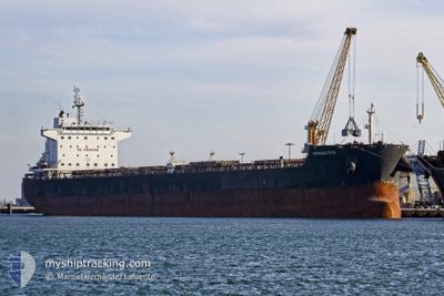
PANAGIOTIS
Bulk Carrier
Current Trip
DAN PILOT
| Time Travelled | 4 days |
|---|---|
| Remaining Time | --- |
| Distance Travelled | 486.38 nm |
| Remaining Distance | --- |
| AVG Speed | 11.9 Noeuds |
| MAX Speed | 15.1 Noeuds |
| AVG Wind | 8.5 knots |
| MAX Wind | 17 knots |
| MIN Temp | 8°C / 46.4°F |
| MAX Temp | 11.3°C / 52.34°F |
| Tirant d eau | 7 m |
| Position reçue | 2 m depuis |
Current Position
| Longitude | 4.31079° |
|---|---|
| Latitude | 57.37321° |
| Etat | Under way using engine |
| Vitesse | 12.8 Noeuds |
| Parcours | 82.2° |
| Zone | North Sea |
| Station | T-AIS |
| Position reçue | 2 m depuis |
Info
Information
The current position of PANAGIOTIS is in North Sea with coordinates 57.37321° / 4.31079° as reported on 2024-05-08 11:17 by AIS to our vessel tracker app. The vessel's current speed is 12.8 Noeuds
The vessel PANAGIOTIS (IMO: 9461063, MMSI: 538007308) is a Bulk Carrier that was built in 2010 ( 14 Age ). It's sailing under the flag of [MH] Marshall Is.
In this page you can find informations about the vessels current position, last detected port calls, and current voyage information. If the vessels is not in coverage by AIS you will find the latest position.
The current position of PANAGIOTIS is detected by our AIS receivers and we are not responsible for the reliability of the data. The last position was recorded while the vessel was in Coverage by the Ais receivers of our vessel tracking app.
The current draught of PANAGIOTIS as reported by AIS is 7 meters
Weather
| Temperature | 8.4°C / 47.12°F |
|---|---|
| Wind Speed | 3 knots |
| Direction | 290° WNW |
| Pressure | 1027.9 hPa |
| Humidity | 86.6 % |
| Cloud Coverage | 97 % |
Featured Company
Last Port Calls
| Port | Arrival | Departure | Time In Port |
|---|---|---|---|
| 2024-04-29 06:36 | 2024-05-03 18:55 | 4 d | |
| 2024-04-10 06:31 | 2024-04-12 06:04 | 1 d | |
| 2024-03-16 13:05 | 2024-03-23 08:17 | 6 d | |
| 2024-03-09 23:07 | 2024-03-12 22:51 | 2 d | |
| 2024-03-02 21:19 | 2024-03-03 17:48 | 20 h |
Most Visited Ports (Last year)
| Port | Arrivals | |
|---|---|---|
| 2 | ||
| 2 | ||
| 2 | ||
| 1 | ||
| 1 | ||
| 1 |
Last Trips
| Origin | Departure | Destination | Arrival | Distance | |
|---|---|---|---|---|---|
| 2024-04-12 06:04 | 2024-04-29 08:36 | 2253.44 nm | |||
| 2024-03-23 09:17 | 2024-04-10 06:31 | 1502.50 nm | |||
| 2024-03-12 23:51 | 2024-03-16 14:05 | 925.82 nm | |||
| 2024-03-03 17:48 | 2024-03-10 00:07 | 1183.41 nm | |||
| 2024-01-30 19:36 | 2024-03-02 21:19 | 4732.07 nm |
Events
| Heure | Evenement | Détails | Position/ Destination | Info |
|---|---|---|---|---|
| 2024-05-08 09:22 | Changement d'ETA | 2024/05/09 16:00 2024/05/07 16:00 |
57.34189 / 3.62070
DAN PILOT
|
Vitesse: 10.7 kn Parcours: 85.5° |
| 2024-05-08 09:09 | Démarrage |
57.34751 / 3.58253
DAN PILOT
|
Vitesse: 4.1 kn Parcours: 171° |
|
| 2024-05-08 07:17 | Etat Changé | Under way using engine Default |
57.37168 / 3.54848
DAN PILOT
|
Vitesse: 0.9 kn Parcours: 210° |
| 2024-05-08 06:56 | Etat Changé | Default Under way using engine |
57.37511 / 3.54370
DAN PILOT
|
Vitesse: 0.7 kn Parcours: 210° |
| 2024-05-08 06:12 | Etat Changé | Under way using engine Default |
57.38229 / 3.53496
DAN PILOT
|
Vitesse: 0.6 kn Parcours: 208° |
| 2024-05-08 06:06 | Etat Changé | Default Under way using engine |
57.38336 / 3.53380
DAN PILOT
|
Vitesse: 0.5 kn Parcours: 210° |
| 2024-05-08 05:27 | Etat Changé | Under way using engine Default |
57.39073 / 3.52898
DAN PILOT
|
Vitesse: 0.6 kn Parcours: 217° |
| 2024-05-08 05:21 | Etat Changé | Default Under way using engine |
57.39183 / 3.52848
DAN PILOT
|
Vitesse: 0.8 kn Parcours: 218° |
| 2024-05-08 05:13 | Etat Changé | Under way using engine Default |
57.39327 / 3.52781
DAN PILOT
|
Vitesse: 0.6 kn Parcours: 217° |
| 2024-05-08 04:51 | Etat Changé | Default Under way using engine |
57.39774 / 3.52585
DAN PILOT
|
Vitesse: 0.8 kn Parcours: 216° |