
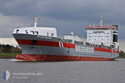
ORANJEBORG
Ro-Ro Cargo
Current Trip
| Time Travelled | 4 days |
|---|---|
| Remaining Time | --- |
| Distance Travelled | 1224.24 nm |
| Remaining Distance | --- |
| AVG Speed | 12.4 Noeuds |
| MAX Speed | 15.7 Noeuds |
| AVG Wind | 12.1 knots |
| MAX Wind | 23.2 knots |
| MIN Temp | 4.8°C / 40.64°F |
| MAX Temp | 13.1°C / 55.58°F |
| Tirant d eau | 6.8 m |
| Position reçue | 3 d depuis |
Current Position
| Longitude | --- |
|---|---|
| Latitude | --- |
| Etat | Under way using engine |
| Vitesse | 13.2 Noeuds |
| Parcours | 70° |
| Zone | North Atlantic Ocean |
| Station | T-AIS |
| Position reçue | 3 d depuis |
Info
Information
The current position of ORANJEBORG is in North Atlantic Ocean with coordinates 39.08042° / -73.39294° as reported on 2024-11-25 04:33 by AIS to our vessel tracker app. The vessel's current speed is 13.2 Noeuds and is heading at the port of IGGESUND. The estimated time of arrival as calculated by MyShipTracking vessel tracking app is 2024-12-09 06:00 LT
The vessel ORANJEBORG (IMO: 9232797, MMSI: 246265000) is a Ro-Ro Cargo that was built in 2004 ( 20 Age ). It's sailing under the flag of [NL] Netherlands.
In this page you can find informations about the vessels current position, last detected port calls, and current voyage information. If the vessels is not in coverage by AIS you will find the latest position.
The current position of ORANJEBORG is detected by our AIS receivers and we are not responsible for the reliability of the data. The last position was recorded while the vessel was in Coverage by the Ais receivers of our vessel tracking app.
The current draught of ORANJEBORG as reported by AIS is 6.8 meters
Weather
| Temperature | 4.6°C / 40.28°F |
|---|---|
| Wind Speed | 5 knots |
| Direction | 350° N |
| Pressure | 1013.3 hPa |
| Humidity | 89.8 % |
| Cloud Coverage | 100 % |
Featured Company
Last Port Calls
| Port | Arrival | Departure | Time In Port |
|---|---|---|---|
| 2024-11-20 05:33 | 2024-11-24 15:21 | 4 d | |
| 2024-11-02 13:20 | 2024-11-05 18:26 | 3 d | |
| 2024-10-27 08:08 | 2024-10-29 15:48 | 2 d | |
| 2024-10-10 20:32 | 2024-10-12 13:01 | 1 d | |
| 2024-09-22 03:54 | 2024-09-27 07:33 | 5 d | |
| 2024-09-09 16:45 |
Last Trips
| Origin | Departure | Destination | Arrival | Distance | |
|---|---|---|---|---|---|
| 2024-11-05 19:26 | 2024-11-20 00:33 | 3711.17 nm | |||
| 2024-10-29 17:48 | 2024-11-02 14:20 | 1010.70 nm | |||
| 2024-10-12 09:01 | 2024-10-27 10:08 | 4708.00 nm | |||
| 2024-09-27 09:33 | 2024-10-10 16:32 | 3623.60 nm | |||
| 2024-09-09 12:45 | 2024-09-22 05:54 | 3634.70 nm |
Events
| Heure | Evenement | Détails | Position/ Destination | Info |
|---|---|---|---|---|
| 2024-11-25 04:36 | Etat Changé | Default Under way using engine |
39.08348 / -73.38177
SEIGG
|
Vitesse: 13.2 kn Parcours: 70° |
| 2024-11-25 04:33 | Hors de la zone couverte |
39.08042 / -73.39294
North Atlantic Ocean
SEIGG
|
Vitesse: 13.2 kn Parcours: 70° |
|
| 2024-11-25 04:27 | Etat Changé | Under way using engine Default |
39.07228 / -73.42253
SEIGG
|
Vitesse: 13.2 kn Parcours: 71° |
| 2024-11-25 04:20 | Etat Changé | Default Under way using engine |
39.06479 / -73.45069
SEIGG
|
Vitesse: 13.2 kn Parcours: 71.5° |
| 2024-11-25 04:16 | Etat Changé | Under way using engine Default |
39.06016 / -73.46761
SEIGG
|
Vitesse: 13.2 kn Parcours: 70° |
| 2024-11-25 04:09 | Dans la zone couverte |
39.06016 / -73.46761
North Atlantic Ocean
SEIGG
|
Vitesse: 13.2 kn Parcours: 71.5° |
|
| 2024-11-25 02:24 | Etat Changé | Default Under way using engine |
38.91968 / -73.97861
SEIGG
|
Vitesse: 13.9 kn Parcours: 72.7° |
| 2024-11-25 02:17 | Hors de la zone couverte |
38.91222 / -74.00905
North Atlantic Ocean
SEIGG
|
Vitesse: 13.9 kn Parcours: 72.7° |
|
| 2024-11-24 19:33 | Etat Changé | Under way using engine Default |
39.23418 / -75.30555
SEIGG
|
Vitesse: 13.6 kn Parcours: 139° |
| 2024-11-24 19:14 | Etat Changé | Default Under way using engine |
39.28521 / -75.36429
SEIGG
|
Vitesse: 14.1 kn Parcours: 137.2° |