
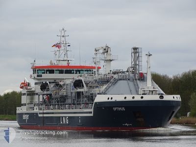
OPTIMUS
Tanker
Current Trip
| Time Travelled | 2 days |
|---|---|
| Remaining Time | 7 h, 24 mins |
| Distance Travelled | 701.85 nm |
| Remaining Distance | 60.40 nm |
| AVG Speed | 9.5 Noeuds |
| MAX Speed | 13.1 Noeuds |
| AVG Wind | 12.5 knots |
| MAX Wind | 26 knots |
| MIN Temp | 9.3°C / 48.74°F |
| MAX Temp | 13.2°C / 55.76°F |
| Tirant d eau | 4.8 m |
| Position reçue | 1 m depuis |
Current Position
| Longitude | 11.03656° |
|---|---|
| Latitude | 55.12658° |
| Etat | Under way using engine |
| Vitesse | 8.2 Noeuds |
| Parcours | 185.3° |
| Zone | Kattegat |
| Station | T-AIS |
| Position reçue | 1 m depuis |
Info
Information
The current position of OPTIMUS is in Kattegat with coordinates 55.12658° / 11.03656° as reported on 2024-05-10 20:23 by AIS to our vessel tracker app. The vessel's current speed is 8.2 Noeuds and is heading at the port of KIEL. The estimated time of arrival as calculated by MyShipTracking vessel tracking app is 2024-05-11 03:48 LT
The vessel OPTIMUS (IMO: 9870472, MMSI: 275525000) is a Tanker It's sailing under the flag of [LV] Latvia.
In this page you can find informations about the vessels current position, last detected port calls, and current voyage information. If the vessels is not in coverage by AIS you will find the latest position.
The current position of OPTIMUS is detected by our AIS receivers and we are not responsible for the reliability of the data. The last position was recorded while the vessel was in Coverage by the Ais receivers of our vessel tracking app.
The current draught of OPTIMUS as reported by AIS is 4.8 meters
Weather
| Temperature | 11.7°C / 53.06°F |
|---|---|
| Wind Speed | 9 knots |
| Direction | 301° WNW |
| Pressure | 1022.9 hPa |
| Humidity | 77.6 % |
| Cloud Coverage | 100 % |
Featured Company
Last Port Calls
| Port | Arrival | Departure | Time In Port |
|---|---|---|---|
| 2024-05-07 07:08 | 2024-05-07 20:33 | 13 h | |
| 2024-05-03 11:49 | 2024-05-04 17:26 | 1 d | |
| 2024-04-29 07:10 | 2024-05-01 17:19 | 2 d | |
| 2024-04-28 02:14 | 2024-04-28 19:50 | 17 h | |
| 2024-04-27 14:36 | 2024-04-28 02:01 | 11 h | |
| 2024-04-26 21:10 | 2024-04-27 13:19 | 16 h | |
| 2024-04-25 09:02 | 2024-04-26 18:58 | 1 d | |
| 2024-04-24 15:48 | 2024-04-25 07:55 | 16 h | |
| 2024-04-23 13:00 | 2024-04-24 14:17 | 1 d | |
| 2024-04-14 03:23 | 2024-04-16 23:45 | 2 d |
Last Trips
| Origin | Departure | Destination | Arrival | Distance | |
|---|---|---|---|---|---|
| 2024-05-04 19:26 | 2024-05-07 09:08 | 127.66 nm | |||
| 2024-05-01 19:19 | 2024-05-03 13:49 | 108.71 nm | |||
| 2024-04-28 21:50 | 2024-04-29 09:10 | 96.89 nm | |||
| 2024-04-28 04:01 | 2024-04-28 04:14 | 1.83 nm | |||
| 2024-04-27 15:19 | 2024-04-27 16:36 | 13.71 nm | |||
| 2024-04-26 20:58 | 2024-04-26 23:10 | 17.58 nm | |||
| 2024-04-25 09:55 | 2024-04-25 11:02 | 12.25 nm | |||
| 2024-04-24 16:17 | 2024-04-24 17:48 | 12.61 nm | |||
| 2024-04-17 01:45 | 2024-04-23 15:00 | 1044.23 nm | |||
| 2024-04-11 07:13 | 2024-04-14 05:23 | 144.95 nm |
Events
| Heure | Evenement | Détails | Position/ Destination | Info |
|---|---|---|---|---|
| 2024-05-09 22:29 | Changement de zone | Danish part of the Kattegat Danish part of the Skaggerak |
57.77527 / 10.86315
Kattegat
DEKEL
|
Vitesse: 10.2 kn Parcours: 140.9° |
| 2024-05-09 13:43 | Changement de zone | Danish part of the Skaggerak Danish part of the North Sea |
57.18770 / 8.49867
Skaggerak
DEKEL
|
Vitesse: 9.6 kn Parcours: 55.8° |
| 2024-05-09 00:32 | Changement de zone | Danish part of the North Sea German part of the North Sea |
55.44990 / 6.09668
North Sea
DEKEL
|
Vitesse: 10.4 kn Parcours: 22.6° |
| 2024-05-08 23:58 | Changement d'ETA | 2024/05/11 02:45 2024/05/11 03:00 |
55.35934 / 6.03167
DEKEL
|
Vitesse: 10.2 kn Parcours: 22.1° |
| 2024-05-08 23:44 | Etat Changé | Under way using engine Default |
55.32284 / 6.00491
DEKEL
|
Vitesse: 10.3 kn Parcours: 21° |
| 2024-05-08 23:28 | Etat Changé | Default Under way using engine |
55.28028 / 5.97525
DEKEL
|
Vitesse: 10.3 kn Parcours: 21.3° |
| 2024-05-08 23:18 | Etat Changé | Under way using engine Default |
55.25333 / 5.95645
DEKEL
|
Vitesse: 10 kn Parcours: 20° |
| 2024-05-08 23:03 | Etat Changé | Default Under way using engine |
55.21167 / 5.92667
DEKEL
|
Vitesse: 10.4 kn Parcours: 22.1° |
| 2024-05-08 22:59 | Etat Changé | Under way using engine Default |
55.20318 / 5.92221
DEKEL
|
Vitesse: 10.4 kn Parcours: 22° |
| 2024-05-08 22:51 | Etat Changé | Default Under way using engine |
55.18053 / 5.90632
DEKEL
|
Vitesse: 10.3 kn Parcours: 21.5° |