
OPTIMA
Cargo
Current Trip
| Trip Time | 5 days |
|---|---|
| Trip Distance | 1581.57 nm |
| AVG Speed | 12.9 Noeuds |
| MAX Speed | 17.1 Noeuds |
| Tirant d eau | 7.8 m |
| AVG Wind | 13.6 knots |
| MAX Wind | 29 knots |
| MIN Temp | 18°C / 64.4°F |
| MAX Temp | 27.2°C / 80.96°F |
| Position reçue | 14 d depuis |
Current Position
| Longitude | --- |
|---|---|
| Latitude | --- |
| Etat | Under way using engine |
| Vitesse | 12.4 Noeuds |
| Parcours | 156.7° |
| Zone | South China Sea |
| Station | T-AIS |
| Position reçue | 14 d depuis |
Info
Information
The current position of OPTIMA is in South China Sea with coordinates 22.25427° / 114.11539° as reported on 2025-01-09 11:07 by AIS to our vessel tracker app. The vessel's current speed is 12.4 Noeuds and is currently inside the port of NANSHA.
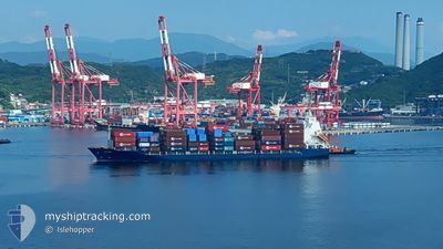
The vessel OPTIMA (IMO: 9609419, MMSI: 311049600) is a Cargo It's sailing under the flag of [BS] Bahamas.
In this page you can find informations about the vessels current position, last detected port calls, and current voyage information. If the vessels is not in coverage by AIS you will find the latest position.
The current position of OPTIMA is detected by our AIS receivers and we are not responsible for the reliability of the data. The last position was recorded while the vessel was in Coverage by the Ais receivers of our vessel tracking app.
The current draught of OPTIMA as reported by AIS is 7.8 meters
Weather
| Temperature | 18.6°C / 65.48°F |
|---|---|
| Wind Speed | 12 knots |
| Direction | 160° SSE |
| Pressure | 1012.6 hPa |
| Humidity | 81.2 % |
| Cloud Coverage | 3 % |
Featured Company
Last Port Calls
| Port | Arrival | Departure | Time In Port |
|---|---|---|---|
| 2025-01-24 05:21 | |||
| 2025-01-18 00:49 | 2025-01-18 10:17 | 9 h | |
| 2025-01-08 23:01 | 2025-01-09 08:45 | 9 h | |
| 2025-01-08 03:34 | 2025-01-08 08:49 | 5 h | |
| 2025-01-07 03:01 | 2025-01-07 16:57 | 13 h | |
| 2024-12-31 05:33 | 2024-12-31 14:33 | 8 h | |
| 2024-12-24 05:36 | 2024-12-24 16:49 | 11 h | |
| 2024-12-21 22:48 | 2024-12-22 04:20 | 5 h | |
| 2024-12-21 02:05 | 2024-12-21 12:37 | 10 h | |
| 2024-12-14 14:32 | 2024-12-14 23:24 | 8 h |
Most Visited Ports (Last year)
| Port | Arrivals | |
|---|---|---|
| 22 | ||
| 19 | ||
| 4 | ||
| 3 | ||
| 3 | ||
| 3 |
Last Trips
| Origin | Departure | Destination | Arrival | Distance | |
|---|---|---|---|---|---|
| 2025-01-18 17:17 | 2025-01-24 13:21 | 1581.57 nm | |||
| 2025-01-09 16:45 | 2025-01-18 07:49 | 1604.57 nm | |||
| 2025-01-08 16:49 | 2025-01-09 07:01 | 59.57 nm | |||
| 2025-01-08 00:57 | 2025-01-08 11:34 | 77.30 nm | |||
| 2024-12-31 21:33 | 2025-01-07 11:01 | 1596.55 nm | |||
| 2024-12-25 00:49 | 2024-12-31 12:33 | 1612.99 nm | |||
| 2024-12-22 12:20 | 2024-12-24 13:36 | 64.02 nm | |||
| 2024-12-21 20:37 | 2024-12-22 06:48 | 76.25 nm | |||
| 2024-12-15 06:24 | 2024-12-21 10:05 | 1589.41 nm | |||
| 2024-12-09 17:00 | 2024-12-14 21:32 | 1597.94 nm |
Events
| Heure | Evenement | Détails | Position/ Destination | Info |
|---|---|---|---|---|
| 2025-01-24 05:21 | Arret |
22.61952 / 113.68818
[CN] NANSHA
|
Vitesse: 0.1 kn Parcours: 351° |
|
| 2025-01-24 05:21 | Port d'arrivée |
|
22.61952 / 113.68818
[CN] NANSHA
|
Vitesse: 1.1 kn Parcours: 343° |
| 2025-01-24 00:33 | Démarrage | 8.97 nm, South of WAILINGDING ISLAND |
21.95852 / 113.97527
VNHCM
|
Vitesse: 4.8 kn Parcours: 333° |
| 2025-01-23 16:29 | Arret | 9.18 nm, South of WAILINGDING ISLAND |
21.95499 / 113.97489
VNHCM
|
Vitesse: 0.1 kn Parcours: 70° |
| 2025-01-20 21:21 | Démarrage | 16.38 nm, West of PHU MY |
10.64661 / 106.74998
VNHCM
|
Vitesse: 6.3 kn Parcours: 100° |
| 2025-01-20 13:09 | Arret | 16.68 nm, West of PHU MY |
10.64771 / 106.74505
VNHCM
|
Vitesse: 0.2 kn Parcours: 135° |
| 2025-01-20 06:31 | Démarrage |
9.81769 / 107.02557
VNHCM
|
Vitesse: 9.6 kn Parcours: 22° |
|
| 2025-01-18 10:17 | PORT DE DEPART |
|
13.07323 / 100.86021
VNHCM
|
Vitesse: 9.4 kn Parcours: 307° |
| 2025-01-18 10:01 | Démarrage |
13.06481 / 100.89056
[TH] LAEM CHABANG
|
Vitesse: 4.2 kn Parcours: 246° |
|
| 2025-01-18 01:13 | Arret |
13.06471 / 100.89246
[TH] LAEM CHABANG
|
Vitesse: 0.1 kn Parcours: 240° |