
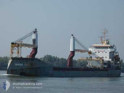
ONEGO ISLE
General Cargo
Current Trip
| Time Travelled | 2 days |
|---|---|
| Remaining Time | --- |
| Distance Travelled | 666.15 nm |
| Remaining Distance | --- |
| AVG Speed | 10.7 Noeuds |
| MAX Speed | 13.7 Noeuds |
| AVG Wind | 14.7 knots |
| MAX Wind | 21 knots |
| MIN Temp | 9.9°C / 49.82°F |
| MAX Temp | 19.6°C / 67.28°F |
| Tirant d eau | 7.2 m |
| Position reçue | 1 d depuis |
Current Position
| Longitude | -73.13350° |
|---|---|
| Latitude | 38.36201° |
| Etat | Under way using engine |
| Vitesse | 9.9 Noeuds |
| Parcours | 110.7° |
| Zone | North Atlantic Ocean |
| Station | T-AIS |
| Position reçue | 1 d depuis |
Info
Information
The current position of ONEGO ISLE is in North Atlantic Ocean with coordinates 38.36201° / -73.13350° as reported on 2024-05-03 19:30 by AIS to our vessel tracker app. The vessel's current speed is 9.9 Noeuds and is heading at the port of KRISTIANSAND. The estimated time of arrival as calculated by MyShipTracking vessel tracking app is 2024-05-18 06:00 LT
The vessel ONEGO ISLE (IMO: 9626156, MMSI: 235095836) is a General Cargo that was built in 2012 ( 12 Age ). It's sailing under the flag of [GB] United Kingdom.
In this page you can find informations about the vessels current position, last detected port calls, and current voyage information. If the vessels is not in coverage by AIS you will find the latest position.
The current position of ONEGO ISLE is detected by our AIS receivers and we are not responsible for the reliability of the data. The last position was recorded while the vessel was in Coverage by the Ais receivers of our vessel tracking app.
The current draught of ONEGO ISLE as reported by AIS is 7.2 meters
Weather
| Temperature | 14.1°C / 57.38°F |
|---|---|
| Wind Speed | 13 knots |
| Direction | 53° NE |
| Pressure | 1024.9 hPa |
| Humidity | 69.8 % |
| Cloud Coverage | 100 % |
Featured Company
Last Port Calls
| Port | Arrival | Departure | Time In Port |
|---|---|---|---|
| 2024-05-02 08:30 | 2024-05-03 03:54 | 19 h | |
| 2024-04-15 07:40 | 2024-04-22 23:10 | 7 d | |
| 2024-03-09 03:22 | 2024-03-15 08:55 | 6 d | |
| 2024-03-03 13:03 | 2024-03-06 19:42 | 3 d |
Most Visited Ports (Last year)
| Port | Arrivals | |
|---|---|---|
| 3 | ||
| 3 | ||
| 2 | ||
| 2 | ||
| 1 | ||
| 1 |
Last Trips
| Origin | Departure | Destination | Arrival | Distance | |
|---|---|---|---|---|---|
| 2024-04-22 18:10 | 2024-05-02 04:30 | 1967.33 nm | |||
| 2024-03-15 10:55 | 2024-04-15 02:40 | 6749.58 nm | |||
| 2024-03-06 20:42 | 2024-03-09 05:22 | 568.58 nm | |||
| 2024-02-13 09:07 | 2024-03-03 14:03 | 4591.44 nm |
Events
| Heure | Evenement | Détails | Position/ Destination | Info |
|---|---|---|---|---|
| 2024-05-03 19:38 | Etat Changé | Default Under way using engine |
38.35500 / -73.10833
NOKRS
|
Vitesse: 9.9 kn Parcours: 110.7° |
| 2024-05-03 19:30 | Hors de la zone couverte |
38.36201 / -73.13350
North Atlantic Ocean
NOKRS
|
Vitesse: 9.9 kn Parcours: 110.7° |
|
| 2024-05-03 19:27 | Etat Changé | Under way using engine Default |
38.36503 / -73.14330
NOKRS
|
Vitesse: 9 kn Parcours: 107° |
| 2024-05-03 19:27 | Dans la zone couverte |
38.36350 / -73.13843
North Atlantic Ocean
NOKRS
|
Vitesse: 9.9 kn Parcours: 111.2° |
|
| 2024-05-03 16:21 | Etat Changé | Default Under way using engine |
38.53390 / -73.76070
NOKRS
|
Vitesse: 9.4 kn Parcours: 106.4° |
| 2024-05-03 16:15 | Etat Changé | Under way using engine Default |
38.53897 / -73.78087
NOKRS
|
Vitesse: 9.2 kn Parcours: 107° |
| 2024-05-03 16:15 | Hors de la zone couverte |
38.53897 / -73.78087
North Atlantic Ocean
NOKRS
|
Vitesse: 9.4 kn Parcours: 106.4° |
|
| 2024-05-03 15:42 | Etat Changé | Default Under way using engine |
38.56659 / -73.88304
NOKRS
|
Vitesse: 9.3 kn Parcours: 112.2° |
| 2024-05-03 15:33 | Etat Changé | Under way using engine Default |
38.57556 / -73.91306
NOKRS
|
Vitesse: 9.3 kn Parcours: 109° |
| 2024-05-03 15:14 | Etat Changé | Default Under way using engine |
38.59118 / -73.97240
NOKRS
|
Vitesse: 9.4 kn Parcours: 108.4° |