
OMVAC GALICIA
Trailing Suction Hopper Dredger
Current Trip
DAKHLA
| Time Travelled | --- |
|---|---|
| Remaining Time | --- |
| Distance Travelled | 6.90 nm |
| Remaining Distance | --- |
| AVG Speed | 5.5 Noeuds |
| MAX Speed | 7.8 Noeuds |
| AVG Wind | 15.6 knots |
| MAX Wind | 18.3 knots |
| MIN Temp | 19.2°C / 66.56°F |
| MAX Temp | 20.9°C / 69.62°F |
| Tirant d eau | 2.3 m |
| Position reçue | 3 d depuis |
Current Position
| Longitude | --- |
|---|---|
| Latitude | --- |
| Etat | Moored |
| Vitesse | |
| Parcours | 144° |
| Zone | North Atlantic Ocean |
| Station | T-AIS |
| Position reçue | 3 d depuis |
Info
Information
The current position of OMVAC GALICIA is in North Atlantic Ocean with coordinates 23.99553° / -15.69106° as reported on 2024-10-04 01:19 by AIS to our vessel tracker app. The vessel's current speed is 0 Noeuds
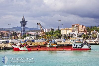
The vessel OMVAC GALICIA (IMO: 9404297, MMSI: 225363000) is a Trailing Suction Hopper Dredger that was built in 2007 ( 17 Age ). It's sailing under the flag of [ES] Spain.
In this page you can find informations about the vessels current position, last detected port calls, and current voyage information. If the vessels is not in coverage by AIS you will find the latest position.
The current position of OMVAC GALICIA is detected by our AIS receivers and we are not responsible for the reliability of the data. The last position was recorded while the vessel was in Coverage by the Ais receivers of our vessel tracking app.
The current draught of OMVAC GALICIA as reported by AIS is 2.3 meters
Weather
| Temperature | 20°C / 68°F |
|---|---|
| Wind Speed | 13 knots |
| Direction | 24° NNE |
| Pressure | 1011.7 hPa |
| Humidity | 90.4 % |
| Cloud Coverage | 76 % |
Featured Company
Last Port Calls
Most Visited Ports (Last year)
| Port | Arrivals | |
|---|---|---|
| 219 | ||
| 47 | ||
| 1 |
Last Trips
| Origin | Departure | Destination | Arrival | Distance |
|---|
Events
| Heure | Evenement | Détails | Position/ Destination | Info |
|---|---|---|---|---|
| 2024-10-04 01:19 | Hors de la zone couverte |
23.99553 / -15.69106
North Atlantic Ocean
|
Vitesse: Parcours: 76° |
|
| 2024-10-04 01:14 | Arret |
23.99551 / -15.69113
DAKHLA
|
Vitesse: 0.3 kn Parcours: 138° |
|
| 2024-10-04 01:05 | Démarrage |
23.99214 / -15.69904
DAKHLA
|
Vitesse: 6.2 kn Parcours: 139.9° |
|
| 2024-10-04 00:22 | Dans la zone couverte |
23.99517 / -15.69075
North Atlantic Ocean
|
Vitesse: 0.2 kn Parcours: 334.1° |
|
| 2024-09-30 16:16 | Hors de la zone couverte |
24.00666 / -15.69571
North Atlantic Ocean
|
Vitesse: 1 kn Parcours: 80.3° |
|
| 2024-09-30 16:10 | Démarrage |
24.00088 / -15.69768
DAKHLA
|
Vitesse: 5.2 kn Parcours: 358.4° |
|
| 2024-09-30 15:06 | Arret |
23.99546 / -15.69113
DAKHLA
|
Vitesse: 0.3 kn Parcours: 134° |
|
| 2024-09-30 15:02 | Dans la zone couverte |
23.99543 / -15.69130
North Atlantic Ocean
|
Vitesse: 0.6 kn Parcours: 75.4° |
|
| 2024-09-30 13:52 | Hors de la zone couverte |
23.99548 / -15.69113
North Atlantic Ocean
|
Vitesse: 0.1 kn Parcours: 132° |
|
| 2024-09-30 13:11 | Arret |
23.99544 / -15.69119
DAKHLA
|
Vitesse: 0.3 kn Parcours: 130° |