

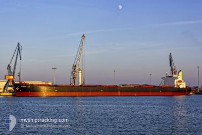
OCEAN LION
Bulk Carrier

Current Trip
BRSSZ
| Time Travelled | 6 days |
|---|---|
| Remaining Time | --- |
| Distance Travelled | 1639.14 nm |
| Remaining Distance | --- |
| AVG Speed | 11.2 Noeuds |
| MAX Speed | 12.1 Noeuds |
| AVG Wind | 13.3 knots |
| MAX Wind | 23 knots |
| MIN Temp | 22.1°C / 71.78°F |
| MAX Temp | 26.9°C / 80.42°F |
| Tirant d eau | 6.8 m |
| Position reçue | 4 d depuis |
Current Position
| Longitude | --- |
|---|---|
| Latitude | --- |
| Etat | At anchor |
| Vitesse | 11.2 Noeuds |
| Parcours | 99.6° |
| Zone | South Atlantic Ocean |
| Station | T-AIS |
| Position reçue | 4 d depuis |
Information
The current position of OCEAN LION is in South Atlantic Ocean with coordinates -25.62993° / -40.62831° as reported on 2025-03-24 01:02 by AIS to our vessel tracker app. The vessel's current speed is 11.2 Noeuds
The vessel OCEAN LION (IMO: 9296248, MMSI: 636014514) is a Bulk Carrier that was built in 2005 ( 20 Age ). It's sailing under the flag of [LR] Liberia.
In this page you can find informations about the vessels current position, last detected port calls, and current voyage information. If the vessels is not in coverage by AIS you will find the latest position.
The current position of OCEAN LION is detected by our AIS receivers and we are not responsible for the reliability of the data. The last position was recorded while the vessel was in Coverage by the Ais receivers of our vessel tracking app.
The current draught of OCEAN LION as reported by AIS is 6.8 meters
Weather
| Temperature | 22.5°C / 72.5°F |
|---|---|
| Wind Speed | 17 knots |
| Direction | 120° ESE |
| Pressure | 1020.7 hPa |
| Humidity | 64.7 % |
| Cloud Coverage | 100 % |


Featured Company
Most Visited Ports (Last year)
| Port | Arrivals | |
|---|---|---|
| 2 | ||
| 1 | ||
| 1 | ||
| 1 | ||
| 1 | ||
| 1 |
Last Trips
| Origin | Departure | Destination | Arrival | Distance | |
|---|---|---|---|---|---|
| 2025-01-14 12:41 | 2025-03-20 23:13 | 7657.23 nm | |||
| 2024-10-26 00:28 | 2025-01-09 14:32 | 8453.71 nm |
Events
| Heure | Evenement | Détails | Position/ Destination | Info |
|---|---|---|---|---|
| 2025-03-24 01:06 | Etat Changé | Default At anchor |
-25.63349 / -40.61275
BRSSZ
|
Vitesse: 11.2 kn Parcours: 99.6° |
| 2025-03-24 01:02 | Hors de la zone couverte |
-25.62993 / -40.62831
South Atlantic Ocean
|
Vitesse: 11.2 kn Parcours: 99.6° |
|
| 2025-03-24 01:01 | Etat Changé | At anchor Default |
-25.62912 / -40.63231
BRSSZ
|
Vitesse: 11.1 kn Parcours: 104° |
| 2025-03-24 00:58 | Etat Changé | Default At anchor |
-25.62731 / -40.64074
BRSSZ
|
Vitesse: 11.2 kn Parcours: 103.7° |
| 2025-03-24 00:30 | Etat Changé | At anchor Default |
-25.60481 / -40.73523
BRSSZ
|
Vitesse: 11.5 kn Parcours: 104° |
| 2025-03-24 00:17 | Etat Changé | Default At anchor |
-25.59333 / -40.77993
BRSSZ
|
Vitesse: 11.2 kn Parcours: 106.8° |
| 2025-03-24 00:00 | Etat Changé | At anchor Default |
-25.57903 / -40.83560
BRSSZ
|
Vitesse: 11.2 kn Parcours: 105° |
| 2025-03-23 23:57 | Etat Changé | Default At anchor |
-25.57675 / -40.84581
BRSSZ
|
Vitesse: 11.3 kn Parcours: 103.6° |
| 2025-03-23 23:49 | Etat Changé | At anchor Default |
-25.57062 / -40.87187
BRSSZ
|
Vitesse: 11.4 kn Parcours: 102° |
| 2025-03-23 23:45 | Etat Changé | Default At anchor |
-25.56685 / -40.88755
BRSSZ
|
Vitesse: 11.3 kn Parcours: 105.8° |