
OCEAN ENERGY
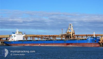
Bulk Carrier
Current Trip
| Trip Time | 31 days |
|---|---|
| Trip Distance | 7628.21 nm |
| AVG Speed | 11.4 Noeuds |
| MAX Speed | 14.9 Noeuds |
| Tirant d eau | 14.7 m |
| AVG Wind | 15.3 knots |
| MAX Wind | 46.8 knots |
| MIN Temp | 19.4°C / 66.92°F |
| MAX Temp | 31°C / 87.8°F |
| Position reçue | 26 d depuis |
Current Position
| Longitude | --- |
|---|---|
| Latitude | --- |
| Etat | Under way using engine |
| Vitesse | 12 Noeuds |
| Parcours | 202° |
| Zone | Java Sea |
| Station | T-AIS |
| Position reçue | 26 d depuis |
Info
Information
The current position of OCEAN ENERGY is in Java Sea with coordinates -3.89563° / 107.46993° as reported on 2024-10-30 13:42 by AIS to our vessel tracker app. The vessel's current speed is 12 Noeuds and is currently inside the port of MAPUTO.
The vessel OCEAN ENERGY (IMO: 9495076, MMSI: 477351500) is a Bulk Carrier that was built in 2011 ( 13 Age ). It's sailing under the flag of [HK] Hong Kong.
In this page you can find informations about the vessels current position, last detected port calls, and current voyage information. If the vessels is not in coverage by AIS you will find the latest position.
The current position of OCEAN ENERGY is detected by our AIS receivers and we are not responsible for the reliability of the data. The last position was recorded while the vessel was in Coverage by the Ais receivers of our vessel tracking app.
The current draught of OCEAN ENERGY as reported by AIS is 14.7 meters
Weather
| Temperature | 25.2°C / 77.36°F |
|---|---|
| Wind Speed | 8 knots |
| Direction | 57° ENE |
| Pressure | 1010.4 hPa |
| Humidity | 80.2 % |
| Cloud Coverage | --- |
Featured Company
Events
| Heure | Evenement | Détails | Position/ Destination | Info |
|---|---|---|---|---|
| 2024-11-18 22:51 | Arret |
-25.96313 / 32.54747
[MZ] MAPUTO
|
Vitesse: Parcours: 130° |
|
| 2024-11-18 22:51 | Port d'arrivée |
|
-25.96313 / 32.54747
[MZ] MAPUTO
|
Vitesse: 1.5 kn Parcours: 136° |
| 2024-11-18 20:11 | Démarrage | 13.93 nm, East of MAPUTO |
-25.97007 / 32.82418
TIAN JIN 0
|
Vitesse: 3.7 kn Parcours: 63° |