
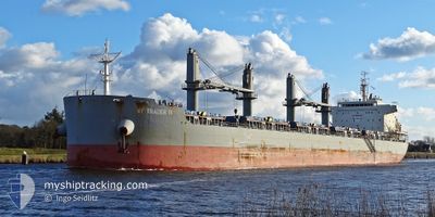
NY TRADER III
Cargo
Current Trip
| Trip Time | 2 days |
|---|---|
| Trip Distance | 642.09 nm |
| AVG Speed | 11.6 Noeuds |
| MAX Speed | 13.4 Noeuds |
| Tirant d eau | 11.1 m |
| AVG Wind | 11.9 knots |
| MAX Wind | 19.5 knots |
| MIN Temp | 22.6°C / 72.68°F |
| MAX Temp | 27°C / 80.6°F |
| Position reçue | 1 d depuis |
Current Position
| Longitude | -41.08035° |
|---|---|
| Latitude | -22.53727° |
| Etat | Under way using engine |
| Vitesse | 13.3 Noeuds |
| Parcours | 225.8° |
| Zone | South Atlantic Ocean |
| Station | T-AIS |
| Position reçue | 1 d depuis |
Info
Information
The current position of NY TRADER III is in South Atlantic Ocean with coordinates -22.53727° / -41.08035° as reported on 2024-05-01 23:19 by AIS to our vessel tracker app. The vessel's current speed is 13.3 Noeuds and is currently inside the port of PARANAGUA.
The vessel NY TRADER III (IMO: 9761231, MMSI: 548946000) is a Cargo It's sailing under the flag of [PH] Philippines.
In this page you can find informations about the vessels current position, last detected port calls, and current voyage information. If the vessels is not in coverage by AIS you will find the latest position.
The current position of NY TRADER III is detected by our AIS receivers and we are not responsible for the reliability of the data. The last position was recorded while the vessel was in Coverage by the Ais receivers of our vessel tracking app.
The current draught of NY TRADER III as reported by AIS is 11.1 meters
Weather
| Temperature | 26.4°C / 79.52°F |
|---|---|
| Wind Speed | 7 knots |
| Direction | 116° ESE |
| Pressure | 1011.9 hPa |
| Humidity | 68.3 % |
| Cloud Coverage | 35 % |
Featured Company
Last Port Calls
| Port | Arrival | Departure | Time In Port |
|---|---|---|---|
| 2024-05-03 16:20 | |||
| 2024-04-29 17:15 | 2024-05-01 09:04 | 1 d | |
| 2024-04-17 04:32 | 2024-04-17 19:28 | 14 h | |
| 2024-04-07 23:14 | 2024-04-14 10:43 | 6 d | |
| 2024-03-13 02:36 | 2024-03-20 21:21 | 7 d |
Last Trips
| Origin | Departure | Destination | Arrival | Distance | |
|---|---|---|---|---|---|
| 2024-05-01 06:04 | 2024-05-03 13:20 | 642.09 nm | |||
| 2024-04-17 20:28 | 2024-04-29 14:15 | 3327.49 nm | |||
| 2024-04-14 11:43 | 2024-04-17 05:32 | 468.60 nm | |||
| 2024-03-20 21:21 | 2024-04-07 23:14 | 460.67 nm | |||
| 2024-02-18 23:06 | 2024-03-13 02:36 | 4696.06 nm |
Events
| Heure | Evenement | Détails | Position/ Destination | Info |
|---|---|---|---|---|
| 2024-05-03 16:21 | Arret |
-25.50241 / -48.51664
[BR] PARANAGUA
|
Vitesse: 0.2 kn Parcours: 97° |
|
| 2024-05-03 16:20 | Port d'arrivée |
|
-25.50241 / -48.51664
[BR] PARANAGUA
|
Vitesse: 0.9 kn Parcours: 114° |
| 2024-05-03 14:05 | Démarrage | 7.07 nm, South East of ILHA DO MEL |
-25.64273 / -48.23569
BR VIX
|
Vitesse: 3.1 kn Parcours: 255° |
| 2024-05-03 13:10 | Arret | 6.92 nm, South East of ILHA DO MEL |
-25.63833 / -48.23333
BR VIX
|
Vitesse: Parcours: -1° |
| 2024-05-01 23:22 | Etat Changé | Default Under way using engine |
-22.54333 / -41.08833
BR VIX
|
Vitesse: 13.3 kn Parcours: 225.8° |
| 2024-05-01 23:19 | Hors de la zone couverte |
-22.53727 / -41.08035
South Atlantic Ocean
|
Vitesse: 13.3 kn Parcours: 225.8° |
|
| 2024-05-01 23:15 | Etat Changé | Under way using engine Default |
-22.52770 / -41.06984
BR VIX
|
Vitesse: 13.2 kn Parcours: 226° |
| 2024-05-01 23:04 | Etat Changé | Default Under way using engine |
-22.49833 / -41.03667
BR VIX
|
Vitesse: 13.2 kn Parcours: 226.9° |
| 2024-05-01 23:00 | Etat Changé | Under way using engine Default |
-22.48926 / -41.02651
BR VIX
|
Vitesse: 13 kn Parcours: 226° |
| 2024-05-01 22:41 | Etat Changé | Default Under way using engine |
-22.44137 / -40.97170
BR VIX
|
Vitesse: 13.1 kn Parcours: 227.1° |