
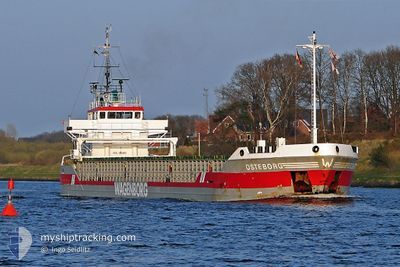
NS SPRINTER
General Cargo
Current Trip
| Time Travelled | 12 days |
|---|---|
| Remaining Time | --- |
| Distance Travelled | 638.02 nm |
| Remaining Distance | --- |
| AVG Speed | 6.7 Noeuds |
| MAX Speed | 7.8 Noeuds |
| AVG Wind | 8.3 knots |
| MAX Wind | 27.7 knots |
| MIN Temp | 5.8°C / 42.44°F |
| MAX Temp | 18.4°C / 65.12°F |
| Tirant d eau | 5.9 m |
| Position reçue | 1 m depuis |
Current Position
| Longitude | --- |
|---|---|
| Latitude | --- |
| Etat | At anchor |
| Vitesse | 0.1 Noeuds |
| Parcours | --- |
| Zone | Adriatic Sea |
| Station | T-AIS |
| Position reçue | 1 m depuis |
Info
Information
The current position of NS SPRINTER is in Adriatic Sea with coordinates 41.27220° / 19.46009° as reported on 2024-12-26 16:20 by AIS to our vessel tracker app. The vessel's current speed is 0.1 Noeuds
The vessel NS SPRINTER (IMO: 9033866, MMSI: 312577000) is a General Cargo that was built in 1992 ( 32 Age ). It's sailing under the flag of [BZ] Belize.
In this page you can find informations about the vessels current position, last detected port calls, and current voyage information. If the vessels is not in coverage by AIS you will find the latest position.
The current position of NS SPRINTER is detected by our AIS receivers and we are not responsible for the reliability of the data. The last position was recorded while the vessel was in Coverage by the Ais receivers of our vessel tracking app.
The current draught of NS SPRINTER as reported by AIS is 5.9 meters
Weather
| Temperature | 10°C / 50°F |
|---|---|
| Wind Speed | 8 knots |
| Direction | 32° NNE |
| Pressure | 1020.8 hPa |
| Humidity | 66.9 % |
| Cloud Coverage | 79 % |
Featured Company
Last Port Calls
| Port | Arrival | Departure | Time In Port |
|---|---|---|---|
| 2024-12-13 04:16 | 2024-12-14 11:57 | 1 d | |
| 2024-12-05 13:33 | 2024-12-09 08:17 | 3 d | |
| 2024-11-29 16:38 | 2024-11-30 13:27 | 20 h | |
| 2024-11-28 06:55 | 2024-11-29 16:04 | 1 d | |
| 2024-11-19 13:31 | 2024-11-23 17:06 | 4 d | |
| 2024-11-17 14:48 | 2024-11-18 21:55 | 1 d | |
| 2024-11-12 06:28 | 2024-11-13 23:03 | 1 d | |
| 2024-11-01 17:21 | 2024-11-03 09:42 | 1 d | |
| 2024-10-23 21:33 | 2024-10-25 17:37 | 1 d | |
| 2024-10-15 06:22 | 2024-10-16 16:08 | 1 d |
Most Visited Ports (Last year)
| Port | Arrivals | |
|---|---|---|
| 6 | ||
| 4 | ||
| 3 | ||
| 2 | ||
| 2 | ||
| 2 |
Last Trips
| Origin | Departure | Destination | Arrival | Distance | |
|---|---|---|---|---|---|
| 2024-12-09 09:17 | 2024-12-13 07:16 | 643.08 nm | |||
| 2024-11-30 16:27 | 2024-12-05 14:33 | 825.91 nm | |||
| 2024-11-29 19:04 | 2024-11-29 19:38 | 3.61 nm | |||
| 2024-11-23 18:06 | 2024-11-28 09:55 | 827.90 nm | |||
| 2024-11-18 22:55 | 2024-11-19 14:31 | 103.91 nm | |||
| 2024-11-14 02:03 | 2024-11-17 15:48 | 532.91 nm | |||
| 2024-11-03 10:42 | 2024-11-12 09:28 | 688.92 nm | |||
| 2024-10-25 20:37 | 2024-11-01 18:21 | 730.43 nm | |||
| 2024-10-16 18:08 | 2024-10-24 00:33 | 747.55 nm | |||
| 2024-10-08 17:54 | 2024-10-15 08:22 | 873.39 nm |
Events
| Heure | Evenement | Détails | Position/ Destination | Info |
|---|---|---|---|---|
| 2024-12-26 12:47 | Etat Changé | At anchor Default |
41.27216 / 19.45944
ALDRZ
|
Vitesse: Parcours: -1° |
| 2024-12-26 12:44 | Etat Changé | Default At anchor |
41.27215 / 19.45943
ALDRZ
|
Vitesse: Parcours: 511° |
| 2024-12-26 07:02 | Etat Changé | At anchor Default |
41.27221 / 19.46023
ALDRZ
|
Vitesse: 0.2 kn Parcours: -1° |
| 2024-12-26 06:59 | Etat Changé | Default At anchor |
41.27220 / 19.46016
ALDRZ
|
Vitesse: 0.1 kn Parcours: 511° |
| 2024-12-26 02:50 | Etat Changé | At anchor Default |
41.27213 / 19.45981
ALDRZ
|
Vitesse: 0.1 kn Parcours: -1° |
| 2024-12-26 02:47 | Etat Changé | Default At anchor |
41.27217 / 19.45978
ALDRZ
|
Vitesse: 0.2 kn Parcours: 511° |
| 2024-12-26 00:50 | Etat Changé | At anchor Default |
41.27215 / 19.45990
ALDRZ
|
Vitesse: 0.3 kn Parcours: -1° |
| 2024-12-26 00:47 | Etat Changé | Default At anchor |
41.27214 / 19.45982
ALDRZ
|
Vitesse: 0.1 kn Parcours: 511° |
| 2024-12-26 00:44 | Etat Changé | At anchor Default |
41.27212 / 19.45977
ALDRZ
|
Vitesse: 0.2 kn Parcours: -1° |
| 2024-12-26 00:38 | Etat Changé | Default At anchor |
41.27213 / 19.45977
ALDRZ
|
Vitesse: 0.2 kn Parcours: 511° |