

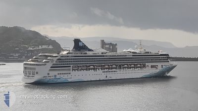
NORWEGIAN SPIRIT
Passengers Ship

Current Trip
CAM RANH
| Time Travelled | 1 day |
|---|---|
| Remaining Time | --- |
| Distance Travelled | 278.72 nm |
| Remaining Distance | --- |
| AVG Speed | 17.9 Noeuds |
| MAX Speed | 20.5 Noeuds |
| AVG Wind | 10.3 knots |
| MAX Wind | 14.4 knots |
| MIN Temp | 27°C / 80.6°F |
| MAX Temp | 28°C / 82.4°F |
| Tirant d eau | 8.4 m |
| Position reçue | 6 d depuis |
Current Position
| Longitude | --- |
|---|---|
| Latitude | --- |
| Etat | Under way using engine |
| Vitesse | 8.3 Noeuds |
| Parcours | 112° |
| Zone | South China Sea |
| Station | T-AIS |
| Position reçue | 6 d depuis |
Information
The current position of NORWEGIAN SPIRIT is in South China Sea with coordinates 22.29086° / 114.22297° as reported on 2025-02-12 08:36 by AIS to our vessel tracker app. The vessel's current speed is 8.3 Noeuds
The vessel NORWEGIAN SPIRIT (IMO: 9141065, MMSI: 311746000) is a Passengers Ship that was built in 1998 ( 27 Age ). It's sailing under the flag of [BS] Bahamas.
In this page you can find informations about the vessels current position, last detected port calls, and current voyage information. If the vessels is not in coverage by AIS you will find the latest position.
The current position of NORWEGIAN SPIRIT is detected by our AIS receivers and we are not responsible for the reliability of the data. The last position was recorded while the vessel was in Coverage by the Ais receivers of our vessel tracking app.
The current draught of NORWEGIAN SPIRIT as reported by AIS is 8.4 meters
Weather
| Temperature | 26.9°C / 80.42°F |
|---|---|
| Wind Speed | 12 knots |
| Direction | 108° ESE |
| Pressure | 1011.9 hPa |
| Humidity | 78.6 % |
| Cloud Coverage | 82 % |


Featured Company
Last Port Calls
| Port | Arrival | Departure | Time In Port |
|---|---|---|---|
| 2025-02-16 23:05 | 2025-02-17 13:41 | 14 h | |
| 2025-02-14 23:11 | 2025-02-15 11:18 | 12 h | |
| 2025-02-11 22:14 | 2025-02-12 08:53 | 10 h | |
| 2025-02-09 21:45 | 2025-02-10 12:17 | 14 h | |
| 2025-02-08 01:38 | 2025-02-08 14:41 | 13 h | |
| 2025-02-04 22:31 | 2025-02-05 11:22 | 12 h | |
| 2025-02-01 22:21 | 2025-02-03 09:52 | 1 d | |
| 2025-01-29 22:32 | 2025-01-30 11:18 | 12 h | |
| 2025-01-26 22:05 | 2025-01-27 13:41 | 15 h | |
| 2025-01-24 23:35 | 2025-01-25 11:19 | 11 h |
Last Trips
| Origin | Departure | Destination | Arrival | Distance | |
|---|---|---|---|---|---|
| 2025-02-15 18:18 | 2025-02-17 06:05 | 670.51 nm | |||
| 2025-02-12 16:53 | 2025-02-15 06:11 | 942.00 nm | |||
| 2025-02-10 20:17 | 2025-02-12 06:14 | 476.30 nm | |||
| 2025-02-08 22:41 | 2025-02-10 05:45 | 483.82 nm | |||
| 2025-02-05 18:22 | 2025-02-08 09:38 | 967.05 nm | |||
| 2025-02-03 16:52 | 2025-02-05 05:31 | 657.11 nm | |||
| 2025-01-30 19:18 | 2025-02-02 05:21 | 855.46 nm | |||
| 2025-01-27 20:41 | 2025-01-30 06:32 | 853.62 nm | |||
| 2025-01-25 18:19 | 2025-01-27 05:05 | 665.56 nm | |||
| 2025-01-22 17:00 | 2025-01-25 06:35 | 946.01 nm |
Events
| Heure | Evenement | Détails | Position/ Destination | Info |
|---|---|---|---|---|
| 2025-02-18 11:54 | Démarrage |
9.53897 / 99.89437
CAM RANH
|
Vitesse: 6.2 kn Parcours: 181° |
|
| 2025-02-18 02:48 | Arret |
9.54163 / 99.89903
CAM RANH
|
Vitesse: 0.1 kn Parcours: 100° |
|
| 2025-02-17 13:41 | PORT DE DEPART |
|
13.07577 / 100.86227
CAM RANH
|
Vitesse: 10.4 kn Parcours: 309° |
| 2025-02-17 13:29 | Démarrage |
13.05594 / 100.88380
[TH] LAEM CHABANG
|
Vitesse: 8.5 kn Parcours: 333° |
|
| 2025-02-16 23:33 | Arret |
13.04850 / 100.89256
[TH] LAEM CHABANG
|
Vitesse: 0.1 kn Parcours: 74° |
|
| 2025-02-16 23:05 | Port d'arrivée |
|
13.06855 / 100.87325
[TH] LAEM CHABANG
|
Vitesse: 10.5 kn Parcours: 120° |
| 2025-02-15 11:18 | PORT DE DEPART |
|
10.55650 / 107.01045
CAM RANH
|
Vitesse: 9 kn Parcours: 213° |
| 2025-02-15 11:13 | Démarrage |
10.56924 / 107.01735
[VN] PHU MY
|
Vitesse: 9 kn Parcours: 213° |
|
| 2025-02-14 23:30 | Arret |
10.57517 / 107.02462
[VN] PHU MY
|
Vitesse: 0.1 kn Parcours: 34° |
|
| 2025-02-14 23:11 | Port d'arrivée |
|
10.57218 / 107.02048
[VN] PHU MY
|
Vitesse: 7.3 kn Parcours: 324° |