
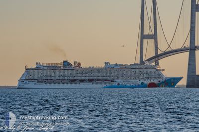
NORWEGIAN BREAKAWAY
Passengers Ship
Current Trip
| Time Travelled | 8 days |
|---|---|
| Remaining Time | --- |
| Distance Travelled | 3561.61 nm |
| Remaining Distance | --- |
| AVG Speed | 15.2 Noeuds |
| MAX Speed | 20.6 Noeuds |
| AVG Wind | 18.3 knots |
| MAX Wind | 30.8 knots |
| MIN Temp | 12.8°C / 55.04°F |
| MAX Temp | 24.2°C / 75.56°F |
| Tirant d eau | 8.6 m |
| Position reçue | 1 d depuis |
Current Position
| Longitude | --- |
|---|---|
| Latitude | --- |
| Etat | Under way using engine |
| Vitesse | 16.5 Noeuds |
| Parcours | 78.5° |
| Zone | North Atlantic Ocean |
| Station | T-AIS |
| Position reçue | 1 d depuis |
Info
Information
The current position of NORWEGIAN BREAKAWAY is in North Atlantic Ocean with coordinates 37.99641° / -24.31742° as reported on 2025-02-15 19:20 by AIS to our vessel tracker app. The vessel's current speed is 16.5 Noeuds and is heading at the port of SOUTHAMPTON. The estimated time of arrival as calculated by MyShipTracking vessel tracking app is 2025-02-19 03:30 LT
The vessel NORWEGIAN BREAKAWAY (IMO: 9606912, MMSI: 311050800) is a Passengers Ship that was built in 2013 ( 12 Age ). It's sailing under the flag of [BS] Bahamas.
In this page you can find informations about the vessels current position, last detected port calls, and current voyage information. If the vessels is not in coverage by AIS you will find the latest position.
The current position of NORWEGIAN BREAKAWAY is detected by our AIS receivers and we are not responsible for the reliability of the data. The last position was recorded while the vessel was in Coverage by the Ais receivers of our vessel tracking app.
The current draught of NORWEGIAN BREAKAWAY as reported by AIS is 8.6 meters
Weather
| Temperature | 15.8°C / 60.44°F |
|---|---|
| Wind Speed | 22 knots |
| Direction | 192° SSW |
| Pressure | 1011 hPa |
| Humidity | 83.6 % |
| Cloud Coverage | 100 % |
Featured Company
Last Port Calls
| Port | Arrival | Departure | Time In Port |
|---|---|---|---|
| 2025-02-07 04:13 | 2025-02-07 16:49 | 12 h | |
| 2025-02-04 06:57 | 2025-02-04 15:41 | 8 h | |
| 2025-02-03 08:46 | 2025-02-03 17:50 | 9 h | |
| 2025-02-02 08:14 | 2025-02-02 17:00 | 8 h | |
| 2025-01-31 06:31 | 2025-01-31 16:04 | 9 h | |
| 2025-01-29 04:57 | 2025-01-29 16:33 | 11 h | |
| 2025-01-26 07:39 | 2025-01-26 15:38 | 7 h | |
| 2025-01-25 08:47 | 2025-01-25 17:56 | 9 h | |
| 2025-01-24 08:06 | 2025-01-24 17:43 | 9 h | |
| 2025-01-22 05:44 | 2025-01-22 16:06 | 10 h |
Last Trips
| Origin | Departure | Destination | Arrival | Distance | |
|---|---|---|---|---|---|
| 2025-02-04 15:41 | 2025-02-07 04:13 | 926.48 nm | |||
| 2025-02-03 17:50 | 2025-02-04 06:57 | 270.32 nm | |||
| 2025-02-02 17:00 | 2025-02-03 08:46 | 307.71 nm | |||
| 2025-01-31 16:04 | 2025-02-02 08:14 | 766.28 nm | |||
| 2025-01-29 16:33 | 2025-01-31 06:31 | 695.21 nm | |||
| 2025-01-26 15:38 | 2025-01-29 04:57 | 927.13 nm | |||
| 2025-01-25 17:56 | 2025-01-26 07:39 | 268.10 nm | |||
| 2025-01-24 17:43 | 2025-01-25 08:47 | 307.55 nm | |||
| 2025-01-22 16:06 | 2025-01-24 08:06 | 764.37 nm | |||
| 2025-01-20 17:09 | 2025-01-22 05:44 | 692.09 nm |
Events
| Heure | Evenement | Détails | Position/ Destination | Info |
|---|---|---|---|---|
| 2025-02-15 19:27 | Etat Changé | Default Under way using engine |
38.00378 / -24.27678
GBSOU
|
Vitesse: 16.5 kn Parcours: 78.5° |
| 2025-02-15 19:20 | Hors de la zone couverte |
37.99641 / -24.31742
North Atlantic Ocean
GBSOU
|
Vitesse: 16.5 kn Parcours: 78.5° |
|
| 2025-02-15 19:09 | Etat Changé | Under way using engine Default |
37.98608 / -24.37829
GBSOU
|
Vitesse: 15.9 kn Parcours: 71° |
| 2025-02-15 19:04 | Etat Changé | Default Under way using engine |
37.98045 / -24.40446
GBSOU
|
Vitesse: 16.4 kn Parcours: 81.1° |
| 2025-02-15 15:04 | Démarrage |
37.73751 / -25.65761
GBSOU
|
Vitesse: 3.4 kn Parcours: 80° |
|
| 2025-02-15 15:00 | Etat Changé | Under way using engine Moored |
37.73849 / -25.66047
GBSOU
|
Vitesse: Parcours: 59° |
| 2025-02-15 12:32 | Changement d'ETA | 2025/02/19 03:30 2025/02/15 07:00 |
37.73855 / -25.66056
GBSOU
|
Vitesse: Parcours: 59° |
| 2025-02-15 12:25 | Changement de destination | GBSOU PT PDL |
37.73855 / -25.66056
GBSOU
|
Vitesse: Parcours: 59° |
| 2025-02-15 08:21 | Etat Changé | Moored Under way using engine |
37.73855 / -25.66058
PT PDL
|
Vitesse: 0.1 kn Parcours: 59° |
| 2025-02-15 07:36 | Arret |
37.73803 / -25.65992
PT PDL
|
Vitesse: 0.3 kn Parcours: 65° |