
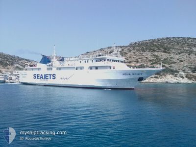
NORTHERN SEA WOLF
Ro-Ro/Passenger Ship
Current Trip
| Trip Time | 3 h, 50 mins |
|---|---|
| Trip Distance | 50.32 nm |
| AVG Speed | 13.7 Noeuds |
| MAX Speed | 14.3 Noeuds |
| Tirant d eau | 3.1 m |
| AVG Wind | 1.6 knots |
| MAX Wind | 2.8 knots |
| MIN Temp | 4.6°C / 40.28°F |
| MAX Temp | 8.3°C / 46.94°F |
| Position reçue | 2 d depuis |
Current Position
| Longitude | -127.67522° |
|---|---|
| Latitude | 52.27233° |
| Etat | Under way using engine |
| Vitesse | 13.5 Noeuds |
| Parcours | 78.1° |
| Zone | The Coastal Waters of Southeast Alaska and British Columbia |
| Station | T-AIS |
| Position reçue | 2 d depuis |
Info
Information
The current position of NORTHERN SEA WOLF is in The Coastal Waters of Southeast Alaska and British Columbia with coordinates 52.27233° / -127.67522° as reported on 2024-06-02 16:40 by AIS to our vessel tracker app. The vessel's current speed is 13.5 Noeuds and is currently inside the port of BELLA COOLA.
The vessel NORTHERN SEA WOLF (IMO: 9212450, MMSI: 316036676) is a Ro-Ro/Passenger Ship that was built in 2000 ( 24 Age ). It's sailing under the flag of [CA] Canada.
In this page you can find informations about the vessels current position, last detected port calls, and current voyage information. If the vessels is not in coverage by AIS you will find the latest position.
The current position of NORTHERN SEA WOLF is detected by our AIS receivers and we are not responsible for the reliability of the data. The last position was recorded while the vessel was in Coverage by the Ais receivers of our vessel tracking app.
The current draught of NORTHERN SEA WOLF as reported by AIS is 3.1 meters
Weather
| Temperature | 1.4°C / 34.52°F |
|---|---|
| Wind Speed | 5 knots |
| Direction | 241° WSW |
| Pressure | 1000.7 hPa |
| Humidity | 99.9 % |
| Cloud Coverage | 100 % |
Featured Company
Last Port Calls
| Port | Arrival | Departure | Time In Port |
|---|---|---|---|
| 2024-06-02 12:51 | |||
| 2024-06-02 08:30 | 2024-06-02 09:01 | 31 m | |
| 2024-06-02 05:11 | 2024-06-02 06:19 | 1 h | |
| 2024-06-01 06:23 | 2024-06-02 02:51 | 20 h | |
| 2024-06-01 01:14 | 2024-06-01 03:18 | 2 h | |
| 2024-05-31 23:16 | 2024-06-01 00:03 | 47 m | |
| 2024-05-31 18:43 | 2024-05-31 20:21 | 1 h | |
| 2024-05-26 11:58 | 2024-05-31 14:57 | 5 d | |
| 2024-05-26 06:48 | 2024-05-26 08:13 | 1 h | |
| 2024-05-26 02:22 | 2024-05-26 03:42 | 1 h |
Most Visited Ports (Last year)
| Port | Arrivals | |
|---|---|---|
| 118 | ||
| 91 | ||
| 64 | ||
| 39 | ||
| 6 |
Last Trips
| Origin | Departure | Destination | Arrival | Distance | |
|---|---|---|---|---|---|
| 2024-06-02 09:01 | 2024-06-02 12:51 | 50.32 nm | |||
| 2024-06-02 06:19 | 2024-06-02 08:30 | 29.83 nm | |||
| 2024-06-02 02:51 | 2024-06-02 05:11 | 5.84 nm | |||
| 2024-06-01 03:18 | 2024-06-01 06:23 | 7.07 nm | |||
| 2024-06-01 00:03 | 2024-06-01 01:14 | 3.16 nm | |||
| 2024-05-31 20:21 | 2024-05-31 23:16 | 28.84 nm | |||
| 2024-05-31 14:57 | 2024-05-31 18:43 | 50.19 nm | |||
| 2024-05-26 08:13 | 2024-05-26 11:58 | 49.58 nm | |||
| 2024-05-26 03:42 | 2024-05-26 06:48 | 29.98 nm | |||
| 2024-05-26 00:40 | 2024-05-26 02:22 | 7.29 nm |
Events
| Heure | Evenement | Détails | Position/ Destination | Info |
|---|---|---|---|---|
| 2024-06-02 19:51 | Arret |
52.37667 / -126.79500
[CA] BELLA COOLA
|
Vitesse: Parcours: -1° |
|
| 2024-06-02 19:51 | Port d'arrivée |
|
52.37667 / -126.79500
[CA] BELLA COOLA
|
Vitesse: 8.1 kn Parcours: 120° |
| 2024-06-02 16:45 | Etat Changé | Default Under way using engine |
52.27500 / -127.64833
OCEAN FALLS
|
Vitesse: 13.5 kn Parcours: 78.1° |
| 2024-06-02 16:40 | Hors de la zone couverte |
52.27233 / -127.67522
The Coastal Waters of Southeast Alaska and British Columbia
|
Vitesse: 13.5 kn Parcours: 78.1° |
|
| 2024-06-02 16:02 | Etat Changé | Under way using engine Default |
52.35125 / -127.72095
OCEAN FALLS
|
Vitesse: 0.4 kn Parcours: 285° |
| 2024-06-02 16:02 | Démarrage | 0.95 nm, West of OCEAN FALLS |
52.35125 / -127.72095
OCEAN FALLS
|
Vitesse: 14.2 kn Parcours: 233° |
| 2024-06-02 16:01 | PORT DE DEPART |
|
52.35125 / -127.72095
OCEAN FALLS
|
Vitesse: 0.4 kn Parcours: 285° |
| 2024-06-02 15:39 | Arret |
52.35333 / -127.69500
[CA] OCEAN FALLS
|
Vitesse: Parcours: -1° |
|
| 2024-06-02 15:30 | Port d'arrivée |
|
52.35166 / -127.69500
[CA] OCEAN FALLS
|
Vitesse: 10.8 kn Parcours: 98° |
| 2024-06-02 15:27 | Etat Changé | Default Under way using engine |
52.35192 / -127.70596
OCEAN FALLS
|
Vitesse: 13.8 kn Parcours: 36.9° |