
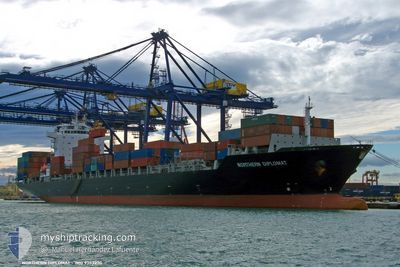
NORTHERN DIPLOMAT
Container Ship
Current Trip
| Trip Time | 2 days |
|---|---|
| Trip Distance | 615.85 nm |
| AVG Speed | 13 Noeuds |
| MAX Speed | 17.2 Noeuds |
| Tirant d eau | 12.5 m |
| AVG Wind | 8.7 knots |
| MAX Wind | 19 knots |
| MIN Temp | 23.1°C / 73.58°F |
| MAX Temp | 28.3°C / 82.94°F |
| Position reçue | 14 h, 49 m depuis |
Current Position
| Longitude | -69.71128° |
|---|---|
| Latitude | 18.24233° |
| Etat | Under way using engine |
| Vitesse | 16.9 Noeuds |
| Parcours | 37° |
| Zone | Caribbean Sea |
| Station | T-AIS |
| Position reçue | 14 h, 49 m depuis |
Info
Information
The current position of NORTHERN DIPLOMAT is in Caribbean Sea with coordinates 18.24233° / -69.71128° as reported on 2024-05-07 07:11 by AIS to our vessel tracker app. The vessel's current speed is 16.9 Noeuds and is currently inside the port of BOCA CHIKA.
The vessel NORTHERN DIPLOMAT (IMO: 9353230, MMSI: 636091783) is a Container Ship that was built in 2009 ( 15 Age ). It's sailing under the flag of [LR] Liberia.
In this page you can find informations about the vessels current position, last detected port calls, and current voyage information. If the vessels is not in coverage by AIS you will find the latest position.
The current position of NORTHERN DIPLOMAT is detected by our AIS receivers and we are not responsible for the reliability of the data. The last position was recorded while the vessel was in Coverage by the Ais receivers of our vessel tracking app.
The current draught of NORTHERN DIPLOMAT as reported by AIS is 12.5 meters
Weather
| Temperature | 28.6°C / 83.48°F |
|---|---|
| Wind Speed | 4 knots |
| Direction | 126° SE |
| Pressure | 1009.2 hPa |
| Humidity | 77 % |
| Cloud Coverage | 24 % |
Featured Company
Last Port Calls
| Port | Arrival | Departure | Time In Port |
|---|---|---|---|
| 2024-05-07 08:52 | |||
| 2024-05-04 15:26 | 2024-05-05 07:58 | 16 h | |
| 2024-05-01 01:22 | 2024-05-02 11:50 | 1 d | |
| 2024-04-28 15:42 | 2024-04-30 09:38 | 1 d | |
| 2024-04-21 13:44 | 2024-04-22 09:12 | 19 h | |
| 2024-04-18 08:52 | 2024-04-19 17:39 | 1 d | |
| 2024-04-16 15:56 | 2024-04-17 05:16 | 13 h | |
| 2024-04-14 15:48 | 2024-04-16 04:35 | 1 d | |
| 2024-04-12 10:45 | 2024-04-12 22:36 | 11 h | |
| 2024-04-10 01:15 | 2024-04-11 11:52 | 1 d |
Most Visited Ports (Last year)
| Port | Arrivals | |
|---|---|---|
| 29 | ||
| 24 | ||
| 23 | ||
| 23 | ||
| 22 | ||
| 20 |
Last Trips
| Origin | Departure | Destination | Arrival | Distance | |
|---|---|---|---|---|---|
| 2024-05-05 02:58 | 2024-05-07 04:52 | 615.85 nm | |||
| 2024-05-02 06:50 | 2024-05-04 10:26 | 300.23 nm | |||
| 2024-04-30 04:38 | 2024-04-30 20:22 | 21.10 nm | |||
| 2024-04-22 05:12 | 2024-04-28 10:42 | 836.99 nm | |||
| 2024-04-19 13:39 | 2024-04-21 09:44 | 283.00 nm | |||
| 2024-04-17 01:16 | 2024-04-18 04:52 | 268.34 nm | |||
| 2024-04-16 00:35 | 2024-04-16 11:56 | 34.18 nm | |||
| 2024-04-12 17:36 | 2024-04-14 11:48 | 615.97 nm | |||
| 2024-04-11 06:52 | 2024-04-12 05:45 | 278.05 nm | |||
| 2024-04-06 14:25 | 2024-04-09 20:15 | 18.73 nm |
Events
| Heure | Evenement | Détails | Position/ Destination | Info |
|---|---|---|---|---|
| 2024-05-07 08:52 | Port d'arrivée |
|
18.42833 / -69.62666
[DO] BOCA CHIKA
|
Vitesse: 3 kn Parcours: 5° |
| 2024-05-07 07:31 | Etat Changé | Default Under way using engine |
18.31167 / -69.65500
DOCAU
|
Vitesse: 16.9 kn Parcours: 37° |
| 2024-05-07 07:11 | Changement de zone | Domican Republic part of the Caribbean Sea Colombian part of the Caribbean Sea |
18.24233 / -69.71128
Caribbean Sea
|
Vitesse: 16.9 kn Parcours: 37° |
| 2024-05-07 07:11 | Etat Changé | Under way using engine Default |
18.24233 / -69.71128
DOCAU
|
Vitesse: 16 kn Parcours: 37° |
| 2024-05-07 07:11 | Hors de la zone couverte |
18.24233 / -69.71128
Caribbean Sea
|
Vitesse: 16.9 kn Parcours: 37° |
|
| 2024-05-07 07:07 | Dans la zone couverte |
18.24233 / -69.71128
Caribbean Sea
|
Vitesse: 16.9 kn Parcours: 37° |
|
| 2024-05-05 14:04 | Etat Changé | Default Under way using engine |
11.46333 / -75.03167
DOCAU
|
Vitesse: 16.6 kn Parcours: 37° |
| 2024-05-05 13:52 | Hors de la zone couverte |
11.41919 / -75.06776
Caribbean Sea
DOCAU
|
Vitesse: 16.6 kn Parcours: 37° |
|
| 2024-05-05 13:50 | Etat Changé | Under way using engine Default |
11.41510 / -75.07090
DOCAU
|
Vitesse: 16 kn Parcours: 37° |
| 2024-05-05 13:46 | Etat Changé | Default Under way using engine |
11.39667 / -75.08334
DOCAU
|
Vitesse: 16.7 kn Parcours: 39° |