
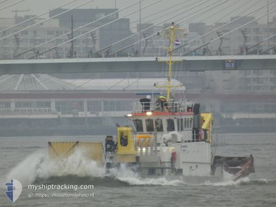
NORMA II
Utility Vessel
Current Trip
| Trip Time | 1 day |
|---|---|
| Trip Distance | 272.40 nm |
| AVG Speed | 6.4 Noeuds |
| MAX Speed | 10.4 Noeuds |
| Tirant d eau | 2.8 m |
| AVG Wind | 11.8 knots |
| MAX Wind | 21 knots |
| MIN Temp | -1.8°C / 28.76°F |
| MAX Temp | 4.8°C / 40.64°F |
| Position reçue | 6 m depuis |
Current Position
| Longitude | --- |
|---|---|
| Latitude | --- |
| Etat | Moored |
| Vitesse | |
| Parcours | 102° |
| Zone | North Sea |
| Station | T-AIS |
| Position reçue | 6 m depuis |
Info
Information
The current position of NORMA II is in North Sea with coordinates 51.81797° / 4.72082° as reported on 2026-01-06 08:38 by AIS to our vessel tracker app. The vessel's current speed is 0 Noeuds and is currently inside the port of DORDRECHT.
The vessel NORMA II (IMO: 9199763, MMSI: 232053696) is a Utility Vessel that was built in 1998 ( 28 Age ). It's sailing under the flag of [GB] United Kingdom.
In this page you can find informations about the vessels current position, last detected port calls, and current voyage information. If the vessels is not in coverage by AIS you will find the latest position.
The current position of NORMA II is detected by our AIS receivers and we are not responsible for the reliability of the data. The last position was recorded while the vessel was in Coverage by the Ais receivers of our vessel tracking app.
The current draught of NORMA II as reported by AIS is 2.8 meters
Weather
| Temperature | -5.1°C / 22.82°F |
|---|---|
| Wind Speed | 5 knots |
| Direction | 233° SW |
| Pressure | 1015.6 hPa |
| Humidity | 90.2 % |
| Cloud Coverage | 36 % |
Featured Company
Last Port Calls
| Port | Arrival | Departure | Time In Port |
|---|---|---|---|
| 2026-01-05 02:23 | |||
| 2025-12-31 02:09 | 2026-01-03 13:26 | 3 d | |
| 2025-12-22 11:17 | 2025-12-28 13:27 | 6 d | |
| 2025-12-22 08:39 | 2025-12-22 11:08 | 2 h | |
| 2025-12-21 14:15 | 2025-12-22 08:30 | 18 h | |
| 2025-12-21 09:40 | 2025-12-21 14:09 | 4 h | |
| 2025-12-20 15:25 | 2025-12-21 09:28 | 18 h | |
| 2025-12-20 13:46 | 2025-12-20 15:13 | 1 h | |
| 2025-12-20 12:43 | 2025-12-20 13:37 | 53 m | |
| 2025-12-18 14:55 | 2025-12-20 12:26 | 1 d |
Last Trips
| Origin | Departure | Destination | Arrival | Distance | |
|---|---|---|---|---|---|
| 2026-01-03 13:26 | 2026-01-05 02:23 | 272.40 nm | |||
| 2025-12-28 13:27 | 2025-12-31 02:09 | 377.37 nm | |||
| 2025-12-22 11:08 | 2025-12-22 11:17 | 1.57 nm | |||
| 2025-12-22 08:30 | 2025-12-22 08:39 | 1.79 nm | |||
| 2025-12-21 14:09 | 2025-12-21 14:15 | 0.98 nm | |||
| 2025-12-21 09:28 | 2025-12-21 09:40 | 1.85 nm | |||
| 2025-12-20 15:13 | 2025-12-20 15:25 | 1.89 nm | |||
| 2025-12-20 13:37 | 2025-12-20 13:46 | 0.50 nm | |||
| 2025-12-20 12:26 | 2025-12-20 12:43 | 1.51 nm | |||
| 2025-12-18 14:44 | 2025-12-18 14:55 | 1.73 nm |
Events
| Heure | Evenement | Détails | Position/ Destination | Info |
|---|---|---|---|---|
| 2026-01-05 14:11 | Dans la zone couverte |
51.81800 / 4.72081
North Sea
[NL] DORDRECHT
|
Vitesse: Parcours: 157.3° |
|
| 2026-01-05 12:08 | Hors de la zone couverte |
51.81799 / 4.72083
North Sea
[NL] DORDRECHT
|
Vitesse: Parcours: 157.3° |
|
| 2026-01-05 01:41 | Etat Changé | Moored Under way using engine |
51.81801 / 4.72081
[NL] DORDRECHT
|
Vitesse: Parcours: 102° |
| 2026-01-05 01:33 | Arret |
51.81829 / 4.72131
[NL] DORDRECHT
|
Vitesse: 0.3 kn Parcours: 112° |
|
| 2026-01-05 01:23 | Port d'arrivée |
|
51.82213 / 4.71256
[NL] DORDRECHT
|
Vitesse: 3.9 kn Parcours: 128° |
| 2026-01-04 19:41 | Dans la zone couverte |
51.98800 / 3.93054
North Sea
DORDRECHT
|
Vitesse: 7.2 kn Parcours: 79.9° |
|
| 2026-01-04 15:26 | Hors de la zone couverte |
51.82716 / 2.97133
North Sea
DORDRECHT
|
Vitesse: 9.4 kn Parcours: 71° |
|
| 2026-01-04 14:27 | Changement de zone | Dutch part of the North Sea Belgian part of the North Sea |
51.76671 / 2.72804
North Sea
DORDRECHT
|
Vitesse: 9.9 kn Parcours: 67.8° |
| 2026-01-04 13:31 | Changement de zone | Belgian part of the North Sea French part of the North Sea |
51.66728 / 2.53663
North Sea
DORDRECHT
|
Vitesse: 9.9 kn Parcours: 37.2° |
| 2026-01-04 13:31 | Dans la zone couverte |
51.66728 / 2.53663
North Sea
DORDRECHT
|
Vitesse: 9.9 kn Parcours: 37.2° |