

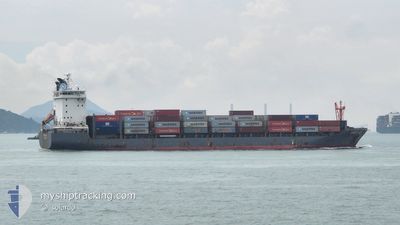
NORDTIGER
Cargo

Current Trip
| Trip Time | 8 days |
|---|---|
| Trip Distance | 1351.40 nm |
| AVG Speed | 16.3 Noeuds |
| MAX Speed | 19.5 Noeuds |
| Tirant d eau | 7.1 m |
| AVG Wind | 9.8 knots |
| MAX Wind | 21 knots |
| MIN Temp | 23.3°C / 73.94°F |
| MAX Temp | 28.8°C / 83.84°F |
| Position reçue | 9 d depuis |
Current Position
| Longitude | --- |
|---|---|
| Latitude | --- |
| Etat | Under way using engine |
| Vitesse | 16.9 Noeuds |
| Parcours | 88.4° |
| Zone | Indian Ocean |
| Station | T-AIS |
| Position reçue | 9 d depuis |
Information
The current position of NORDTIGER is in Indian Ocean with coordinates 5.70249° / 80.49708° as reported on 2025-03-18 16:49 by AIS to our vessel tracker app. The vessel's current speed is 16.9 Noeuds and is currently inside the port of CHITTAGONG.
The vessel NORDTIGER (IMO: 9626247, MMSI: 212283000) is a Cargo It's sailing under the flag of [CY] Cyprus.
In this page you can find informations about the vessels current position, last detected port calls, and current voyage information. If the vessels is not in coverage by AIS you will find the latest position.
The current position of NORDTIGER is detected by our AIS receivers and we are not responsible for the reliability of the data. The last position was recorded while the vessel was in Coverage by the Ais receivers of our vessel tracking app.
The current draught of NORDTIGER as reported by AIS is 7.1 meters
Weather
| Temperature | 25.8°C / 78.44°F |
|---|---|
| Wind Speed | 8 knots |
| Direction | 222° SW |
| Pressure | 1008 hPa |
| Humidity | 88 % |
| Cloud Coverage | 17 % |


Featured Company
Last Port Calls
| Port | Arrival | Departure | Time In Port |
|---|---|---|---|
| 2025-03-26 14:34 | |||
| 2025-03-17 13:18 | 2025-03-18 10:38 | 21 h | |
| 2025-03-15 06:30 | 2025-03-15 21:10 | 14 h | |
| 2025-03-09 11:37 | 2025-03-11 15:25 | 2 d | |
| 2025-02-28 20:38 | 2025-03-02 22:41 | 2 d | |
| 2025-02-23 12:05 | 2025-02-25 02:33 | 1 d | |
| 2025-02-15 19:29 | 2025-02-17 18:25 | 1 d | |
| 2025-02-06 09:49 | 2025-02-09 03:59 | 2 d | |
| 2025-02-01 12:03 | 2025-02-01 22:49 | 10 h | |
| 2025-01-30 17:37 | 2025-01-31 09:41 | 16 h |
Most Visited Ports (Last year)
| Port | Arrivals | |
|---|---|---|
| 18 | ||
| 12 | ||
| 3 | ||
| 3 | ||
| 1 | ||
| 1 |
Last Trips
| Origin | Departure | Destination | Arrival | Distance | |
|---|---|---|---|---|---|
| 2025-03-18 16:08 | 2025-03-26 20:34 | 1351.40 nm | |||
| 2025-03-16 02:40 | 2025-03-17 18:48 | 21.46 nm | |||
| 2025-03-11 21:25 | 2025-03-15 12:00 | 1333.12 nm | |||
| 2025-03-03 04:11 | 2025-03-09 17:37 | 1354.38 nm | |||
| 2025-02-25 08:33 | 2025-03-01 02:08 | 1329.62 nm | |||
| 2025-02-17 23:55 | 2025-02-23 18:05 | 1334.52 nm | |||
| 2025-02-09 09:59 | 2025-02-16 00:59 | 1353.74 nm | |||
| 2025-02-02 04:19 | 2025-02-06 15:49 | 1332.05 nm | |||
| 2025-01-31 15:11 | 2025-02-01 17:33 | 21.29 nm | |||
| 2025-01-24 17:37 | 2025-01-30 23:07 | 1331.34 nm |
Events
| Heure | Evenement | Détails | Position/ Destination | Info |
|---|---|---|---|---|
| 2025-03-26 14:34 | Arret |
22.30187 / 91.79992
[BD] CHITTAGONG
|
Vitesse: 0.1 kn Parcours: 225° |
|
| 2025-03-26 14:34 | Port d'arrivée |
|
22.30187 / 91.79992
[BD] CHITTAGONG
|
Vitesse: 2.3 kn Parcours: 202° |
| 2025-03-26 13:14 | Démarrage | 4.05 nm, South West of CHITTAGONG |
22.19905 / 91.75474
LKCMB
|
Vitesse: 4.1 kn Parcours: 70° |
| 2025-03-26 12:18 | Arret | 3.97 nm, South West of CHITTAGONG |
22.19459 / 91.75977
LKCMB
|
Vitesse: 0.3 kn Parcours: 36° |
| 2025-03-26 09:58 | Démarrage | 12.34 nm, South of CHITTAGONG |
22.04399 / 91.73193
LKCMB
|
Vitesse: 4.5 kn Parcours: 346° |
| 2025-03-21 12:34 | Arret | 12.49 nm, South of CHITTAGONG |
22.04108 / 91.73250
LKCMB
|
Vitesse: 0.3 kn Parcours: 357° |
| 2025-03-18 16:53 | Etat Changé | Default Under way using engine |
5.70284 / 80.51417
LKCMB
|
Vitesse: 16.9 kn Parcours: 88.4° |
| 2025-03-18 16:49 | Changement de zone | Sri Lankan part of the Indian Ocean Sri Lankan part of the Laccadive Sea |
5.70249 / 80.49708
Indian Ocean
|
Vitesse: 16.9 kn Parcours: 88.4° |
| 2025-03-18 16:49 | Etat Changé | Under way using engine Default |
5.70249 / 80.49708
LKCMB
|
Vitesse: 16.8 kn Parcours: 92° |
| 2025-03-18 16:49 | Hors de la zone couverte |
5.70249 / 80.49708
Indian Ocean
|
Vitesse: 16.9 kn Parcours: 88.4° |