
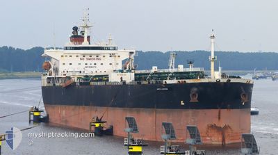
NORDIC JOSEPHINE
Crude Oil Tanker
Current Trip
| Time Travelled | 16 days |
|---|---|
| Remaining Time | --- |
| Distance Travelled | 4031.51 nm |
| Remaining Distance | --- |
| AVG Speed | 11.3 Noeuds |
| MAX Speed | 14.2 Noeuds |
| AVG Wind | 13.2 knots |
| MAX Wind | 31 knots |
| MIN Temp | 18°C / 64.4°F |
| MAX Temp | 32.9°C / 91.22°F |
| Tirant d eau | 12.8 m |
| Position reçue | 1 m depuis |
Current Position
| Longitude | 32.64273° |
|---|---|
| Latitude | -29.11957° |
| Etat | Under way using engine |
| Vitesse | 13.3 Noeuds |
| Parcours | 215° |
| Zone | Laccadive Sea |
| Station | T-AIS |
| Position reçue | 1 m depuis |
Info
Information
The current position of NORDIC JOSEPHINE is in Laccadive Sea with coordinates -29.11957° / 32.64273° as reported on 2024-06-05 14:12 by AIS to our vessel tracker app. The vessel's current speed is 13.3 Noeuds and is heading at the port of KOCHI.
The vessel NORDIC JOSEPHINE (IMO: 9284374, MMSI: 636092955) is a Crude Oil Tanker that was built in 2007 ( 17 Age ). It's sailing under the flag of [LR] Liberia.
In this page you can find informations about the vessels current position, last detected port calls, and current voyage information. If the vessels is not in coverage by AIS you will find the latest position.
The current position of NORDIC JOSEPHINE is detected by our AIS receivers and we are not responsible for the reliability of the data. The last position was recorded while the vessel was in Coverage by the Ais receivers of our vessel tracking app.
The current draught of NORDIC JOSEPHINE as reported by AIS is 12.8 meters
Weather
| Temperature | 23.4°C / 74.12°F |
|---|---|
| Wind Speed | 7 knots |
| Direction | 59° ENE |
| Pressure | 1008.9 hPa |
| Humidity | 44.6 % |
| Cloud Coverage | --- |
Featured Company
Most Visited Ports (Last year)
| Port | Arrivals | |
|---|---|---|
| 3 | ||
| 2 | ||
| 1 | ||
| 1 | ||
| 1 | ||
| 1 |
Events
| Heure | Evenement | Détails | Position/ Destination | Info |
|---|---|---|---|---|
| 2024-06-05 14:07 | Tirant d'eau modifié | 12.8 8.2 |
-29.10412 / 32.65548
NEW YORK
|
Vitesse: 13.3 kn Parcours: 215° |
| 2024-06-05 14:07 | Changement de destination | NEW YORK COCHIN, INDIA |
-29.10412 / 32.65548
NEW YORK
|
Vitesse: 13.3 kn Parcours: 215° |
| 2024-06-05 14:07 | Changement d'ETA | 2024/07/01 07:00 2024/05/08 10:30 |
-29.10412 / 32.65548
NEW YORK
|
Vitesse: 13.3 kn Parcours: 215° |
| 2024-06-05 14:05 | Changement de zone | South African part of the Indian Ocean Indian part of the Laccadive Sea |
-29.09912 / 32.65963
Indian Ocean
|
Vitesse: 13.3 kn Parcours: 216° |
| 2024-06-05 14:03 | Dans la zone couverte |
-29.09912 / 32.65963
Indian Ocean
|
Vitesse: 13.3 kn Parcours: 216° |
|
| 2024-06-05 14:02 | Etat Changé | Under way using engine Default |
-29.09155 / 32.66598
COCHIN, INDIA
|
Vitesse: 13.3 kn Parcours: 215° |
| 2024-06-04 15:27 | Démarrage | 11.62 nm, East of MAPUTO |
-25.93312 / 32.77602
COCHIN, INDIA
|
Vitesse: 4.2 kn Parcours: 38° |
| 2024-06-04 04:11 | Arret | 11.66 nm, East of MAPUTO |
-25.93653 / 32.77767
COCHIN, INDIA
|
Vitesse: 0.3 kn Parcours: 232° |