
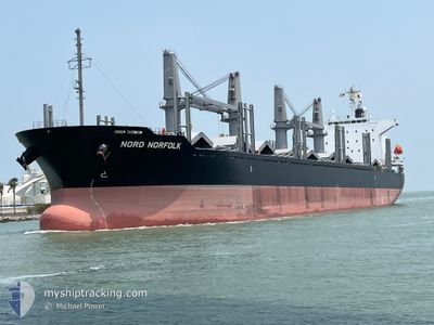
NORD NORFOLK
Cargo
Current Trip
USBRO
| Time Travelled | 3 days |
|---|---|
| Remaining Time | --- |
| Distance Travelled | 158.72 nm |
| Remaining Distance | --- |
| AVG Speed | 9.5 Noeuds |
| MAX Speed | 12.8 Noeuds |
| AVG Wind | 11.1 knots |
| MAX Wind | 17.3 knots |
| MIN Temp | 23.7°C / 74.66°F |
| MAX Temp | 30.2°C / 86.36°F |
| Tirant d eau | 6.3 m |
| Position reçue | 1 d depuis |
Current Position
| Longitude | -97.46588° |
|---|---|
| Latitude | 27.81791° |
| Etat | Moored |
| Vitesse | |
| Parcours | 102° |
| Zone | Gulf of Mexico |
| Station | T-AIS |
| Position reçue | 1 d depuis |
Info
Information
The current position of NORD NORFOLK is in Gulf of Mexico with coordinates 27.81791° / -97.46588° as reported on 2024-05-01 01:06 by AIS to our vessel tracker app. The vessel's current speed is 0 Noeuds
The vessel NORD NORFOLK (IMO: 9984479, MMSI: 636023584) is a Cargo It's sailing under the flag of [LR] Liberia.
In this page you can find informations about the vessels current position, last detected port calls, and current voyage information. If the vessels is not in coverage by AIS you will find the latest position.
The current position of NORD NORFOLK is detected by our AIS receivers and we are not responsible for the reliability of the data. The last position was recorded while the vessel was in Coverage by the Ais receivers of our vessel tracking app.
The current draught of NORD NORFOLK as reported by AIS is 6.3 meters
Weather
| Temperature | 29.2°C / 84.56°F |
|---|---|
| Wind Speed | 12 knots |
| Direction | 145° SE |
| Pressure | 1005.3 hPa |
| Humidity | 69.6 % |
| Cloud Coverage | 94 % |
Featured Company
Last Port Calls
| Port | Arrival | Departure | Time In Port |
|---|---|---|---|
| 2024-04-28 05:58 | 2024-04-29 00:22 | 18 h | |
| 2024-04-18 14:42 | 2024-04-22 05:26 | 3 d |
Most Visited Ports (Last year)
| Port | Arrivals | |
|---|---|---|
| 1 | ||
| 1 |
Last Trips
| Origin | Departure | Destination | Arrival | Distance | |
|---|---|---|---|---|---|
| 2024-04-22 00:26 | 2024-04-28 00:58 | 1628.67 nm |
Events
| Heure | Evenement | Détails | Position/ Destination | Info |
|---|---|---|---|---|
| 2024-05-01 01:12 | Etat Changé | Default Moored |
27.81791 / -97.46586
USBRO
|
Vitesse: Parcours: 102° |
| 2024-05-01 01:06 | Hors de la zone couverte |
27.81791 / -97.46588
Gulf of Mexico
|
Vitesse: Parcours: 237.7° |
|
| 2024-05-01 01:00 | Detecté en mer | United States part of the Gulf of Mexico |
27.81794 / -97.46588
Gulf of Mexico
|
Vitesse: Parcours: 237.7° |
| 2024-05-01 01:00 | Etat Changé | Moored Default |
27.81794 / -97.46588
USBRO
|
Vitesse: Parcours: 102° |
| 2024-05-01 00:54 | Dans la zone couverte |
27.81794 / -97.46588
Gulf of Mexico
|
Vitesse: Parcours: 237.7° |
|
| 2024-04-29 20:21 | Arret | 4.41 nm, West of CORPUS CHRISTI |
27.81794 / -97.46590
USBRO
|
Vitesse: Parcours: 102° |
| 2024-04-29 16:02 | Démarrage | 9.99 nm, East of PORT ARANSAS |
27.78371 / -96.89097
USBRO
|
Vitesse: 4 kn Parcours: 229° |
| 2024-04-29 13:01 | Arret | 9.74 nm, East of PORT ARANSAS |
27.78608 / -96.89497
USBRO
|
Vitesse: 0.2 kn Parcours: 65° |
| 2024-04-29 00:22 | PORT DE DEPART |
|
25.97810 / -97.32612
USBRO
|
Vitesse: 9.3 kn Parcours: 69° |
| 2024-04-28 23:46 | Démarrage |
25.95446 / -97.39253
[US] BROWNSVILLE
|
Vitesse: 4.1 kn Parcours: 67° |