
NOAAS REUBEN LASKER
Fishery Research Vessel
Current Trip
US ALAMEDA
| Time Travelled | 9 days |
|---|---|
| Remaining Time | --- |
| Distance Travelled | 1341.96 nm |
| Remaining Distance | --- |
| AVG Speed | 8.7 Noeuds |
| MAX Speed | 11.4 Noeuds |
| AVG Wind | 7.4 knots |
| MAX Wind | 26.5 knots |
| MIN Temp | 12.4°C / 54.32°F |
| MAX Temp | 21.1°C / 69.98°F |
| Tirant d eau | 6 m |
| Position reçue | 8 h, 20 m depuis |
Current Position
| Longitude | --- |
|---|---|
| Latitude | --- |
| Etat | Restricted manoeuverability |
| Vitesse | 1.8 Noeuds |
| Parcours | 334° |
| Zone | North Pacific Ocean |
| Station | T-AIS |
| Position reçue | 8 h, 20 m depuis |
Info
Information
The current position of NOAAS REUBEN LASKER is in North Pacific Ocean with coordinates 32.57238° / -122.82757° as reported on 2025-01-13 07:32 by AIS to our vessel tracker app. The vessel's current speed is 1.8 Noeuds
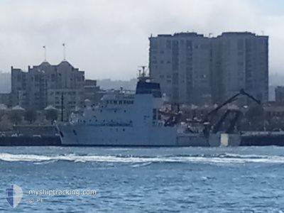
The vessel NOAAS REUBEN LASKER (IMO: 9664988, MMSI: 369970573) is a Fishery Research Vessel that was built in 2013 ( 12 Age ). It's sailing under the flag of [US] USA.
In this page you can find informations about the vessels current position, last detected port calls, and current voyage information. If the vessels is not in coverage by AIS you will find the latest position.
The current position of NOAAS REUBEN LASKER is detected by our AIS receivers and we are not responsible for the reliability of the data. The last position was recorded while the vessel was in Coverage by the Ais receivers of our vessel tracking app.
The current draught of NOAAS REUBEN LASKER as reported by AIS is 6 meters
Weather
| Temperature | 14°C / 57.2°F |
|---|---|
| Wind Speed | 16 knots |
| Direction | 355° N |
| Pressure | 1021.6 hPa |
| Humidity | 75.4 % |
| Cloud Coverage | 100 % |
Featured Company
Most Visited Ports (Last year)
| Port | Arrivals | |
|---|---|---|
| 9 | ||
| 2 | ||
| 1 |
Last Trips
| Origin | Departure | Destination | Arrival | Distance |
|---|
Events
| Heure | Evenement | Détails | Position/ Destination | Info |
|---|---|---|---|---|
| 2025-01-13 07:32 | Hors de la zone couverte |
32.57238 / -122.82757
North Pacific Ocean
US ALAMEDA
|
Vitesse: 1.8 kn Parcours: 305.8° |
|
| 2025-01-13 06:25 | Etat Changé | Restricted manoeuverability Under way using engine |
32.57060 / -122.80525
US ALAMEDA
|
Vitesse: 1.8 kn Parcours: 333° |
| 2025-01-13 05:44 | Dans la zone couverte |
32.52707 / -122.89944
North Pacific Ocean
US ALAMEDA
|
Vitesse: 9.4 kn Parcours: 63.4° |
|
| 2025-01-13 01:39 | Hors de la zone couverte |
32.25514 / -123.51091
North Pacific Ocean
US ALAMEDA
|
Vitesse: 1.4 kn Parcours: 313.3° |
|
| 2025-01-13 00:20 | Arret |
32.24422 / -123.49055
US ALAMEDA
|
Vitesse: 0.1 kn Parcours: 342° |
|
| 2025-01-13 00:20 | Etat Changé | Restricted manoeuverability Under way using engine |
32.24423 / -123.49054
US ALAMEDA
|
Vitesse: 9.8 kn Parcours: 62.5° |
| 2025-01-12 22:55 | Changement de zone | United States part of the North Pacific Ocean High seas of the North Pacific Ocean |
32.13815 / -123.71038
North Pacific Ocean
US ALAMEDA
|
Vitesse: 9.5 kn Parcours: 57.9° |
| 2025-01-12 22:39 | Dans la zone couverte |
32.11808 / -123.75015
North Pacific Ocean
US ALAMEDA
|
Vitesse: 9.7 kn Parcours: 59.7° |
|
| 2025-01-12 15:26 | Hors de la zone couverte |
31.67035 / -123.98503
North Pacific Ocean
US ALAMEDA
|
Vitesse: 6.6 kn Parcours: 329.2° |
|
| 2025-01-12 14:57 | Dans la zone couverte |
31.61326 / -123.94628
North Pacific Ocean
US ALAMEDA
|
Vitesse: 8.6 kn Parcours: 327.4° |