
NIL-OBSTAT
Cargo
Current Trip
NIL-OBSTAT is out of coverage. Learn how you can join the community and extend the coverage to your area by clicking here!
LOSS_ __
Unknown Port
ETA*
---
| Time Travelled | 1 day |
|---|---|
| Remaining Time | --- |
| Distance Travelled | 70.07 nm |
| Remaining Distance | --- |
| AVG Speed | 5.9 Noeuds |
| MAX Speed | 7 Noeuds |
| AVG Wind | 11.8 knots |
| MAX Wind | 14 knots |
| MIN Temp | 4.3°C / 39.74°F |
| MAX Temp | 10.4°C / 50.72°F |
| Tirant d eau | 0 m |
| Position reçue | 9 d depuis |
Current Position
| Longitude | 2.27847° |
|---|---|
| Latitude | 51.04402° |
| Etat | Under way using engine |
| Vitesse | |
| Parcours | --- |
| Zone | North Sea |
| Station | T-AIS |
| Position reçue | 9 d depuis |
Info
info
Information
The current position of NIL-OBSTAT is in North Sea with coordinates 51.04402° / 2.27847° as reported on 2024-04-17 02:12 by AIS to our vessel tracker app. The vessel's current speed is 0 Noeuds
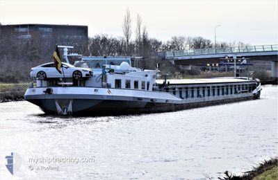
The vessel NIL-OBSTAT (MMSI: 205455790) is a Cargo It's sailing under the flag of [BE] Belgium.
In this page you can find informations about the vessels current position, last detected port calls, and current voyage information. If the vessels is not in coverage by AIS you will find the latest position.
The current position of NIL-OBSTAT is detected by our AIS receivers and we are not responsible for the reliability of the data. The last position was recorded while the vessel was in Coverage by the Ais receivers of our vessel tracking app.
Weather
| Temperature | 5.6°C / 42.08°F |
|---|---|
| Wind Speed | 6 knots |
| Direction | 190° S |
| Pressure | 1002.9 hPa |
| Humidity | 91.8 % |
| Cloud Coverage | 97 % |
Featured Company
Limited time offer - Install a base station receiver to your area and list your company on MyShipTracking Free forever!
Last Port Calls
| Port | Arrival | Departure | Time In Port |
|---|---|---|---|
| 2024-04-24 06:12 | 2024-04-24 07:00 | 48 m | |
| 2024-04-22 15:39 | 2024-04-23 23:08 | 1 d | |
| 2024-04-22 10:52 | 2024-04-22 11:19 | 26 m | |
| 2024-04-17 07:54 | 2024-04-17 08:51 | 56 m | |
| 2024-04-16 11:39 | 2024-04-17 05:09 | 17 h | |
| 2024-04-16 06:15 | 2024-04-16 07:51 | 1 h | |
| 2024-04-12 06:31 | 2024-04-12 08:43 | 2 h | |
| 2024-04-10 11:31 | 2024-04-12 03:24 | 1 d | |
| 2024-04-10 06:55 | 2024-04-10 07:37 | 41 m | |
| 2024-02-13 19:42 | 2024-02-14 01:50 | 6 h |
Last Trips
| Origin | Departure | Destination | Arrival | Distance | |
|---|---|---|---|---|---|
| 2024-04-24 01:08 | 2024-04-24 08:12 | 16.02 nm | |||
| 2024-04-22 13:19 | 2024-04-22 17:39 | 16.45 nm | |||
| 2024-04-17 10:51 | 2024-04-22 12:52 | 106.49 nm | |||
| 2024-04-17 07:09 | 2024-04-17 09:54 | 15.84 nm | |||
| 2024-04-16 09:51 | 2024-04-16 13:39 | 14.90 nm | |||
| 2024-04-12 10:43 | 2024-04-16 08:15 | 81.81 nm | |||
| 2024-04-12 05:24 | 2024-04-12 08:31 | 15.74 nm | |||
| 2024-04-10 09:37 | 2024-04-10 13:31 | 15.84 nm | |||
| 2024-02-14 02:50 | 2024-04-10 08:55 | 43.04 nm | |||
| 2024-02-13 16:15 | 2024-02-13 20:42 | 21.54 nm |
Events
| Heure | Evenement | Détails | Position/ Destination | Info |
|---|---|---|---|---|
| 2024-04-26 06:23 | Démarrage | 4.55 nm, South East of MORTAGNE DU NORD |
50.45667 / 3.54333
LOSS_ __
|
Vitesse: 5 kn Parcours: 293° |
| 2024-04-25 15:21 | Démarrage | 4.86 nm, South West of MARLY |
50.32333 / 3.41167
LOSS_ __
|
Vitesse: 5 kn Parcours: 83° |
| 2024-04-24 17:35 | Arret | 5.99 nm, South West of MARLY |
50.31667 / 3.38333
LOSS_ __
|
Vitesse: Parcours: -1° |
| 2024-04-24 17:02 | Démarrage | 8.42 nm, South West of MARLY |
50.29167 / 3.33333
LOSS_ __
|
Vitesse: 7 kn Parcours: 41° |
| 2024-04-24 07:15 | Démarrage | 2.07 nm, South East of ARQUES |
50.72167 / 2.34500
LOSS_ __
|
Vitesse: 6 kn Parcours: -1° |
| 2024-04-24 07:00 | PORT DE DEPART |
|
50.72167 / 2.34500
LOSS_ __
|
Vitesse: Parcours: -1° |
| 2024-04-24 06:12 | Arret |
50.74333 / 2.29500
[FR] ARQUES
|
Vitesse: Parcours: -1° |
|
| 2024-04-24 06:12 | Port d'arrivée |
|
50.74333 / 2.29500
[FR] ARQUES
|
Vitesse: 5 kn Parcours: 142° |
| 2024-04-24 05:33 | Démarrage | 2.42 nm, South East of WATTEN |
50.79666 / 2.24167
LOSS_ __
|
Vitesse: 5 kn Parcours: 142° |
| 2024-04-24 01:12 | Arret | 0.74 nm, North of WATTEN |
50.84372 / 2.21066
LOSS_ __
|
Vitesse: Parcours: -1° |