
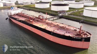
NEPTUNE MOON
Tanker
Current Trip
NGDQJ
| Time Travelled | 48 days |
|---|---|
| Remaining Time | --- |
| Distance Travelled | 7847.38 nm |
| Remaining Distance | --- |
| AVG Speed | 11 Noeuds |
| MAX Speed | 14.7 Noeuds |
| AVG Wind | 10.9 knots |
| MAX Wind | 28 knots |
| MIN Temp | -1.7°C / 28.94°F |
| MAX Temp | 27.9°C / 82.22°F |
| Tirant d eau | 9.7 m |
| Position reçue | 2024-10-04 05:48 |
Current Position
| Longitude | --- |
|---|---|
| Latitude | --- |
| Etat | Under way using engine |
| Vitesse | 5.7 Noeuds |
| Parcours | 188.4° |
| Zone | North Atlantic Ocean |
| Station | T-AIS |
| Position reçue | 2024-10-04 05:48 |
Info
Information
The current position of NEPTUNE MOON is in North Atlantic Ocean with coordinates 17.60075° / -18.57452° as reported on 2024-10-04 05:48 by AIS to our vessel tracker app. The vessel's current speed is 5.7 Noeuds
The vessel NEPTUNE MOON (IMO: 9784013, MMSI: 636019079) is a Tanker It's sailing under the flag of [LR] Liberia.
In this page you can find informations about the vessels current position, last detected port calls, and current voyage information. If the vessels is not in coverage by AIS you will find the latest position.
The current position of NEPTUNE MOON is detected by our AIS receivers and we are not responsible for the reliability of the data. The last position was recorded while the vessel was in Coverage by the Ais receivers of our vessel tracking app.
The current draught of NEPTUNE MOON as reported by AIS is 9.7 meters
Weather
| Temperature | 7.3°C / 45.14°F |
|---|---|
| Wind Speed | 6 knots |
| Direction | 207° SSW |
| Pressure | 1010.1 hPa |
| Humidity | 91.1 % |
| Cloud Coverage | 100 % |
Featured Company
Last Port Calls
| Port | Arrival | Departure | Time In Port |
|---|---|---|---|
| 2024-09-22 17:35 | 2024-09-24 03:56 | 1 d |
Last Trips
| Origin | Departure | Destination | Arrival | Distance | |
|---|---|---|---|---|---|
| 2024-08-16 13:21 | 2024-09-22 19:35 | 7789.31 nm |
Events
| Heure | Evenement | Détails | Position/ Destination | Info |
|---|---|---|---|---|
| 2024-11-04 23:34 | Arret | 3.44 nm, South West of CANAPORT LNG |
45.15538 / -66.01616
NGDQJ
|
Vitesse: 0.3 kn Parcours: 189° |
| 2024-11-04 22:54 | Démarrage | 0.94 nm, South West of CANAPORT LNG |
45.19280 / -65.98987
NGDQJ
|
Vitesse: 5.3 kn Parcours: 250° |
| 2024-11-04 06:26 | Arret | 0.88 nm, South West of CANAPORT LNG |
45.19592 / -65.99320
NGDQJ
|
Vitesse: 0.2 kn Parcours: 73° |
| 2024-11-04 04:38 | Démarrage | 4.78 nm, South of CANAPORT LNG |
45.13016 / -66.01248
NGDQJ
|
Vitesse: 4.3 kn Parcours: 294° |
| 2024-11-04 03:10 | Arret | 4.78 nm, South West of CANAPORT LNG |
45.13261 / -66.02191
NGDQJ
|
Vitesse: 0.3 kn Parcours: 77° |
| 2024-11-04 01:54 | Démarrage | 4.85 nm, South of CANAPORT LNG |
45.12543 / -65.98610
NGDQJ
|
Vitesse: 3.1 kn Parcours: 211° |
| 2024-11-03 23:54 | Arret | 3.86 nm, South of CANAPORT LNG |
45.14475 / -66.00581
NGDQJ
|
Vitesse: 0.3 kn Parcours: 71° |