

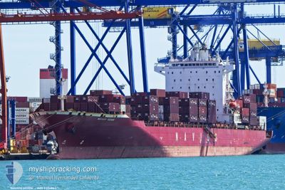
NAVIOS VERDE
Not available

Current Trip
| Time Travelled | 2 days |
|---|---|
| Remaining Time | 2 h, 29 mins |
| Distance Travelled | 819.76 nm |
| Remaining Distance | 37.15 nm |
| AVG Speed | 13.4 Noeuds |
| MAX Speed | 17.3 Noeuds |
| AVG Wind | 7 knots |
| MAX Wind | 18 knots |
| MIN Temp | 17.9°C / 64.22°F |
| MAX Temp | 26°C / 78.8°F |
| Tirant d eau | 8.7 m |
| Position reçue | 1 m depuis |
Current Position
| Longitude | --- |
|---|---|
| Latitude | --- |
| Etat | Under way using engine |
| Vitesse | 15.8 Noeuds |
| Parcours | 23.7° |
| Zone | Indian Ocean |
| Station | T-AIS |
| Position reçue | 1 m depuis |
Information
The current position of NAVIOS VERDE is in Indian Ocean with coordinates -30.28562° / 30.92549° as reported on 2025-02-24 02:47 by AIS to our vessel tracker app. The vessel's current speed is 15.8 Noeuds and is heading at the port of DURBAN. The estimated time of arrival as calculated by MyShipTracking vessel tracking app is 2025-02-24 07:17 LT
The vessel NAVIOS VERDE (IMO: 9324863, MMSI: 538007622) is a Not available It's sailing under the flag of [MH] Marshall Is.
In this page you can find informations about the vessels current position, last detected port calls, and current voyage information. If the vessels is not in coverage by AIS you will find the latest position.
The current position of NAVIOS VERDE is detected by our AIS receivers and we are not responsible for the reliability of the data. The last position was recorded while the vessel was in Coverage by the Ais receivers of our vessel tracking app.
The current draught of NAVIOS VERDE as reported by AIS is 8.7 meters
Weather
| Temperature | 26°C / 78.8°F |
|---|---|
| Wind Speed | 16 knots |
| Direction | 205° SSW |
| Pressure | 1013.5 hPa |
| Humidity | 82.5 % |
| Cloud Coverage | 11 % |


Featured Company
Last Port Calls
| Port | Arrival | Departure | Time In Port |
|---|---|---|---|
| 2025-02-20 20:23 | 2025-02-21 20:45 | 1 d | |
| 2025-02-06 16:05 | 2025-02-13 01:13 | 6 d | |
| 2025-01-21 03:38 | 2025-01-22 21:39 | 1 d | |
| 2025-01-10 00:15 | 2025-01-11 10:43 | 1 d | |
| 2025-01-05 01:15 | 2025-01-05 18:27 | 17 h | |
| 2025-01-01 15:58 | 2025-01-02 21:16 | 1 d | |
| 2024-12-27 19:18 | 2024-12-29 08:51 | 1 d | |
| 2024-12-12 07:23 | 2024-12-16 09:31 | 4 d |
Last Trips
| Origin | Departure | Destination | Arrival | Distance | |
|---|---|---|---|---|---|
| 2025-02-13 01:13 | 2025-02-20 20:23 | 2763.92 nm | |||
| 2025-01-22 21:39 | 2025-02-06 16:05 | 3689.25 nm | |||
| 2025-01-11 10:43 | 2025-01-21 03:38 | 3672.25 nm | |||
| 2025-01-05 18:27 | 2025-01-10 00:15 | 919.05 nm | |||
| 2025-01-02 21:16 | 2025-01-05 01:15 | 549.34 nm | |||
| 2024-12-29 08:51 | 2025-01-01 15:58 | 928.42 nm | |||
| 2024-12-16 09:31 | 2024-12-27 19:18 | 4202.41 nm | |||
| 2024-11-18 07:12 | 2024-12-12 07:23 | 3615.91 nm |
Events
| Heure | Evenement | Détails | Position/ Destination | Info |
|---|---|---|---|---|
| 2025-02-24 02:37 | Tirant d'eau modifié | 8.7 8 |
-30.32462 / 30.90537
ZADUR
|
Vitesse: 15.2 kn Parcours: 24.1° |
| 2025-02-24 02:37 | Changement d'ETA | 2025/02/24 05:30 |
-30.32462 / 30.90537
ZADUR
|
Vitesse: 15.2 kn Parcours: 24.1° |
| 2025-02-24 02:16 | Changement de zone | South African part of the Indian Ocean South African part of the South Atlantic Ocean |
-30.40113 / 30.86872
Indian Ocean
|
Vitesse: 14.2 kn Parcours: 21.6° |
| 2025-02-24 02:16 | Dans la zone couverte |
-30.40113 / 30.86872
Indian Ocean
|
Vitesse: 14.2 kn Parcours: 21.6° |
|
| 2025-02-24 02:14 | Etat Changé | Under way using engine Default |
-30.40824 / 30.86539
ZADUR
|
Vitesse: 14.1 kn Parcours: 22° |
| 2025-02-21 23:15 | Etat Changé | Default Under way using engine |
-34.69758 / 18.21489
ZADUR
|
Vitesse: 16.3 kn Parcours: 116.8° |
| 2025-02-21 23:12 | Etat Changé | Under way using engine Default |
-34.69149 / 18.20087
ZADUR
|
Vitesse: 16.3 kn Parcours: 114° |
| 2025-02-21 23:12 | Hors de la zone couverte |
-34.69149 / 18.20087
South Atlantic Ocean
|
Vitesse: 16.3 kn Parcours: 116.8° |
|
| 2025-02-21 22:19 | Etat Changé | Default Under way using engine |
-34.52550 / 18.02301
ZADUR
|
Vitesse: 15.3 kn Parcours: 163° |
| 2025-02-21 21:04 | Tirant d'eau modifié | 8 8.7 |
-34.22063 / 18.08324
ZADUR
|
Vitesse: 15.9 kn Parcours: 205° |