
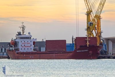
NAVIN KESTREL
General Cargo
Current Trip
| Time Travelled | 6 days |
|---|---|
| Remaining Time | --- |
| Distance Travelled | 743.86 nm |
| Remaining Distance | --- |
| AVG Speed | 9 Noeuds |
| MAX Speed | 10.8 Noeuds |
| AVG Wind | 10 knots |
| MAX Wind | 20.8 knots |
| MIN Temp | 7.9°C / 46.22°F |
| MAX Temp | 15.7°C / 60.26°F |
| Tirant d eau | 4.2 m |
| Position reçue | 2 d depuis |
Current Position
| Longitude | --- |
|---|---|
| Latitude | --- |
| Etat | Under way using engine |
| Vitesse | 9.9 Noeuds |
| Parcours | 319.4° |
| Zone | Aegean Sea |
| Station | T-AIS |
| Position reçue | 2 d depuis |
Info
Information
The current position of NAVIN KESTREL is in Aegean Sea with coordinates 38.00842° / 25.00802° as reported on 2025-02-15 19:40 by AIS to our vessel tracker app. The vessel's current speed is 9.9 Noeuds and is heading at the port of ACHLADI. The estimated time of arrival as calculated by MyShipTracking vessel tracking app is 2025-02-16 16:00 LT
The vessel NAVIN KESTREL (IMO: 9381811, MMSI: 538004897) is a General Cargo that was built in 2006 ( 19 Age ). It's sailing under the flag of [MH] Marshall Is.
In this page you can find informations about the vessels current position, last detected port calls, and current voyage information. If the vessels is not in coverage by AIS you will find the latest position.
The current position of NAVIN KESTREL is detected by our AIS receivers and we are not responsible for the reliability of the data. The last position was recorded while the vessel was in Coverage by the Ais receivers of our vessel tracking app.
The current draught of NAVIN KESTREL as reported by AIS is 4.2 meters
Weather
| Temperature | 8.2°C / 46.76°F |
|---|---|
| Wind Speed | 2 knots |
| Direction | 99° E |
| Pressure | 1015.4 hPa |
| Humidity | 95.4 % |
| Cloud Coverage | 100 % |
Featured Company
Events
| Heure | Evenement | Détails | Position/ Destination | Info |
|---|---|---|---|---|
| 2025-02-15 19:57 | Etat Changé | Default Under way using engine |
38.04469 / 24.97094
ACHLADI
|
Vitesse: 9.9 kn Parcours: 319.4° |
| 2025-02-15 19:40 | Etat Changé | Under way using engine Default |
38.00842 / 25.00802
ACHLADI
|
Vitesse: 9.8 kn Parcours: 323° |
| 2025-02-15 19:40 | Hors de la zone couverte |
38.00842 / 25.00802
Aegean Sea
ACHLADI
|
Vitesse: 9.9 kn Parcours: 319.4° |
|
| 2025-02-15 19:17 | Etat Changé | Default Under way using engine |
37.95954 / 25.05963
ACHLADI
|
Vitesse: 9.6 kn Parcours: 321.9° |
| 2025-02-15 19:14 | Etat Changé | Under way using engine Default |
37.95360 / 25.06556
ACHLADI
|
Vitesse: 9.6 kn Parcours: 322° |
| 2025-02-15 19:02 | Dans la zone couverte |
37.95710 / 25.06213
Aegean Sea
ACHLADI
|
Vitesse: 9.6 kn Parcours: 321.9° |
|
| 2025-02-15 17:59 | Etat Changé | Default Under way using engine |
37.80150 / 25.23332
ACHLADI
|
Vitesse: 9.8 kn Parcours: 311.3° |
| 2025-02-15 17:57 | Hors de la zone couverte |
37.79913 / 25.23669
Aegean Sea
ACHLADI
|
Vitesse: 9.8 kn Parcours: 311.3° |
|
| 2025-02-15 05:00 | Etat Changé | Under way using engine Default |
36.29026 / 27.08882
ACHLADI
|
Vitesse: 9.4 kn Parcours: 311° |
| 2025-02-15 04:41 | Etat Changé | Default Under way using engine |
36.25685 / 27.13781
ACHLADI
|
Vitesse: 9.5 kn Parcours: 308.6° |