
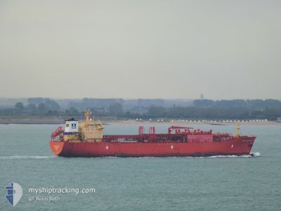
NAVIGATOR UMBRIO
Tanker
Current Trip
BEANR>BEANR
| Time Travelled | 4 days |
|---|---|
| Remaining Time | --- |
| Distance Travelled | 80.27 nm |
| Remaining Distance | --- |
| AVG Speed | 14.4 Noeuds |
| MAX Speed | 17.6 Noeuds |
| AVG Wind | 9 knots |
| MAX Wind | 15.9 knots |
| MIN Temp | 9.1°C / 48.38°F |
| MAX Temp | 15.5°C / 59.9°F |
| Tirant d eau | 7.9 m |
| Position reçue | 2 m depuis |
Current Position
| Longitude | 2.62960° |
|---|---|
| Latitude | 51.43330° |
| Etat | At anchor |
| Vitesse | 0.1 Noeuds |
| Parcours | 54° |
| Zone | North Sea |
| Station | T-AIS |
| Position reçue | 2 m depuis |
Info
Information
The current position of NAVIGATOR UMBRIO is in North Sea with coordinates 51.43330° / 2.62960° as reported on 2024-05-12 12:25 by AIS to our vessel tracker app. The vessel's current speed is 0.1 Noeuds
The vessel NAVIGATOR UMBRIO (IMO: 9704491, MMSI: 636016400) is a Tanker It's sailing under the flag of [LR] Liberia.
In this page you can find informations about the vessels current position, last detected port calls, and current voyage information. If the vessels is not in coverage by AIS you will find the latest position.
The current position of NAVIGATOR UMBRIO is detected by our AIS receivers and we are not responsible for the reliability of the data. The last position was recorded while the vessel was in Coverage by the Ais receivers of our vessel tracking app.
The current draught of NAVIGATOR UMBRIO as reported by AIS is 7.9 meters
Weather
| Temperature | 15.8°C / 60.44°F |
|---|---|
| Wind Speed | 12 knots |
| Direction | 83° E |
| Pressure | 1013.6 hPa |
| Humidity | 77.6 % |
| Cloud Coverage | 100 % |
Featured Company
Last Port Calls
| Port | Arrival | Departure | Time In Port |
|---|---|---|---|
| 2024-05-05 18:29 | 2024-05-08 04:16 | 2 d | |
| 2024-04-22 19:14 | 2024-04-24 10:58 | 1 d | |
| 2024-04-05 09:51 | 2024-04-07 20:25 | 2 d | |
| 2024-03-27 13:06 | 2024-03-30 15:12 | 3 d | |
| 2024-03-12 22:30 | 2024-03-13 19:43 | 21 h |
Most Visited Ports (Last year)
| Port | Arrivals | |
|---|---|---|
| 16 | ||
| 10 | ||
| 2 | ||
| 1 | ||
| 1 |
Last Trips
| Origin | Departure | Destination | Arrival | Distance | |
|---|---|---|---|---|---|
| 2024-04-24 06:58 | 2024-05-05 20:29 | 3666.04 nm | |||
| 2024-04-07 22:25 | 2024-04-22 15:14 | 3703.10 nm | |||
| 2024-03-30 16:12 | 2024-04-05 11:51 | 174.08 nm | |||
| 2024-03-13 15:43 | 2024-03-27 14:06 | 3689.24 nm | |||
| 2024-02-27 04:09 | 2024-03-12 18:30 | 3712.98 nm |
Events
| Heure | Evenement | Détails | Position/ Destination | Info |
|---|---|---|---|---|
| 2024-05-12 11:46 | Etat Changé | At anchor Default |
51.43326 / 2.62948
BEANR>BEANR
|
Vitesse: 0.1 kn Parcours: 55° |
| 2024-05-12 11:43 | Etat Changé | Default At anchor |
51.43328 / 2.62950
BEANR>BEANR
|
Vitesse: 0.1 kn Parcours: 57° |
| 2024-05-11 22:58 | Etat Changé | At anchor Default |
51.43377 / 2.63023
BEANR>BEANR
|
Vitesse: 0.1 kn Parcours: 54° |
| 2024-05-11 22:55 | Etat Changé | Default At anchor |
51.43377 / 2.63022
BEANR>BEANR
|
Vitesse: 0.2 kn Parcours: 52° |
| 2024-05-11 17:22 | Etat Changé | At anchor Default |
51.43653 / 2.63207
BEANR>BEANR
|
Vitesse: 0.3 kn Parcours: 205° |
| 2024-05-11 17:19 | Etat Changé | Default At anchor |
51.43661 / 2.63225
BEANR>BEANR
|
Vitesse: 0.2 kn Parcours: 217° |
| 2024-05-11 11:58 | Etat Changé | At anchor Default |
51.43317 / 2.63026
BEANR>BEANR
|
Vitesse: 0.1 kn Parcours: 37° |
| 2024-05-11 11:55 | Etat Changé | Default At anchor |
51.43311 / 2.63037
BEANR>BEANR
|
Vitesse: 0.1 kn Parcours: 42° |
| 2024-05-11 09:22 | Etat Changé | At anchor Default |
51.43351 / 2.62991
BEANR>BEANR
|
Vitesse: 0.2 kn Parcours: 63° |
| 2024-05-11 09:19 | Etat Changé | Default At anchor |
51.43365 / 2.62967
BEANR>BEANR
|
Vitesse: 0.2 kn Parcours: 54° |