
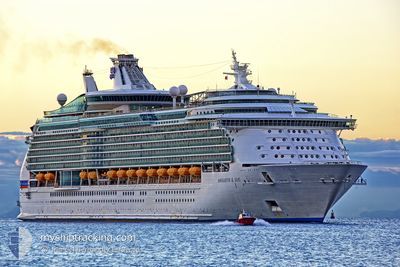
NAVIGATOR OF THE SEA
Passenger
Current Trip
| Time Travelled | 2 days |
|---|---|
| Remaining Time | --- |
| Distance Travelled | 462.97 nm |
| Remaining Distance | --- |
| AVG Speed | 7.7 Noeuds |
| MAX Speed | 12.1 Noeuds |
| AVG Wind | 12.6 knots |
| MAX Wind | 25 knots |
| MIN Temp | 14.5°C / 58.1°F |
| MAX Temp | 17.5°C / 63.5°F |
| Tirant d eau | 9.1 m |
| Position reçue | Maintenant |
Current Position
| Longitude | --- |
|---|---|
| Latitude | --- |
| Etat | Under way using engine |
| Vitesse | 10 Noeuds |
| Parcours | 279.9° |
| Zone | North Pacific Ocean |
| Station | T-AIS |
| Position reçue | Maintenant |
Info
Information
The current position of NAVIGATOR OF THE SEA is in North Pacific Ocean with coordinates 32.18239° / -117.50025° as reported on 2025-01-09 06:24 by AIS to our vessel tracker app. The vessel's current speed is 10 Noeuds and is heading at the port of AVALON. The estimated time of arrival as calculated by MyShipTracking vessel tracking app is 2025-01-07 14:30 LT
The vessel NAVIGATOR OF THE SEA (IMO: 9227508, MMSI: 311478000) is a Passenger It's sailing under the flag of [BS] Bahamas.
In this page you can find informations about the vessels current position, last detected port calls, and current voyage information. If the vessels is not in coverage by AIS you will find the latest position.
The current position of NAVIGATOR OF THE SEA is detected by our AIS receivers and we are not responsible for the reliability of the data. The last position was recorded while the vessel was in Coverage by the Ais receivers of our vessel tracking app.
The current draught of NAVIGATOR OF THE SEA as reported by AIS is 9.1 meters
Weather
| Temperature | --- |
|---|---|
| Wind Speed | --- |
| Direction | --- |
| Pressure | --- |
| Humidity | --- |
| Cloud Coverage | --- |
Featured Company
Last Port Calls
| Port | Arrival | Departure | Time In Port |
|---|---|---|---|
| 2025-01-06 14:05 | 2025-01-07 00:39 | 10 h | |
| 2025-01-05 15:11 | 2025-01-06 02:11 | 11 h | |
| 2025-01-03 13:44 | 2025-01-04 00:47 | 11 h | |
| 2024-12-31 13:19 | 2025-01-01 00:06 | 10 h | |
| 2024-12-30 14:00 | 2024-12-31 00:59 | 10 h | |
| 2024-12-27 13:41 | 2024-12-28 00:40 | 10 h | |
| 2024-12-24 13:19 | 2024-12-25 00:18 | 10 h | |
| 2024-12-23 14:12 | 2024-12-24 01:19 | 11 h | |
| 2024-12-20 13:40 | 2024-12-21 00:34 | 10 h | |
| 2024-12-19 15:17 | 2024-12-20 02:17 | 10 h |
Most Visited Ports (Last year)
| Port | Arrivals | |
|---|---|---|
| 71 | ||
| 56 | ||
| 16 | ||
| 15 | ||
| 3 | ||
| 2 |
Last Trips
| Origin | Departure | Destination | Arrival | Distance | |
|---|---|---|---|---|---|
| 2025-01-05 18:11 | 2025-01-06 06:05 | 147.03 nm | |||
| 2025-01-03 16:47 | 2025-01-05 07:11 | 257.34 nm | |||
| 2024-12-31 18:06 | 2025-01-03 05:44 | 1113.39 nm | |||
| 2024-12-30 17:59 | 2024-12-31 07:19 | 195.81 nm | |||
| 2024-12-27 16:40 | 2024-12-30 07:00 | 1013.94 nm | |||
| 2024-12-24 18:18 | 2024-12-27 05:41 | 1115.63 nm | |||
| 2024-12-23 18:19 | 2024-12-24 07:19 | 195.52 nm | |||
| 2024-12-20 16:34 | 2024-12-23 07:12 | 1015.78 nm | |||
| 2024-12-19 18:17 | 2024-12-20 05:40 | 148.10 nm | |||
| 2024-12-16 16:38 | 2024-12-19 07:17 | 356.04 nm |
Events
| Heure | Evenement | Détails | Position/ Destination | Info |
|---|---|---|---|---|
| 2025-01-09 04:10 | Etat Changé | Under way using engine Default |
31.86235 / -117.33100
US AOU
|
Vitesse: 10.8 kn Parcours: 356° |
| 2025-01-09 03:56 | Etat Changé | Default Under way using engine |
31.81960 / -117.32661
US AOU
|
Vitesse: 10.8 kn Parcours: 353.5° |
| 2025-01-09 03:27 | Etat Changé | Under way using engine Default |
31.73356 / -117.31374
US AOU
|
Vitesse: 10.6 kn Parcours: 351° |
| 2025-01-09 03:12 | Dans la zone couverte |
31.73405 / -117.31382
North Pacific Ocean
|
Vitesse: 10.5 kn Parcours: 351.4° |
|
| 2025-01-09 00:46 | Etat Changé | Default Under way using engine |
31.59105 / -117.19132
US AOU
|
Vitesse: 10.3 kn Parcours: 119.6° |
| 2025-01-09 00:39 | Hors de la zone couverte |
31.60080 / -117.21122
North Pacific Ocean
|
Vitesse: 10.3 kn Parcours: 119.6° |
|
| 2025-01-09 00:23 | Etat Changé | Under way using engine Default |
31.63429 / -117.24808
US AOU
|
Vitesse: 10.2 kn Parcours: 181° |
| 2025-01-08 23:43 | Etat Changé | Default Under way using engine |
31.72772 / -117.20613
US AOU
|
Vitesse: 10.2 kn Parcours: 228.8° |
| 2025-01-08 23:38 | Etat Changé | Under way using engine Default |
31.73584 / -117.19265
US AOU
|
Vitesse: 10.2 kn Parcours: 218° |
| 2025-01-08 23:33 | Etat Changé | Default Under way using engine |
31.74679 / -117.17953
US AOU
|
Vitesse: 10.4 kn Parcours: 209.1° |