

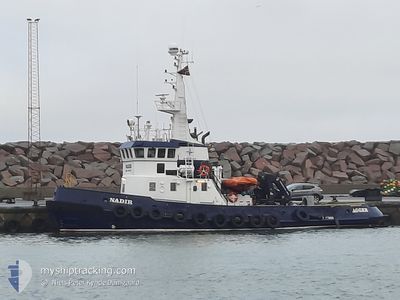
NADIR
Tug

Current Trip
SEVVK
| Time Travelled | 1 day |
|---|---|
| Remaining Time | --- |
| Distance Travelled | 70.38 nm |
| Remaining Distance | --- |
| AVG Speed | 4.7 Noeuds |
| MAX Speed | 7 Noeuds |
| AVG Wind | 11.1 knots |
| MAX Wind | 17 knots |
| MIN Temp | 2.8°C / 37.04°F |
| MAX Temp | 5.7°C / 42.26°F |
| Tirant d eau | 3.4 m |
| Position reçue | 7 d depuis |
Current Position
| Longitude | --- |
|---|---|
| Latitude | --- |
| Etat | Under way using engine |
| Vitesse | 8.4 Noeuds |
| Parcours | 9.8° |
| Zone | Baltic Sea |
| Station | T-AIS |
| Position reçue | 7 d depuis |
Information
The current position of NADIR is in Baltic Sea with coordinates 57.55700° / 16.87968° as reported on 2025-03-18 12:12 by AIS to our vessel tracker app. The vessel's current speed is 8.4 Noeuds
The vessel NADIR (IMO: 7401277, MMSI: 219794000) is a Tug that was built in 1974 ( 51 Age ). It's sailing under the flag of [DK] Denmark.
In this page you can find informations about the vessels current position, last detected port calls, and current voyage information. If the vessels is not in coverage by AIS you will find the latest position.
The current position of NADIR is detected by our AIS receivers and we are not responsible for the reliability of the data. The last position was recorded while the vessel was in Coverage by the Ais receivers of our vessel tracking app.
The current draught of NADIR as reported by AIS is 3.4 meters
Weather
| Temperature | 4.8°C / 40.64°F |
|---|---|
| Wind Speed | 5 knots |
| Direction | 317° NW |
| Pressure | 1009.1 hPa |
| Humidity | 97.4 % |
| Cloud Coverage | 100 % |


Featured Company
Last Port Calls
| Port | Arrival | Departure | Time In Port |
|---|---|---|---|
| 2025-03-23 11:30 | 2025-03-24 08:46 | 21 h | |
| 2025-03-15 20:47 | 2025-03-16 13:03 | 16 h | |
| 2025-03-13 17:05 | 2025-03-13 17:36 | 30 m | |
| 2025-03-12 23:03 | 2025-03-12 23:51 | 47 m | |
| 2025-03-07 21:15 | 2025-03-07 21:35 | 20 m | |
| 2025-03-03 14:01 | |||
| 2025-02-12 03:01 | 2025-02-25 12:48 | 13 d | |
| 2025-02-11 09:34 | 2025-02-11 11:06 | 1 h | |
| 2025-02-07 17:05 | 2025-02-08 15:13 | 22 h | |
| 2025-02-03 13:02 | 2025-02-06 07:17 | 2 d |
Last Trips
| Origin | Departure | Destination | Arrival | Distance | |
|---|---|---|---|---|---|
| 2025-03-16 14:03 | 2025-03-23 12:30 | 557.03 nm | |||
| 2025-03-13 18:36 | 2025-03-15 21:47 | 441.43 nm | |||
| 2025-03-13 00:51 | 2025-03-13 18:05 | 146.91 nm | |||
| 2025-03-07 22:35 | 2025-03-13 00:03 | 629.28 nm | |||
| 2025-03-03 15:01 | 2025-03-07 22:15 | 331.98 nm | |||
| 2025-02-11 12:06 | 2025-02-12 04:01 | 152.64 nm | |||
| 2025-02-08 16:13 | 2025-02-11 10:34 | 409.01 nm | |||
| 2025-02-06 08:17 | 2025-02-07 18:05 | 222.26 nm | |||
| 2025-02-01 16:19 | 2025-02-03 14:02 | 307.29 nm | |||
| 2025-01-25 18:11 | 2025-01-30 11:03 | 557.67 nm |
Events
| Heure | Evenement | Détails | Position/ Destination | Info |
|---|---|---|---|---|
| 2025-03-25 16:42 | Arret | 9.29 nm, South East of VASTERVIK |
57.66283 / 16.89597
SEVVK
|
Vitesse: 0.3 kn Parcours: 227° |
| 2025-03-25 10:34 | Démarrage | 8.78 nm, South East of VASTERVIK |
57.66251 / 16.87577
SEVVK
|
Vitesse: 5.2 kn Parcours: 326° |
| 2025-03-25 10:26 | Arret | 8.93 nm, South East of VASTERVIK |
57.66038 / 16.87876
SEVVK
|
Vitesse: 0.3 kn Parcours: 40° |
| 2025-03-24 16:02 | Démarrage | 8.72 nm, South East of VASTERVIK |
57.65052 / 16.85356
SEVVK
|
Vitesse: 6.5 kn Parcours: 96° |
| 2025-03-24 12:34 | Arret | 9.56 nm, South East of VASTERVIK |
57.65718 / 16.89859
SEVVK
|
Vitesse: 0.3 kn Parcours: 169° |
| 2025-03-24 12:22 | Démarrage | 9.51 nm, South East of VASTERVIK |
57.65980 / 16.90035
SEVVK
|
Vitesse: 4.8 kn Parcours: 180° |
| 2025-03-24 11:22 | Arret | 9.35 nm, South East of VASTERVIK |
57.66736 / 16.90385
SEVVK
|
Vitesse: 0.3 kn Parcours: 212° |
| 2025-03-24 08:46 | PORT DE DEPART |
|
57.73117 / 16.69535
SEVVK
|
Vitesse: 5.1 kn Parcours: 149° |
| 2025-03-24 08:34 | Démarrage |
57.74616 / 16.68003
[SE] VASTERVIK
|
Vitesse: 4.7 kn Parcours: 159° |
|
| 2025-03-23 12:02 | Arret |
57.74960 / 16.67582
[SE] VASTERVIK
|
Vitesse: Parcours: 197° |