
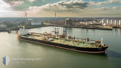
MT SAMURAI
Crude Oil Tanker
Current Trip
SUNGAI LINGGI
| Time Travelled | --- |
|---|---|
| Remaining Time | --- |
| Distance Travelled | 2879.58 nm |
| Remaining Distance | --- |
| AVG Speed | 9.5 Noeuds |
| MAX Speed | 14.3 Noeuds |
| AVG Wind | 9.3 knots |
| MAX Wind | 31.7 knots |
| MIN Temp | 5.2°C / 41.36°F |
| MAX Temp | 30.7°C / 87.26°F |
| Tirant d eau | 8.8 m |
| Position reçue | 11 h, 32 m depuis |
Current Position
| Longitude | 103.53310° |
|---|---|
| Latitude | 1.21085° |
| Etat | Under way using engine |
| Vitesse | 10.8 Noeuds |
| Parcours | 285° |
| Zone | Singapore Strait |
| Station | T-AIS |
| Position reçue | 11 h, 32 m depuis |
Info
Information
The current position of MT SAMURAI is in Singapore Strait with coordinates 1.21085° / 103.53310° as reported on 2024-04-27 03:18 by AIS to our vessel tracker app. The vessel's current speed is 10.8 Noeuds
The vessel MT SAMURAI (IMO: 9378876, MMSI: 636013852) is a Crude Oil Tanker that was built in 2009 ( 15 Age ). It's sailing under the flag of [LR] Liberia.
In this page you can find informations about the vessels current position, last detected port calls, and current voyage information. If the vessels is not in coverage by AIS you will find the latest position.
The current position of MT SAMURAI is detected by our AIS receivers and we are not responsible for the reliability of the data. The last position was recorded while the vessel was in Coverage by the Ais receivers of our vessel tracking app.
The current draught of MT SAMURAI as reported by AIS is 8.8 meters
Weather
| Temperature | 28.8°C / 83.84°F |
|---|---|
| Wind Speed | 7 knots |
| Direction | 79° E |
| Pressure | 1008.2 hPa |
| Humidity | 79.3 % |
| Cloud Coverage | 92 % |
Featured Company
Last Port Calls
| Port | Arrival | Departure | Time In Port |
|---|---|---|---|
| 2024-02-05 01:48 | 2024-02-06 01:43 | 23 h | |
| 2024-02-02 23:26 |
Most Visited Ports (Last year)
| Port | Arrivals | |
|---|---|---|
| 4 | ||
| 1 | ||
| 1 | ||
| 1 | ||
| 1 | ||
| 1 |
Last Trips
| Origin | Departure | Destination | Arrival | Distance | |
|---|---|---|---|---|---|
| 2024-02-03 03:26 | 2024-02-05 04:48 | 470.77 nm |
Events
| Heure | Evenement | Détails | Position/ Destination | Info |
|---|---|---|---|---|
| 2024-04-27 13:44 | Arret | 7.71 nm, West of SUNGAI UDANG |
2.26388 / 102.00145
SUNGAI LINGGI
|
Vitesse: 0.3 kn Parcours: 327° |
| 2024-04-27 03:24 | Etat Changé | Default Under way using engine |
1.21640 / 103.51405
SUNGAI LINGGI
|
Vitesse: 10.8 kn Parcours: 285° |
| 2024-04-27 03:18 | Hors de la zone couverte |
1.21085 / 103.53310
Singapore Strait
SUNGAI LINGGI
|
Vitesse: 10.8 kn Parcours: 285° |
|
| 2024-04-27 03:02 | Changement de zone | Malaysian part of the Singapore Strait Indonesian part of the Singapore Strait |
1.19973 / 103.58357
Singapore Strait
SUNGAI LINGGI
|
Vitesse: 10.9 kn Parcours: 279° |
| 2024-04-27 02:17 | Changement de zone | Indonesian part of the Singapore Strait Singaporean part of the Singapore Strait |
1.14818 / 103.71480
Singapore Strait
SUNGAI LINGGI
|
Vitesse: 10.3 kn Parcours: 303° |
| 2024-04-27 00:39 | Démarrage | 3.26 nm, East of SINGAPORE |
1.23940 / 103.90577
SUNGAI LINGGI
|
Vitesse: 3.1 kn Parcours: 220° |
| 2024-04-27 00:18 | Changement de destination | SUNGAI LINGGI SINGAPORE |
1.24723 / 103.90673
SUNGAI LINGGI
|
Vitesse: 0.2 kn Parcours: 210° |
| 2024-04-27 00:18 | Changement d'ETA | 2024/04/27 14:00 2024/04/24 20:00 |
1.24723 / 103.90673
SUNGAI LINGGI
|
Vitesse: 0.2 kn Parcours: 210° |
| 2024-04-27 00:13 | Etat Changé | Under way using engine At anchor |
1.24750 / 103.90725
SINGAPORE
|
Vitesse: 0.5 kn Parcours: 225° |
| 2024-04-26 22:53 | Etat Changé | At anchor Default |
1.24795 / 103.90780
SINGAPORE
|
Vitesse: 0.1 kn Parcours: 211° |