
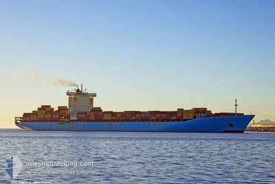
MSC YUKTA X
Container Ship
Current Trip
| Time Travelled | 3 days |
|---|---|
| Remaining Time | 7 h, 11 mins |
| Distance Travelled | 1390.63 nm |
| Remaining Distance | 245.26 nm |
| AVG Speed | 16.2 Noeuds |
| MAX Speed | 17.2 Noeuds |
| AVG Wind | 12.7 knots |
| MAX Wind | 24 knots |
| MIN Temp | 14.3°C / 57.74°F |
| MAX Temp | 19.9°C / 67.82°F |
| Tirant d eau | 11.7 m |
| Position reçue | 7 h, 52 m depuis |
Current Position
| Longitude | 25.52767° |
|---|---|
| Latitude | 32.71708° |
| Etat | Under way using engine |
| Vitesse | 16.1 Noeuds |
| Parcours | 115° |
| Zone | Mediterranean Sea - Eastern Basin |
| Station | T-AIS |
| Position reçue | 7 h, 52 m depuis |
Info
Information
The current position of MSC YUKTA X is in Mediterranean Sea - Eastern Basin with coordinates 32.71708° / 25.52767° as reported on 2024-05-03 14:47 by AIS to our vessel tracker app. The vessel's current speed is 16.1 Noeuds and is heading at the port of EL DEKHEILA. The estimated time of arrival as calculated by MyShipTracking vessel tracking app is 2024-05-04 05:50 LT
The vessel MSC YUKTA X (IMO: 9146467, MMSI: 636022658) is a Container Ship that was built in 1998 ( 26 Age ). It's sailing under the flag of [LR] Liberia.
In this page you can find informations about the vessels current position, last detected port calls, and current voyage information. If the vessels is not in coverage by AIS you will find the latest position.
The current position of MSC YUKTA X is detected by our AIS receivers and we are not responsible for the reliability of the data. The last position was recorded while the vessel was in Coverage by the Ais receivers of our vessel tracking app.
The current draught of MSC YUKTA X as reported by AIS is 11.7 meters
Weather
| Temperature | 19.6°C / 67.28°F |
|---|---|
| Wind Speed | 14 knots |
| Direction | 282° WNW |
| Pressure | 1014.5 hPa |
| Humidity | 79.8 % |
| Cloud Coverage | --- |
Featured Company
Last Port Calls
| Port | Arrival | Departure | Time In Port |
|---|---|---|---|
| 2024-04-29 03:39 | 2024-04-30 05:09 | 1 d | |
| 2024-04-22 22:32 | 2024-04-25 00:52 | 2 d | |
| 2024-04-20 18:13 | 2024-04-21 08:14 | 14 h | |
| 2024-04-11 06:53 | 2024-04-13 09:44 | 2 d | |
| 2024-04-04 09:15 | 2024-04-08 10:57 | 4 d | |
| 2024-04-01 02:30 | 2024-04-02 09:48 | 1 d | |
| 2024-03-30 20:23 | 2024-03-31 20:15 | 23 h | |
| 2024-03-27 16:19 | 2024-03-28 16:21 | 1 d | |
| 2024-03-24 05:43 | 2024-03-25 17:25 | 1 d | |
| 2024-03-16 06:32 | 2024-03-19 06:13 | 2 d |
Most Visited Ports (Last year)
| Port | Arrivals | |
|---|---|---|
| 8 | ||
| 5 | ||
| 4 | ||
| 4 | ||
| 3 | ||
| 3 |
Last Trips
| Origin | Departure | Destination | Arrival | Distance | |
|---|---|---|---|---|---|
| 2024-04-25 02:52 | 2024-04-29 05:39 | 1848.97 nm | |||
| 2024-04-21 09:14 | 2024-04-23 00:32 | 315.75 nm | |||
| 2024-04-13 11:44 | 2024-04-20 19:13 | 2415.58 nm | |||
| 2024-04-08 12:57 | 2024-04-11 08:53 | 1005.70 nm | |||
| 2024-04-02 12:48 | 2024-04-04 11:15 | 496.75 nm | |||
| 2024-03-31 23:15 | 2024-04-01 05:30 | 91.16 nm | |||
| 2024-03-28 17:21 | 2024-03-30 23:23 | 1013.96 nm | |||
| 2024-03-25 18:25 | 2024-03-27 17:19 | 764.28 nm | |||
| 2024-03-19 07:13 | 2024-03-24 06:43 | 1837.59 nm | |||
| 2024-03-15 19:45 | 2024-03-16 07:32 | 127.67 nm |
Events
| Heure | Evenement | Détails | Position/ Destination | Info |
|---|---|---|---|---|
| 2024-05-03 14:56 | Etat Changé | Default Under way using engine |
32.70186 / 25.57438
ESVLC=>EGEDK
|
Vitesse: 16.1 kn Parcours: 115° |
| 2024-05-03 14:47 | Hors de la zone couverte |
32.71708 / 25.52767
Mediterranean Sea - Eastern Basin
ESVLC=>EGEDK
|
Vitesse: 16.1 kn Parcours: 115° |
|
| 2024-05-03 12:33 | Etat Changé | Under way using engine Default |
32.94789 / 24.85815
ESVLC=>EGEDK
|
Vitesse: 16.7 kn Parcours: 113° |
| 2024-05-03 12:21 | Etat Changé | Default Under way using engine |
32.96854 / 24.79694
ESVLC=>EGEDK
|
Vitesse: 16.7 kn Parcours: 112.3° |
| 2024-05-03 11:52 | Etat Changé | Under way using engine Default |
33.01698 / 24.64728
ESVLC=>EGEDK
|
Vitesse: 16.8 kn Parcours: 110° |
| 2024-05-03 11:43 | Dans la zone couverte |
33.01698 / 24.64728
Mediterranean Sea - Eastern Basin
ESVLC=>EGEDK
|
Vitesse: 16.7 kn Parcours: 110° |
|
| 2024-05-03 10:12 | Etat Changé | Default Under way using engine |
33.19217 / 24.13641
ESVLC=>EGEDK
|
Vitesse: 16.8 kn Parcours: 111° |
| 2024-05-03 10:01 | Hors de la zone couverte |
33.21287 / 24.07672
Mediterranean Sea - Eastern Basin
ESVLC=>EGEDK
|
Vitesse: 16.8 kn Parcours: 111° |
|
| 2024-05-03 09:46 | Detecté en mer | Libyan part of the Mediterranean Sea - Eastern Basin |
33.23869 / 24.00168
Mediterranean Sea - Eastern Basin
ESVLC=>EGEDK
|
Vitesse: 16.8 kn Parcours: 113.1° |
| 2024-05-03 09:44 | Etat Changé | Under way using engine Default |
33.24243 / 23.99092
ESVLC=>EGEDK
|
Vitesse: 16.9 kn Parcours: 113° |