
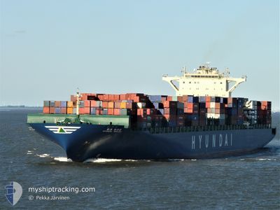
MSC RIDA
Container Ship
Current Trip
| Time Travelled | 19 days |
|---|---|
| Remaining Time | --- |
| Distance Travelled | 7675.09 nm |
| Remaining Distance | --- |
| AVG Speed | 15.9 Noeuds |
| MAX Speed | 19.7 Noeuds |
| AVG Wind | 12.6 knots |
| MAX Wind | 20 knots |
| MIN Temp | 15.1°C / 59.18°F |
| MAX Temp | 29°C / 84.2°F |
| Tirant d eau | 11.3 m |
| Position reçue | 1 d depuis |
Current Position
| Longitude | 18.66537° |
|---|---|
| Latitude | -34.82232° |
| Etat | Under way using engine |
| Vitesse | 18.3 Noeuds |
| Parcours | 98° |
| Zone | South Atlantic Ocean |
| Station | T-AIS |
| Position reçue | 1 d depuis |
Info
Information
The current position of MSC RIDA is in South Atlantic Ocean with coordinates -34.82232° / 18.66537° as reported on 2024-05-18 03:40 by AIS to our vessel tracker app. The vessel's current speed is 18.3 Noeuds and is heading at the port of ABU DHABI. The estimated time of arrival as calculated by MyShipTracking vessel tracking app is 2024-05-30 06:00 LT
The vessel MSC RIDA (IMO: 9393307, MMSI: 255803480) is a Container Ship that was built in 2009 ( 15 Age ). It's sailing under the flag of [PT] Portugal.
In this page you can find informations about the vessels current position, last detected port calls, and current voyage information. If the vessels is not in coverage by AIS you will find the latest position.
The current position of MSC RIDA is detected by our AIS receivers and we are not responsible for the reliability of the data. The last position was recorded while the vessel was in Coverage by the Ais receivers of our vessel tracking app.
The current draught of MSC RIDA as reported by AIS is 11.3 meters
Weather
| Temperature | 22.2°C / 71.96°F |
|---|---|
| Wind Speed | 12 knots |
| Direction | 62° ENE |
| Pressure | 1017.3 hPa |
| Humidity | 64.1 % |
| Cloud Coverage | 5 % |
Featured Company
Last Port Calls
| Port | Arrival | Departure | Time In Port |
|---|---|---|---|
| 2024-04-29 04:54 | 2024-04-30 01:53 | 20 h | |
| 2024-04-25 12:46 | 2024-04-27 19:36 | 2 d | |
| 2024-04-22 02:36 | 2024-04-23 00:40 | 22 h | |
| 2024-04-20 17:18 | 2024-04-21 08:53 | 15 h | |
| 2024-04-16 03:32 | 2024-04-18 10:20 | 2 d | |
| 2024-03-18 07:16 | |||
| 2024-03-07 22:08 | |||
| 2024-03-01 10:36 | 2024-03-02 08:17 | 21 h |
Most Visited Ports (Last year)
| Port | Arrivals | |
|---|---|---|
| 7 | ||
| 6 | ||
| 5 | ||
| 4 | ||
| 4 | ||
| 4 |
Last Trips
| Origin | Departure | Destination | Arrival | Distance | |
|---|---|---|---|---|---|
| 2024-04-27 19:36 | 2024-04-29 04:54 | 416.96 nm | |||
| 2024-04-23 00:40 | 2024-04-25 12:46 | 461.35 nm | |||
| 2024-04-21 08:53 | 2024-04-22 02:36 | 146.74 nm | |||
| 2024-04-18 10:20 | 2024-04-20 17:18 | 735.32 nm | |||
| 2024-03-18 07:16 | 2024-04-16 03:32 | 11337.24 nm | |||
| 2024-02-29 20:38 | 2024-03-01 10:36 | 80.25 nm |
Events
| Heure | Evenement | Détails | Position/ Destination | Info |
|---|---|---|---|---|
| 2024-05-18 03:45 | Etat Changé | Default Under way using engine |
-34.82578 / 18.69692
AEAUH
|
Vitesse: 18.3 kn Parcours: 98° |
| 2024-05-18 03:40 | Hors de la zone couverte |
-34.82232 / 18.66537
South Atlantic Ocean
AEAUH
|
Vitesse: 18.3 kn Parcours: 98° |
|
| 2024-05-18 03:38 | Etat Changé | Under way using engine Default |
-34.82073 / 18.65108
AEAUH
|
Vitesse: 18.3 kn Parcours: 95° |
| 2024-05-18 03:24 | Etat Changé | Default Under way using engine |
-34.81167 / 18.56533
AEAUH
|
Vitesse: 18.6 kn Parcours: 86° |
| 2024-05-18 01:11 | Etat Changé | Under way using engine Default |
-34.73572 / 17.76753
AEAUH
|
Vitesse: 17.7 kn Parcours: 101° |
| 2024-05-18 01:06 | Etat Changé | Default Under way using engine |
-34.73105 / 17.74173
AEAUH
|
Vitesse: 17.7 kn Parcours: 102° |
| 2024-05-18 00:56 | Etat Changé | Under way using engine Default |
-34.72010 / 17.68162
AEAUH
|
Vitesse: 17.8 kn Parcours: 103° |
| 2024-05-18 00:53 | Etat Changé | Default Under way using engine |
-34.71727 / 17.66630
AEAUH
|
Vitesse: 18 kn Parcours: 95° |
| 2024-05-18 00:42 | Etat Changé | Under way using engine Default |
-34.70997 / 17.59770
AEAUH
|
Vitesse: 18 kn Parcours: 97° |
| 2024-05-18 00:39 | Etat Changé | Default Under way using engine |
-34.70842 / 17.57773
AEAUH
|
Vitesse: 18 kn Parcours: 96° |